
TPO - The water level of the Red River and the Da River has dried up, causing many foundations of the Van Lang and Trung Ha bridges (connecting Phu Tho with Hanoi) to be exposed on the white sandbanks on the riverbed.
TPO - The water level of the Red River and the Da River has dried up, causing many foundations of the Van Lang and Trung Ha bridges (connecting Phu Tho with Hanoi) to be exposed on the white sandbanks on the riverbed.
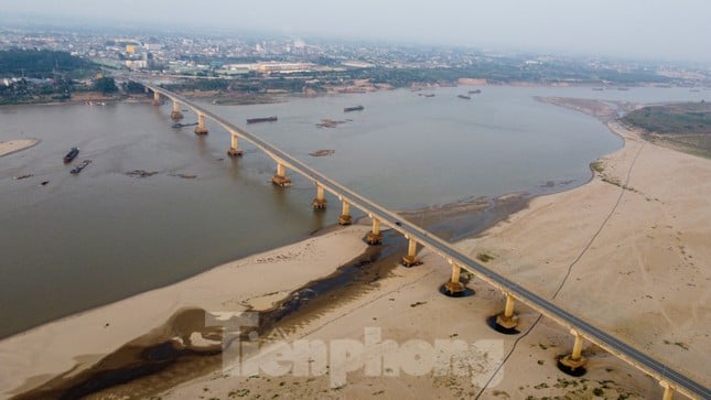 |
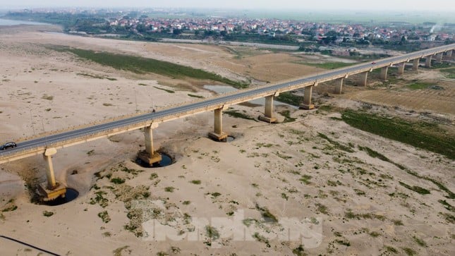
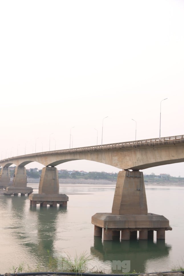
Crossing the Red River, Van Lang Bridge is the border point between Phu Cuong Commune (Ba Vi, Hanoi) and Tho Son Ward (Viet Tri City, Phu Tho), located in the area of the confluence of the Red River - Da River - Lo River with complex flows, especially many sand mines. |
 |
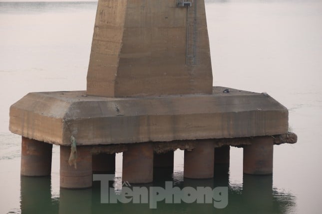
Due to low river water levels, the foundation of Van Lang Bridge has been exposed even though it is not yet the dry season. This is a bridge with a total investment of nearly 1,500 billion VND and was opened to traffic in 2018. |
 |
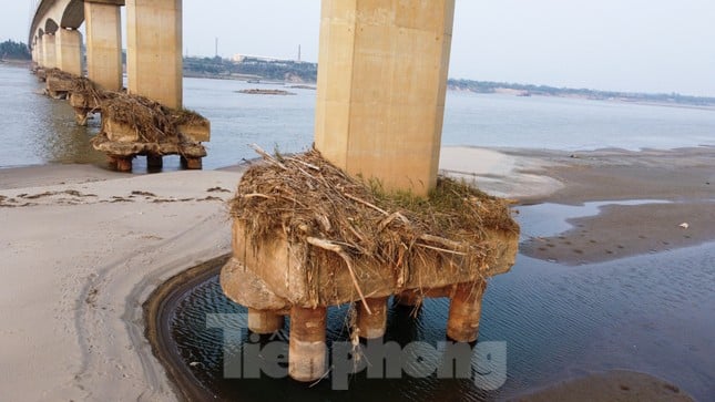
The bridge pier foundation is clearly visible when the water level in the riverbed drops deeply. |
 |
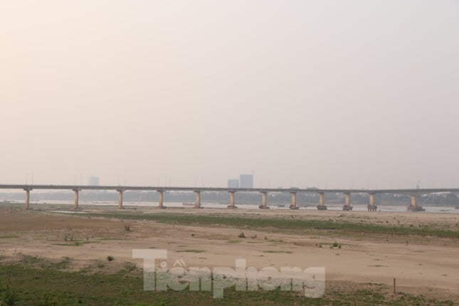
The Red River is shallow, with its bed often narrowing by more than half. Huge sandbanks make navigation through the river difficult. |
 |
The receding river water carried away a large amount of sand around the pillar areas. |
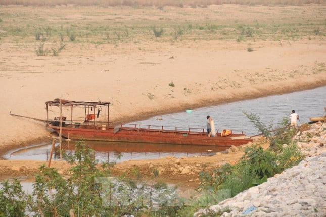 |
The water level of the Red River dropped so low that many ships ran aground, even small ones. |
 |
The fact that the Red River has dried up, exposing the bridge foundation, has not yet directly affected the quality of the bridge. However, this phenomenon has raised concerns about the change in the flow of water in areas where many sand mines are continuously exploited. |
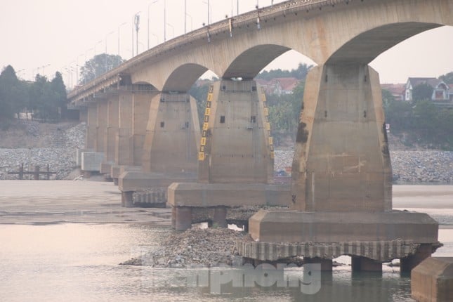 |
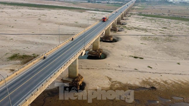
Located on the Da River, Trung Ha Bridge is also in a similar situation with 8/12 bridge pillars exposed. |
 |
Currently, the water level of the Da River is low, although not at its lowest, many bridge foundations have been exposed 60-70cm above the water surface. |
 |
The water level of the Da River is often regulated by hydroelectric reservoirs. When the reservoirs are full, they will dry up downstream and vice versa. |
 |
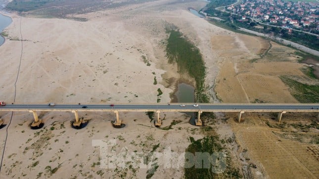
New alluvial land formed on the bank of Da River in Phu Tho province. |
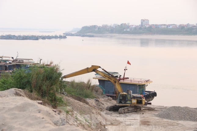 |
Worryingly, sand dredging activities are still going on downstream of these bridges. |
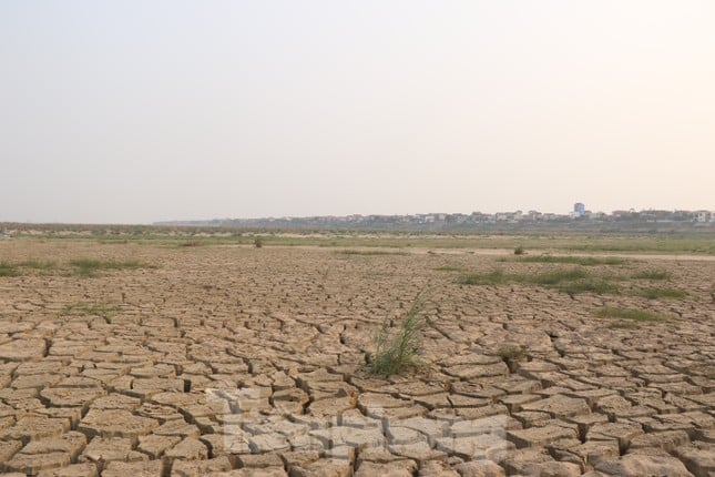 |
The water level of the Red River and Da River has become shallow due to climate change and the construction of hydroelectric projects, which has reduced the amount of water flowing in. In addition, sand mining and erosion have also changed the flow of the riverbed, increasing the dryness. |
Source: https://tienphong.vn/tau-thuyen-mac-can-cau-nghin-ty-tro-mong-giua-long-song-hong-song-da-post1728407.tpo
![[Photo] Cultural, sports and media bloc at the 50th Anniversary of Southern Liberation and National Reunification Day](https://vphoto.vietnam.vn/thumb/1200x675/vietnam/resource/IMAGE/2025/4/30/8a22f876e8d24890be2ae3d88c9b201c)
![[Photo] Chinese, Lao, and Cambodian troops participate in the parade to celebrate the 50th anniversary of the Liberation of the South and National Reunification Day](https://vphoto.vietnam.vn/thumb/1200x675/vietnam/resource/IMAGE/2025/4/30/30d2204b414549cfb5dc784544a72dee)
![[Photo] The parade took to the streets, walking among the arms of tens of thousands of people.](https://vphoto.vietnam.vn/thumb/1200x675/vietnam/resource/IMAGE/2025/4/30/180ec64521094c87bdb5a983ff1a30a4)


![[Photo] Performance of the Air Force Squadron at the 50th Anniversary of the Liberation of the South and National Reunification Day](https://vphoto.vietnam.vn/thumb/1200x675/vietnam/resource/IMAGE/2025/4/30/cb781ed625fc4774bb82982d31bead1e)


Comment (0)