
The announcement dated March 12 of the UN Secretary General to member countries stated that on March 7, the Vietnamese Government deposited at the United Nations a nautical chart along with a list of geographical coordinates of the points determining the straight baseline for the mainland territory in the Gulf of Tonkin and the outer boundary of the territorial sea in this area.
According to this announcement, the Vietnamese Government's Declaration dated February 21, 2025 on the baseline for calculating the breadth of the territorial sea in the Gulf of Tonkin will be published in the upcoming official publication of the United Nations called "Bullet on the Law of the Sea".
The baseline used to calculate the width of Vietnam's territorial waters in the Gulf of Tonkin is the basis for determining the boundaries and scope of Vietnam's maritime zones according to the provisions of UNCLOS and the Agreement on the Delimitation of the Gulf of Tonkin between Vietnam and China signed in 2000.

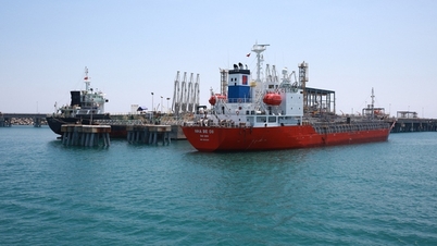
Vietnam's Bach Long Vi Island in the Gulf of Tonkin. Photo: Photography and Life Magazine
Affirming the sea areas under Vietnam's sovereignty
The Gulf of Tonkin, located in the northwest of the East Sea, is a common and important sea area for both Vietnam and China. The Gulf has an area of about 126,250 km2 (36,000 square nautical miles), with a width of about 320 km (176 nautical miles) at its widest point and about 220 km (119 nautical miles) at its narrowest point. The coastline on the Vietnamese side is about 763 km, and on the Chinese side is about 695 km. Bach Long Vi Island belongs to Vietnam, about 110 km from Hon Dau near the Vietnamese mainland, and has a position that creates special circumstances in delimitation.
The process of negotiating the delimitation of the Gulf of Tonkin consisted of three periods: 1974, 1977-1978 and 1993-2004. As a result of the delimitation of the Gulf of Tonkin, Bach Long Vi Island has a territorial sea of 12 nautical miles, an exclusive economic zone and a continental shelf of 3 nautical miles, equivalent to 25% of the validity. Vietnam enjoys 53.23% and China 46.77% of the Gulf area (ratio 1.135/1). This ratio is equivalent to the ratio of the coastline length of the two countries (763/695) and is considered fair, consistent with national judgments and practices on delimitation.
During the delimitation negotiations, both countries refrained from making unilateral declarations on baselines in the Gulf. National practice and international court rulings show that unilaterally declared baselines are almost never taken into account in the delimitation. The agreement on the delimitation of territorial waters, exclusive economic zones and continental shelves came into effect simultaneously with the agreement on fisheries cooperation and the common fishing zone in the Gulf of Tonkin from June 30, 2004.
The Fisheries Agreement is valid for 12 years and will be automatically renewed for 3 years if both sides have no objections. In 2019, the two sides agreed to extend the Fisheries Agreement for another year, ending in 2020. After 2020, when the Fisheries Cooperation Agreement ends, both countries will need to manage the sea area, clearly define the responsibilities of the maritime control forces in the territorial waters, exclusive economic zones and continental shelves, monitor the implementation of the right of innocent passage in the territorial waters as well as respect the freedom of the seas of other countries in their exclusive economic zones.
It also creates a basis for the two countries to continue negotiating fisheries cooperation and joint patrols at sea. Determining the baseline is also related to the national airspace boundary, which is the vertical plane passing through the national maritime border, which is the 12-nautical mile boundary of the territorial sea. This allows for better management of international flights into and out of the national airspace of the two countries, ensuring aviation security and international trade.
The baseline system declared by the two countries in the Gulf of Tonkin cannot affect the delimitation results because the Agreements and agreements on border and maritime boundaries are permanent and unchanged regardless of changing circumstances (according to Article 62 of the Vienna Convention on the Law of Treaties, of which both Vietnam and China are members). The Chinese side affirmed that China's baseline declaration on March 1, 2024 is a step that is completely consistent with national law, international law and bilateral agreements and will not affect the interests of Vietnam or any other country.
In the statement dated February 21, 2025, Vietnam reiterated the demarcation points of territorial waters adjacent to the coasts of the two countries at the mouth of the Bac Luan River, including 9 points along the territorial waters demarcation line shown in the Agreement on the demarcation of territorial waters, exclusive economic zones and continental shelves in the Gulf of Tonkin signed between the Socialist Republic of Vietnam and the People's Republic of China in the Gulf of Tonkin, connected to point 10 with specified coordinates in Vietnam's waters. This is necessary for maritime law enforcement forces and vessels to monitor.
Thus, the Declaration of Vietnam's baselines in the Gulf of Tonkin on February 21, 2025 is not a response to China's baseline declaration on March 1, 2024, but stems from the objective needs of international maritime management and cooperation, affirming Vietnam's rights and obligations under the 1982 United Nations Convention on the Law of the Sea (UNCLOS) and in accordance with the 2012 Law of the Sea of Vietnam. This is a solid legal basis for protecting and exercising Vietnam's sovereignty, sovereign rights and jurisdiction, contributing to economic development, maritime management and enhancing international cooperation.

In accordance with the provisions of the 1982 Convention on the Law of the Sea
The declaration of baselines from which the breadth of the territorial sea is measured is within the competence of the coastal state. UNCLOS does not prohibit a coastal state from unilaterally declaring its own baseline system and registering it with the United Nations (Article 16), but only if it is consistent with international law, in particular Articles 5 (normal baselines) and 7 (straight baselines) of the Convention. The coastal state may choose the normal baseline method, straight baselines or a combination thereof.
UNCLOS does not clearly define what an island chain is, the distance between the island chain and the shore, or the length of the baselines. However, the parties claiming baselines must demonstrate that the waters within the baselines must be closely and permanently attached to enjoy the status of internal waters.
Vietnam's baselines in the Gulf of Tonkin apply a mixed method, straight baselines and normal baselines for Bach Long Vi Island. Vietnam's declaration dated February 21, 2025 is completely consistent with UNCLOS. The declaration is also not contrary to Article 8 of the 2012 Law of the Sea of Vietnam: "The baselines used to calculate the breadth of Vietnam's territorial waters are straight baselines announced by the Government. The Government determines and announces baselines in areas where baselines are not available after being approved by the National Assembly Standing Committee". The mixed application of both straight baselines and normal baselines demonstrates Vietnam's flexible stance.
Vietnam's straight baseline in the Gulf of Tonkin is applied to the island chain that runs through and is not separated from the general trend of the coast. This baseline connects 12 islands, with the farthest distance from the shore being Thanh Lam Island at 21.59 nautical miles. The other islands are 12 nautical miles from the normal shore. Thus, these islands run close to the coast, are not separated from the general trend of the coast and the distance does not exceed the breadth of the territorial sea from the mainland and from the island.
The straight baseline in the Gulf of Tonkin also does not cross any strait or sea area with international shipping routes, so it does not affect the right of passage and harmlessness of foreign vessels in the territorial sea as well as the freedom of navigation in the exclusive economic zone.
Thus, Vietnam's baseline declaration in the Gulf of Tonkin has a solid legal basis, in accordance with UNCLOS.
Vietnamnet.vn
Source: https://vietnamnet.vn/buoc-tien-trong-viec-khang-dinh-cac-vung-bien-thuoc-chu-quyen-cua-viet-nam-2383608.html
![[Photo] The parade took to the streets, walking among the arms of tens of thousands of people.](https://vphoto.vietnam.vn/thumb/1200x675/vietnam/resource/IMAGE/2025/4/30/180ec64521094c87bdb5a983ff1a30a4)
![[Photo] Mass parade to celebrate 50 years of national reunification](https://vphoto.vietnam.vn/thumb/1200x675/vietnam/resource/IMAGE/2025/4/30/825e459ee2f54d85b3a134cdcda46e0d)

![[Photo] Panorama of the parade celebrating the 50th anniversary of the Liberation of the South and National Reunification](https://vphoto.vietnam.vn/thumb/1200x675/vietnam/resource/IMAGE/2025/4/30/affbd72e439d4362962babbf222ffb8b)
![[Photo] "King Cobra" Su-30MK2 completed its glorious mission on April 30](https://vphoto.vietnam.vn/thumb/1200x675/vietnam/resource/IMAGE/2025/4/30/5724b5c99b7a40db81aa7c418523defe)


![[Photo] Soldiers work through the holidays to help people build houses in Sang Ma Sao](https://vphoto.vietnam.vn/thumb/402x226/vietnam/resource/IMAGE/2025/4/30/717906518e374fbeb2001b711cc964e6)


Comment (0)