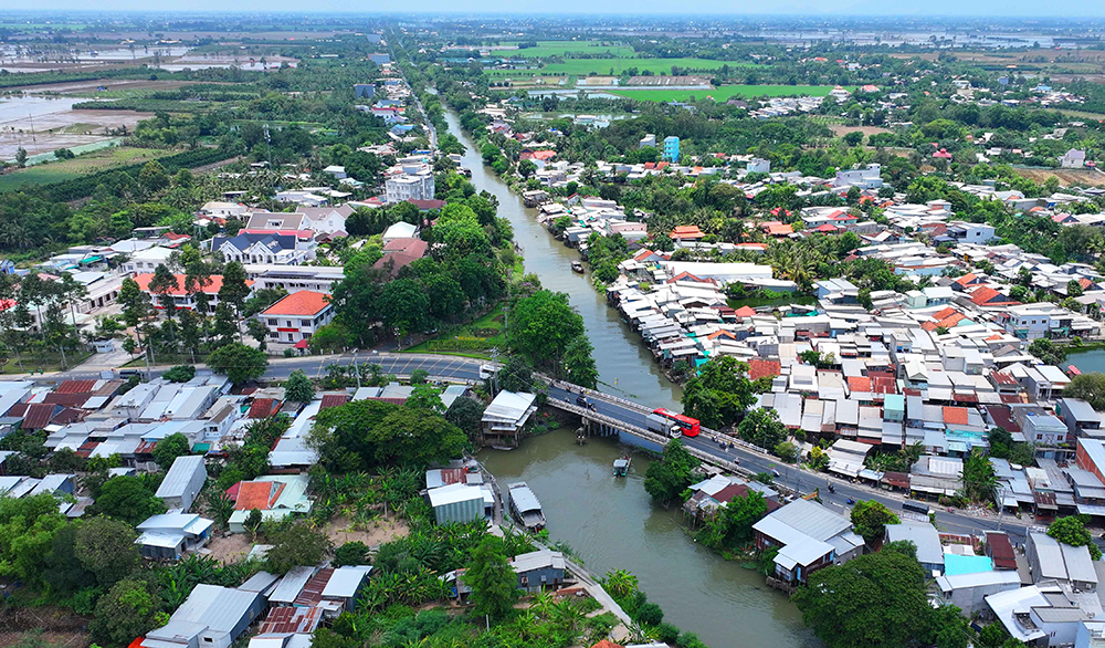
From above, the bridge across Highway 91 looks like an S-shape at the beginning of the canal.
Populous
In the scientific conference on the history of land reclamation in the Long Xuyen quadrangle from the beginning of the 18th century to the present, Prof. Dr. Tran Thi Mai (University of Social Sciences and Humanities) informed that after April 30, 1975, irrigation work was given importance by the authorities of the provinces in the Long Xuyen quadrangle, aiming to exploit land and water resources. In An Giang, the first project was the digging of the Chau Phu canal 10, from the provincial budget, from November 1976 to December 1978. The length of the canal is more than 20km, the water surface is 20m wide, and the average depth is 2.5m. The canal starts from the S-shaped bridge, connecting the Lo Te canal (Tri Ton district) at the iron bridge No. 10 (Chau Thanh district), becoming the junction between 4 localities: Chau Thanh, Chau Phu, Tri Ton and Tinh Bien town.
To explore this canal, at dawn, from Highway 91, we followed a rural road, running straight through the fields of Lang Linh. In the past, the canal was a dirt road, dusty in the dry season, and muddy in the rainy season, making it difficult to travel, so people had to travel by boat or canoe.
At this time, farmer Nguyen Van Thanh (71 years old, living in Thanh My Tay commune, Chau Phu district) is looking after the young green rice seedlings on a 20-hectare field. He said, in the past, there was no canal, so it was very deserted here! People mainly grew floating rice. During the flood season, the rice grows as the water rises. When the flood recedes, people harvest rice at the same time. Every household brings tools to the field to thresh rice as loudly as a festival. Each hectare yields a few bushels, enough to eat for the whole year, and there is little left over to sell like now.
But after the liberation day, the State dug an S-shaped canal along the field, bringing fresh water to the inner area. Farmers boldly switched to growing Than Nong rice, two crops a year. “At that time, water penetrated deep into the field, I planted rice with a good harvest, 20 hectares harvested 600 bushels of rice. For the first time in my life, my family had such a good harvest. Back then, growing rice required less fertilizer and pesticides than now, and the rice was still green and lush,” Mr. Thanh said excitedly. Since then, houses were built on this remote field, and a large population came to settle down. The lives of the people on the field gradually changed, creating the prosperous life today.
Important canal
Continuing to wander deep into the Da Noi palace, we met farmers sitting and chatting in the shade of the fields. When asked about the role of this canal, Mr. Tran Van Hung (70 years old) recalled that when they heard that the State was preparing to dig a canal, everyone was very happy. When the canal was completed, bringing water into the fields, people could pump it up to the fields to cultivate two rice crops. "The canal regulates water from the Hau River deep into the fields, helping farmers cultivate rice while creating conditions for smooth waterway traffic from An Giang to Ha Tien (Kien Giang province). In addition, the S canal also solves the problem of domestic water for people" - Mr. Hung expressed.
Currently, Mr. Hung is cultivating 40 hectares of rice in two crops. In recent years, rice prices have been at a good level, so his income is stable. With surplus production, he continues to reinvest in summer-autumn rice cultivation. After producing up to 70 hectares of rice fields, he bought a plow to make land for his family. Seeing that people have a need to level rice fields, he boldly serves them. Since then, with the accumulated money, he has invested in more rice fields. "Now that I am older, I have divided the land among my 3 children, each of whom gets 10 hectares of rice fields. In the last winter-spring crop, I grew Dai Thom rice, which was sold for 7,200 VND/kg, and each hectare yielded 1 ton. After deducting expenses, I pocketed more than 150 million VND," Mr. Hung said excitedly.
Running close to the middle of the S-shaped canal (the section connecting Mac Can Dung canal, Chau Thanh district), I met Mr. Nguyen Van Thanh (68 years old, living in Vinh An commune, Chau Thanh district). He has lived here since he was young, so he knows the story of digging canals very well. Back then, this area was uninhabited, farmers came to cultivate rice in the morning, and hurried home in the afternoon, because the fields were deserted and desolate! When the canal was completed, farmers came to build houses close together. The muddy rural dirt road was later paved smooth by the State, and cars drove straight from the beginning to the end of the canal.
Pointing down the canal, Mr. Thanh said that the most important thing about this canal is to regulate water. During years of big floods, boats crossing the canal often sink. “Before the flood, we always set up rescue teams at the sections where boats are often swept away by the flood. After the S-shaped canal is completed, every time the flood comes, the water will be regulated to the sea, reducing the pressure of water flowing through the canals,” said Mr. Thanh.
After decades, this S-shaped canal still brings water from the Hau River to the fields for farmers to produce. On the canal, boats and canoes run back and forth carrying rice and goods to distribute everywhere, creating a developed appearance in the once remote land.
| The first line of the S-shaped canal, on the North bank is Vinh Thanh Trung town, on the South bank is Cai Dau town (Chau Phu district), the end point is adjacent to Rach Gia - Ha Tien canal. The canal has 2 sections, section 1, from Hau river through Chau Phu district (20km long) intersects with Mac Can Dung canal, at bridge number 10 (Provincial road 941), so it is also called canal 10. Section 2 (19km long), from bridge number 10 goes straight through Tan Tuyen commune (Tri Ton district), continues My Thai canal, continues to Rach Gia - Ha Tien canal. From 1990 to 2002, the S-shaped canal was dredged by the government and people with scrapers, taking soil to fill up both banks of the canal to make a dike, thanks to that the canal is deeper and wider. |
LUU MY
Source: https://baoangiang.com.vn/di-qua-dong-kenh-chu-s-a419907.html



![[Photo] "King Cobra" Su-30MK2 completed its glorious mission on April 30](https://vphoto.vietnam.vn/thumb/1200x675/vietnam/resource/IMAGE/2025/4/30/5724b5c99b7a40db81aa7c418523defe)

![[Photo] Cultural, sports and media bloc at the 50th Anniversary of Southern Liberation and National Reunification Day](https://vphoto.vietnam.vn/thumb/1200x675/vietnam/resource/IMAGE/2025/4/30/8a22f876e8d24890be2ae3d88c9b201c)
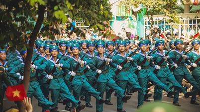
![[Photo] The parade took to the streets, walking among the arms of tens of thousands of people.](https://vphoto.vietnam.vn/thumb/1200x675/vietnam/resource/IMAGE/2025/4/30/180ec64521094c87bdb5a983ff1a30a4)



























Comment (0)