

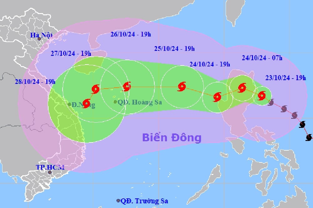
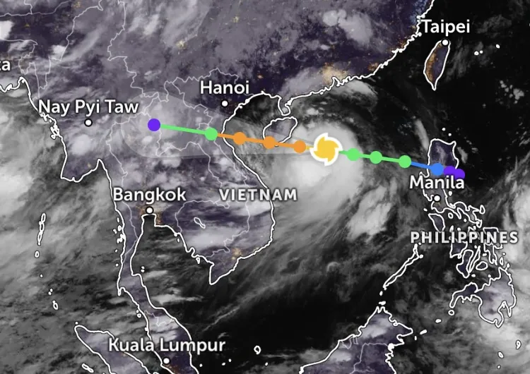
Typhoon Tra Mi (Trami) has entered the East Sea, becoming storm number 6. Due to the simultaneous impact of cold air and a newly formed storm circulation off the eastern Philippines, the storm's direction of movement has changed abnormally.
This afternoon (October 24), storm Tra Mi (Trami) crossed the 120th meridian and entered the East Sea, becoming storm number 6. At 4:00 p.m., the center was located at about 17.3 degrees North latitude; 119.9 degrees East longitude, in the eastern sea of the North East Sea. The strongest wind near the storm center was level 9 (75-88 km/h), gusting to level 11; moving westward at a speed of 15-20 km/h.
On the same day, Mr. Nguyen Van Huong, Head of Weather Forecast Department, National Center for Hydro-Meteorological Forecasting, also gave his opinion on the direction of storm No. 6.
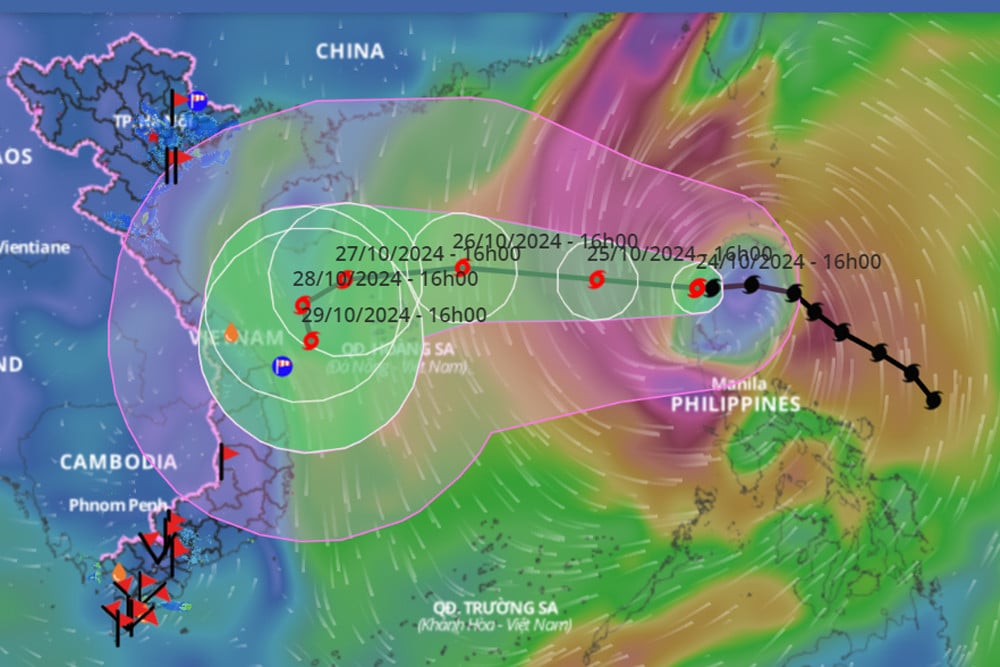
Accordingly, in the next 48 hours, storm No. 6 will move mainly in a westerly direction, with an average speed of about 15km/h and a tendency to gradually strengthen. When moving to the eastern area of the Hoang Sa archipelago, the storm's intensity is likely to reach its strongest (level 12, gusting to level 15).
Mr. Huong said that in the coming days, due to the simultaneous impact of a cold air system and a newly formed storm circulation off the eastern Philippines, the storm's direction of movement will continue to change abnormally.
In particular, when passing through the Hoang Sa archipelago, reaching the sea off the Central Coast (after October 26), storm No. 6 may slow down, weaken and change direction, the possibility of making landfall is still unclear, and needs to be monitored further.
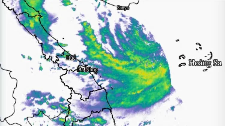
The immediate notes for the next 2 days, Mr. Huong emphasized, are the dangers of strong winds and big waves at sea, including in the northern and central areas of the East Sea; the sea area of Hoang Sa island district from today onwards will have strong winds of level 6-7, the area near the storm center will have level 8-9, then it will increase sharply as the storm intensifies.
At the same time, even the southern area of the East Sea is affected by the strong southwest monsoon of level 6, causing rough seas.
The impact of strong winds on coastal areas will be monitored further in the next bulletin.
In addition, the National Center for Hydro-Meteorological Forecasting said that in the next 24-48 hours, the North and Thanh Hoa will have no rain at night, some places will have fog in the early morning, and sunny days. The night and early morning will be cold, and the mountainous areas will be cold. Other areas will have scattered showers and thunderstorms.
Further assessment, from the night of November 26 to November 3, the North will have rain in some places, early morning fog in some places, sunny during the day; cold at night and early morning.
In the North and Central Central regions, there is a possibility of widespread heavy rain from the night of October 26-28.
In the Central Highlands and the South, from the night of October 26-29, there will be scattered showers and thunderstorms in the late afternoon and evening. During thunderstorms, there is a possibility of tornadoes, lightning and strong gusts of wind.
Storm Tra Mi is about to enter the East Sea, moving 'chaotically'

Hanoi weather for the next 3 days: Cold air remains, day and night temperatures differ
Source: https://vietnamnet.vn/bao-so-6-kha-nang-gap-khac-tinh-khong-khi-lanh-huong-di-chuyen-bat-thuong-2335114.html


Comment (0)