

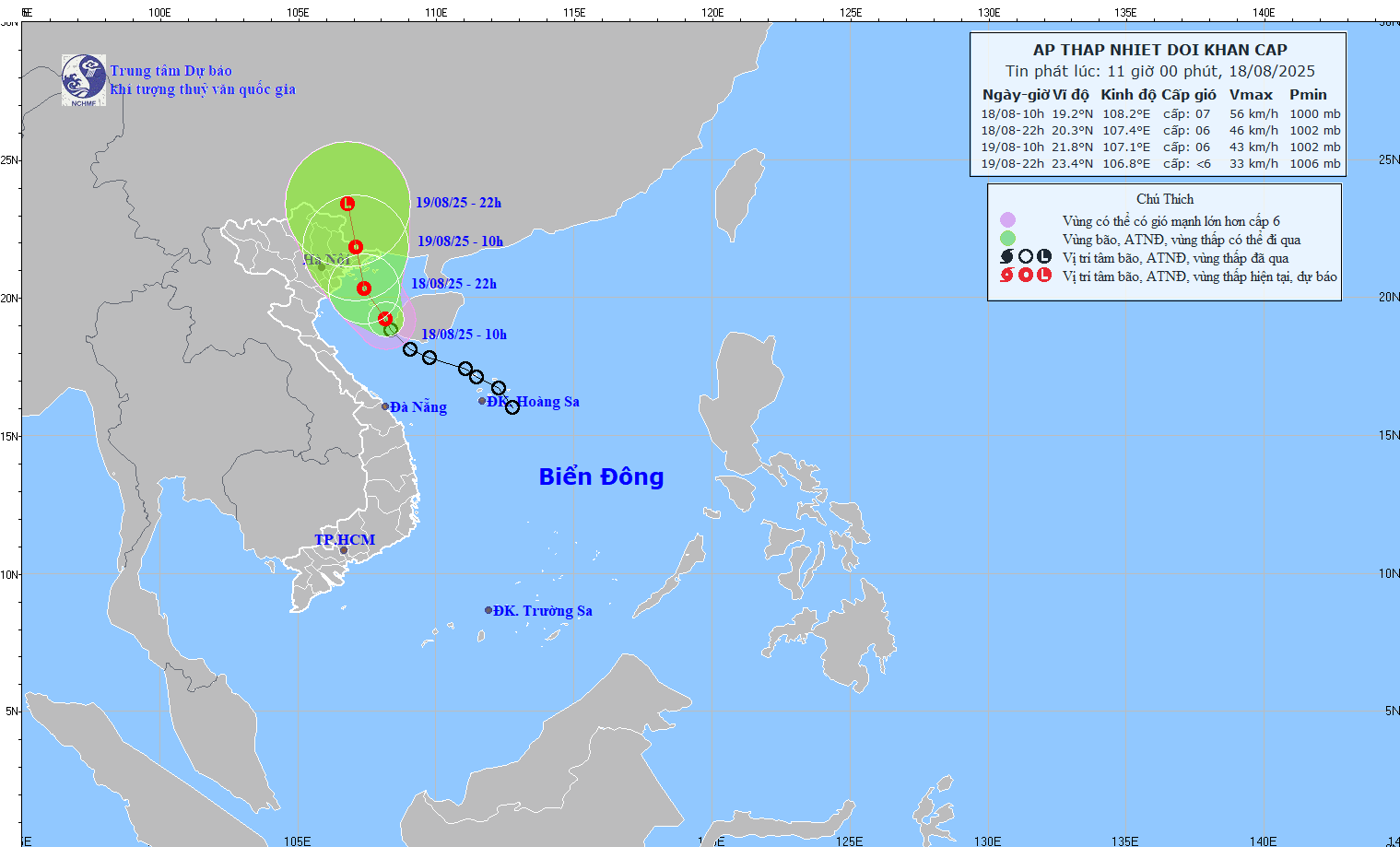
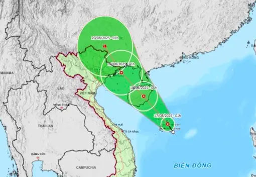
The National Center for Hydro-Meteorological Forecasting said that this morning, August 22, the low pressure area in the eastern part of Luzon Island (Philippines) strengthened into a tropical depression. Around tonight, August 22, the tropical depression will move into the East Sea, and is likely to strengthen into storm number 5 in the East Sea (international name is storm Kajiki).

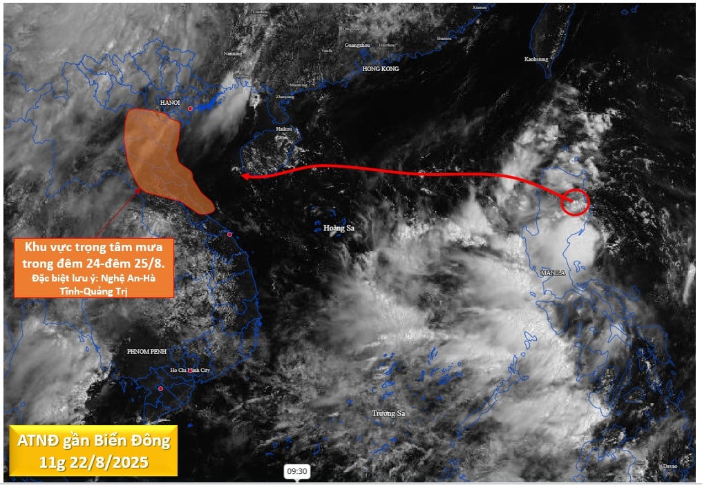
Tonight, August 22, the tropical depression will enter the East Sea and strengthen into storm No. 5. PHOTO: NATIONAL CENTER FOR HYDRO-METEORO-METEORO-GEOLOGICAL FORECASTING
When entering the East Sea, storm No. 5 moves quickly, at a speed of about 20 km/hour. Around August 25, when the storm moves to the Hoang Sa archipelago, its intensity can reach level 10 - level 11, gusting to level 13 - level 14 and can even get stronger when moving into the Gulf of Tonkin. It is forecasted that on August 25, storm No. 5 will move to the mainland of our country.
According to the National Center for Hydro-Meteorological Forecasting, due to the influence of storm No. 5, the northern and central East Sea (including Hoang Sa special zone) from tomorrow, August 23, will have strong winds of level 6 - level 7, then increasing to level 8 - level 9.
Forecast from August 24, the storm will increase to level 10 - level 11, gusting to level 13. Waves 4 - 7 m high, very rough seas with thunderstorms and heavy rain.
The sea area from Thanh Hoa - Da Nang from August 25 will have strong storm winds of level 8, near the storm center of level 11 - level 12, gusting to level 15.
Proactive response plan for storm number 5
The National Center for Hydro-Meteorological Forecasting assessed that, with the current impact scenario, the impact circulation of storm No. 5 is very wide, affecting the coast of the North and North Central regions. The coastal area from Nghe An - Quang Tri will be the main area affected by the storm circulation, with the possibility of strong coastal winds of level 10 - level 11, gusting to level 13 - level 14.
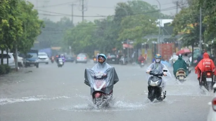
From the night of August 24 to the end of August 27, the provinces from Thanh Hoa to Hue City experienced heavy to very heavy rain, with rainfall ranging from 150 - 300 mm, with some places over 600 mm.
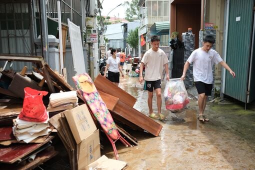
During the heavy rains of storm No. 5, a flood occurred on rivers from Thanh Hoa to Quang Tri; there is a risk of flash floods, landslides and inundation in low-lying areas, riverside areas, and urban areas of the provinces in the above region.
Localities need to proactively deploy flood prevention and control plans, review residents in dangerous areas, and ensure the safety of reservoirs and flood prevention works./.
According to Thanh Nien Newspaper
Source: https://thanhnien.vn/bien-dong-sap-don-bao-so-5-manh-cap-11-mien-trung-mua-lon-600-m-185250822122258003.htm
Source: https://baolongan.vn/bien-dong-sap-don-bao-so-5-manh-cap-11-mien-trung-mua-lon-600-m-a201176.html
![[Photo] Prime Minister Pham Minh Chinh chairs the conference to review the 2024-2025 school year and deploy tasks for the 2025-2026 school year.](https://vstatic.vietnam.vn/vietnam/resource/IMAGE/2025/8/22/2ca5ed79ce6a46a1ac7706a42cefafae)


![[Photo] President Luong Cuong receives delegation of the Youth Committee of the Liberal Democratic Party of Japan](https://vstatic.vietnam.vn/vietnam/resource/IMAGE/2025/8/22/2632d7f5cf4f4a8e90ce5f5e1989194a)


Comment (0)