


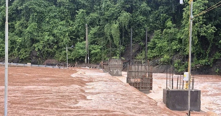
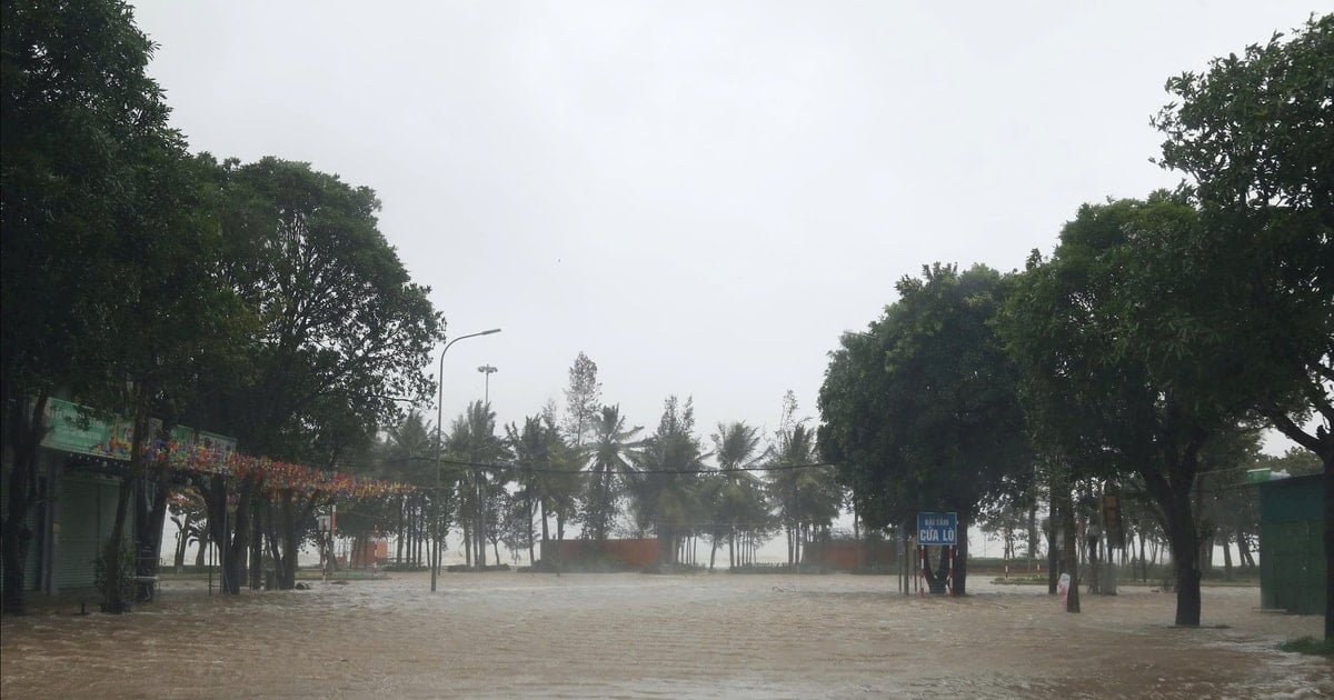
Storm No. 5 has made landfall in the North Central region - the focus is Nghe An - Ha Tinh, but from noon to evening of August 25, Hanoi and many places in the North have been experiencing heavy, incessant rain. In the provinces of Phu Tho, Lao Cai, Thai Nguyen... the rain poured down, rivers and streams poured rainwater.
 on the afternoon of August 25 due to incessant rain")
, afternoon of August 25")
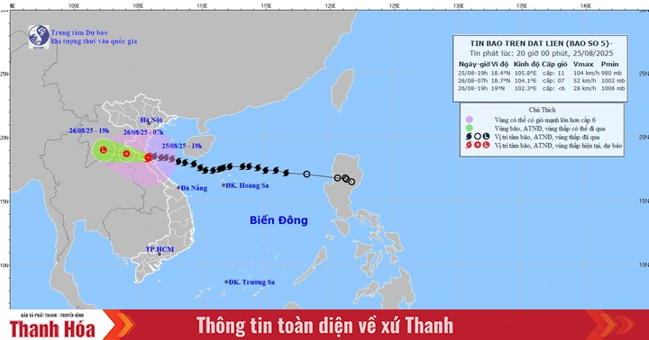
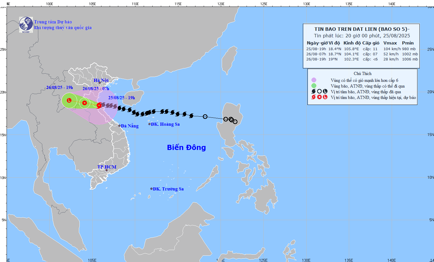
According to the National Center for Hydro-Meteorological Forecasting, as of 6 p.m. on August 25, the storm's eye was still on land in the Nghe An - Ha Tinh region, continuing to cause heavy rain and strong winds that lasted for many hours. The storm's eye at 6 p.m. on August 25 was at about 18.4 degrees North latitude and 105.8 degrees East longitude, with winds reduced to level 11, gusting to level 13. In the next 3 hours, the storm will move in a West-Northwest direction at a speed of 10 to 15 km/hour.


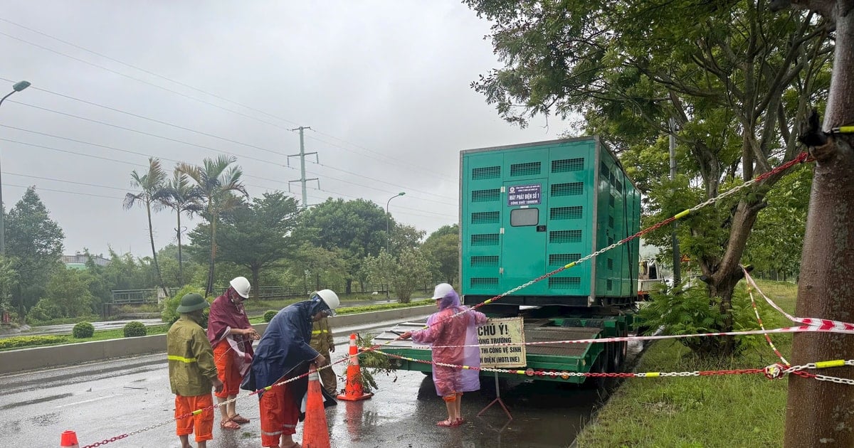
In the North Central provinces, especially Nghe An and Ha Tinh, strong winds and heavy rains have isolated many areas, increasing the risk of flash floods and landslides. Electricity and communication systems in some areas have been affected. Local authorities have advised people to limit their movements and closely monitor warning information.
On the evening of August 25, Mr. Hoang Phuc Lam, Deputy Director of the National Center for Hydro-Meteorological Forecasting, warned that storm No. 5 is still dangerous and will move slowly after making landfall in our country.
Source: https://www.sggp.org.vn/ha-noi-va-mien-bac-mua-tam-ta-post810126.html


![[Photo] General Secretary To Lam attends the 80th anniversary of Vietnam's diplomacy](https://vstatic.vietnam.vn/vietnam/resource/IMAGE/2025/8/25/3dc715efdbf74937b6fe8072bac5cb30)


Comment (0)