

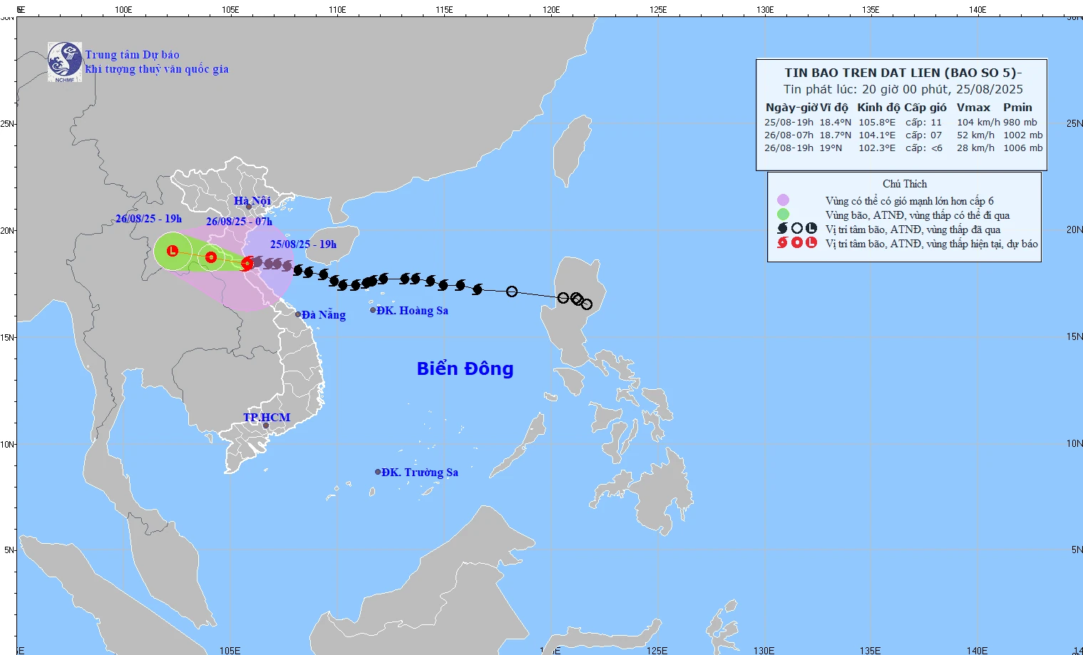
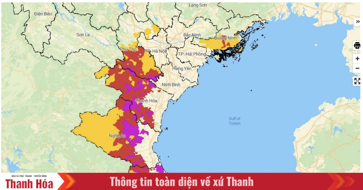
Forecast map of storm No. 5's path at 8:00 p.m. on August 25.
On the evening of August 25, storm No. 5 made landfall in the southern Nghe An - northern Ha Tinh provinces . At 7:00 p.m., the center of the storm was at 18.4°N - 105.8°E on the southern Nghe An - northern Ha Tinh provinces, with strong winds of level 10-11, gusting to level 13, moving in the West Northwest direction at a speed of 10 km/h.
Due to the influence of storm No. 5, at Bach Long Vi ( Hai Phong ) wind level 7, gust level 9; Co To (Quang Ninh) wind level 7, gust level 10; Hon Ngu (Nghe An) wind level 8, gust level 11.
Coastal areas of Quang Ninh - Thanh Hoa have winds of level 6-8, gusting to level 9. Nghe An - Ha Tinh area has strong winds of level 8-10, gusting to 11-12.
Storm surge: Sam Son (Thanh Hoa) 1.01m, Hon Ngu (Nghe An) 1.66m, Vung Ang (Ha Tinh) 0.51m.
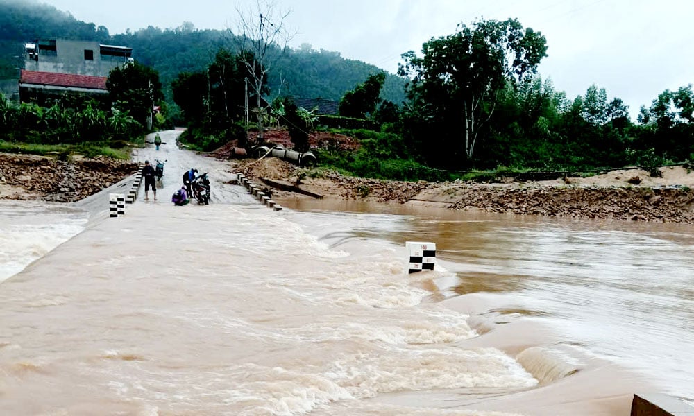
The Northern Delta provinces to Thanh Hoa - Quang Tri have had moderate to heavy rain, in some places over 500mm.
Storm forecast (next 12 – 24 hours):
7:00 a.m. August 26: The storm moved to the West Northwest at a speed of 15 km/h, weakening into a tropical depression, center at 18.7°N - 104.1°E (Central Laos), wind level 7, gust level 9.
Danger zone: 17.0°N – 20.5°N; West 109.0°E.
Level 3 risk: Northern Gulf of Tonkin (Bach Long Vi), Thanh Hoa - Quang Tri sea area (Hon Ngu).
7:00 p.m. August 26: The storm continues to move in the West Northwest direction, speed 15 km/h, center at 19.0°N - 102.3°E (Central Laos), wind below level 6.
Forecasting the impact of storms
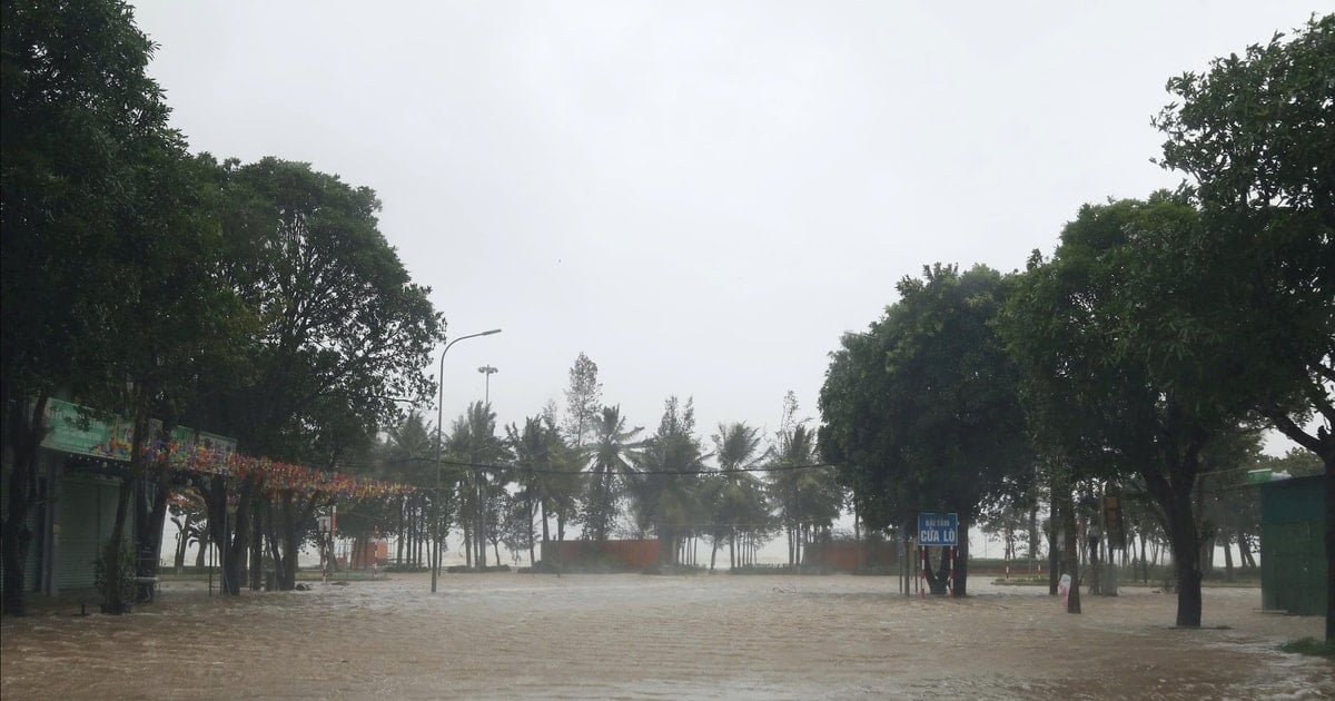
At sea: Thanh Hoa - Quang Tri sea area (Hon Ngu, Con Co) wind level 8-9, near the storm center level 10-11, gust level 13; waves 3-5m high, near the storm center 4-6m, rough sea. Northern Bac Bo Gulf (Bach Long Vi, Cat Hai, Co To, Van Don) wind level 6-7, gust level 9; waves 2-4m high, rough sea. The water level along the Thanh Hoa - Ha Tinh coast has peaked and is slowly falling with the tide.
Warning: Weather conditions at sea and along the coast are extremely dangerous. Boats, rafts, aquaculture areas, and coastal structures are at high risk of damage, capsizing, and flooding due to strong winds, large waves, and rising waters.
On land:
Northern Thanh Hoa wind level 7-8, gust level 9-10; Southern Thanh Hoa - Northern Ha Tinh wind level 8-9, near the storm center level 10-11, gust level 12-13; Southern Ha Tinh and coastal Quang Ninh - Ninh Binh wind level 6-7, gust level 8-9.
Heavy rain:
From the evening of August 25 - 26: The midlands and northern deltas, Lao Cai, Son La, Thanh Hoa - Northern Quang Tri will have rain of 50-100mm, some places >200mm; Ninh Binh - Ha Tinh will have rain of 100-200mm, some places >400mm. Warning of heavy rain >150mm/3 hours.
From the evening of August 25 to 27: Upper and Central Laos will have 100-250mm of rain, with some places in Central Laos having >500mm.
NM
Source: https://baothanhhoa.vn/bao-tren-dat-lien-nghe-an-ha-tinh-du-bao-sang-mai-suy-yeu-thanh-ap-thap-nhiet-doi-259478.htm

![[Photo] General Secretary To Lam attends the 80th anniversary of Vietnam's diplomacy](https://vstatic.vietnam.vn/vietnam/resource/IMAGE/2025/8/25/3dc715efdbf74937b6fe8072bac5cb30)


Comment (0)