

The Ministry of Transport said that in order to determine the cause, responsibility and propose solutions in an objective, scientific and careful manner, the ministry sent a working group including specialized agencies, construction units, consulting units, and experienced hydrological experts to conduct field inspections, assess in detail the terrain and hydrological conditions upstream and downstream of the flooded area, and review survey and design documents.

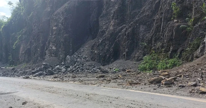
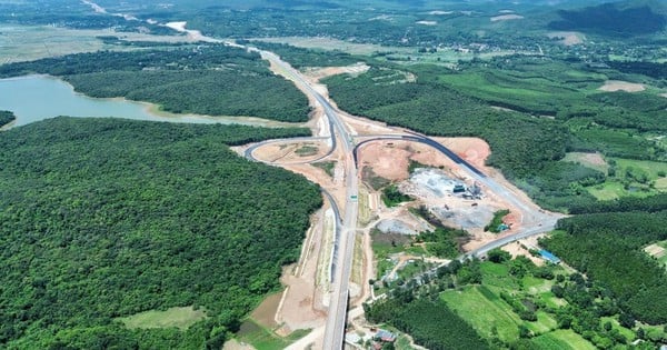
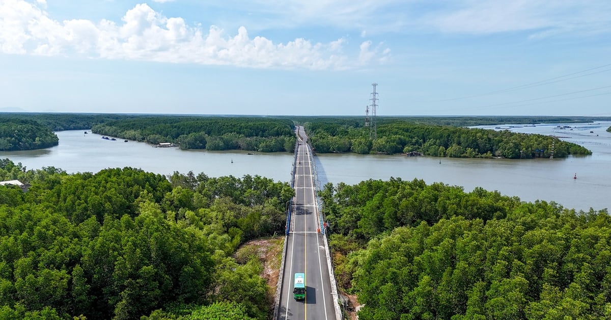
Previously, the Thang Long Project Management Board determined that the cause of the local flooding on the Phan Thiet - Dau Giay highway was due to the water in the Phan River rising, flowing into the downstream of the culvert, combined with water from upstream not being able to drain through the culvert, overflowing onto the road surface.
Based on the investor's report and the results of the actual inspection and review by experts, it shows that during the construction process, the units have implemented in accordance with the approved design documents, ensuring quality requirements.
Ministry of Transport announces cause of flooding on Phan Thiet - Dau Giay highway
Regarding the culvert aperture at the flooded location, the design consultant conducted a survey of the highest historical flood level in 1992 at the culvert location of 43.14m and calculated the culvert aperture. The results of reviewing the basin and input parameters showed that the culvert location at Km25+419 was designed with an aperture of (2.5x2.5m) to meet the drainage requirements of the upstream natural basin. At the time of the flood, although the rainfall had not yet reached the calculated frequency, the height had reached 45.23m, higher than the historical flood peak. This is an unusual factor that needs to be studied and clarified.
Regarding the cause of flooding, the section is located close to the Phan River, upstream there is a Phan River dam 8.6 km away from the flooded location. In general, after dams are put into operation, the downstream flow often changes. After inspection, experts assessed that from the culvert location to the downstream of the Phan River bridge, the riverbed and stream have invasive vegetation, sedimentation, narrowing the flow, causing local water stagnation, leading to a rise in the water level in the culvert area, causing flooding of the road.
"Experts unanimously assessed that this is a new route, and the area the route passes through at the time of the survey was sparsely populated. The investigation of hydrological data was difficult, and the consultant did not fully anticipate the narrowing of the flow downstream of the culvert, leading to local water stagnation. Experts also unanimously assessed that the calculation of the design elevation at a frequency of 1% at the culvert location without considering the water stagnation level was the responsibility of the consulting unit, although it was not an intentional error," the report of the Ministry of Transport stated.
Regarding the solution, the transport sector leader informed: In the immediate future, experts propose to organize the clearance of riverbed obstacles from the culvert location to the downstream of the Phan River bridge to increase drainage capacity and lower the water level at the culvert location. This solution is low cost, can be implemented immediately and the investor is directing the implementation to be completed this August. All implementation costs will be paid by the consultant.
In addition, to ensure long-term stability of the project, due to the complex hydrological regime in the downstream area of the dams, the Ministry of Transport requires the investor to hire a leading consulting unit to conduct a survey and calculation, build a calculation model for the entire area, thereby determining the water level corresponding to the design frequency of the project. Based on the calculated water level and comprehensive, scientific and highly accurate data, the solution will be considered and decided. If necessary, the red line of the flooded area can be raised if the calculated elevation is higher than the current route elevation. Currently, the Thang Long Project Management Board is directing units to implement these contents.
"The Ministry of Transport always adheres to the viewpoint of 'not trading off the quality of the project for any reason'. At the same time, considering this a lesson, we have requested investors to review the design documents for projects under construction, especially projects implemented in areas with complex geological and hydrological factors, need to calculate hydrological conditions affected by climate change factors and impacts of construction and production activities... to promptly adjust (if necessary) to ensure the sustainable quality of the project. The Ministry will strictly handle related entities if there are any problems affecting the quality according to the signed contract" - the leader of the transport sector affirmed.
Source link
![[Photo] President Luong Cuong attends special political-artistic television show "Golden Opportunity"](https://vstatic.vietnam.vn/vietnam/resource/IMAGE/2025/8/22/44ca13c28fa7476796f9aa3618ff74c4)
![[Photo] President Luong Cuong receives delegation of the Youth Committee of the Liberal Democratic Party of Japan](https://vstatic.vietnam.vn/vietnam/resource/IMAGE/2025/8/22/2632d7f5cf4f4a8e90ce5f5e1989194a)

![[Photo] Prime Minister Pham Minh Chinh chairs the conference to review the 2024-2025 school year and deploy tasks for the 2025-2026 school year.](https://vstatic.vietnam.vn/vietnam/resource/IMAGE/2025/8/22/2ca5ed79ce6a46a1ac7706a42cefafae)


Comment (0)