

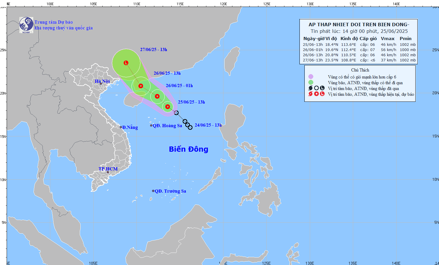
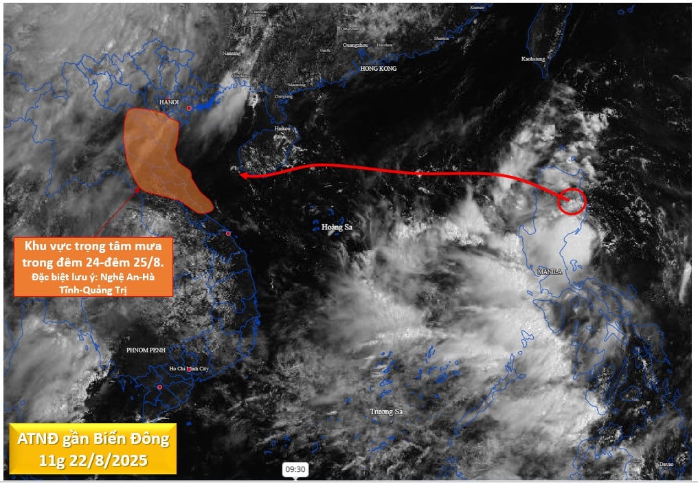
Forecast of the path of the tropical depression at 2:00 p.m. on June 25, 2025.
The center of the tropical depression is located at about 18.4 degrees North latitude; 113.6 degrees East longitude, about 300km northeast of Hoang Sa archipelago.
The strongest wind near the center reaches level 6 (39-49km/h), gusting to level 8.
The low pressure is moving northwest at a speed of about 20km/h.
It is forecasted that at 1am on June 26, the tropical depression will continue to move northwest at 15-20km/h, with the possibility of strengthening. The expected location is around 19.6N - 112.4E, about 170km east of Hainan Island. The intensity will reach level 6-7, with gusts of level 9.
Dangerous area at sea: from latitude 17.0N to 22.0N; longitude 111.0E to 115.0E. Natural disaster risk level: level 3, affecting the western sea area of the North East Sea (including the North of Hoang Sa archipelago).
At 1 p.m. on June 26, the tropical depression continued to move northwest at 15-20 km/h and tended to weaken. The center of the depression was at about 20.8N - 110.5E, in the sea east of Leizhou Peninsula (China). Wind strength decreased to level 6, gusting to level 8.
Dangerous area at sea: the northwest sea area of the North East Sea
Disaster risk level: level 3, affecting the northwest sea area of the North East Sea.
At 1:00 p.m. on June 27, the tropical depression is likely to gradually weaken into a low pressure area over the southern mainland of Guangxi province (China), at about 23.5N - 108.8E.
Due to the impact of the tropical depression, the western sea area of the North East Sea (including the North of Hoang Sa archipelago) has strong winds of level 6-7, gusts of level 9, and rough seas. Waves are 2.0 - 4.0m high.
Vessels operating in the hazard area are at high risk of encountering strong winds, large waves, tornadoes and severe thunderstorms.
NDS
Source: https://baothanhhoa.vn/ap-thap-nhiet-doi-di-chuyen-theo-huong-tay-bac-toc-do-khoang-20km-h-253195.htm

![[Photo] Prime Minister Pham Minh Chinh chairs the conference to review the 2024-2025 school year and deploy tasks for the 2025-2026 school year.](https://vstatic.vietnam.vn/vietnam/resource/IMAGE/2025/8/22/2ca5ed79ce6a46a1ac7706a42cefafae)
![[Photo] President Luong Cuong receives delegation of the Youth Committee of the Liberal Democratic Party of Japan](https://vstatic.vietnam.vn/vietnam/resource/IMAGE/2025/8/22/2632d7f5cf4f4a8e90ce5f5e1989194a)


Comment (0)