

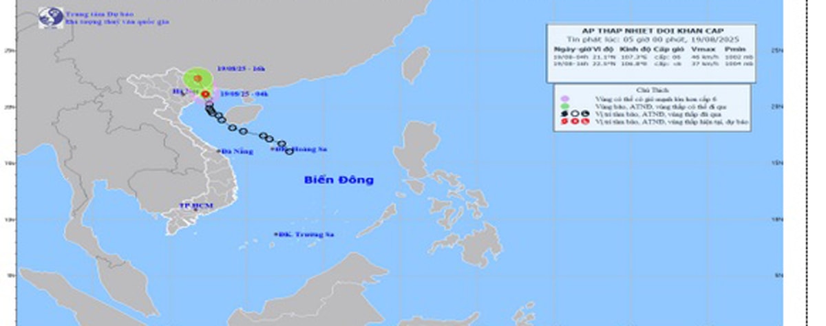
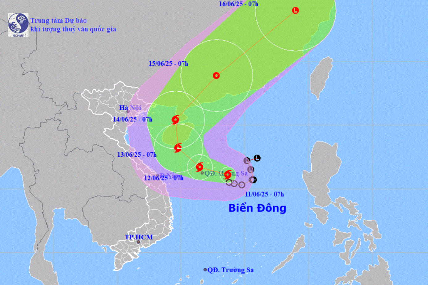
The early morning news of the city's Hydrometeorological Station said that at 4:00 a.m. this morning, August 19, the center of the tropical depression was at about 21.1 degrees North latitude; 107.3 degrees East longitude, on the coast of Quang Ninh - Hai Phong provinces. The strongest wind near the center of the tropical depression was level 6 (39-49 km/h), gusting to level 8; moving in the North-Northwest direction at a speed of about 15 km/h.
Due to the influence of the tropical depression, Bach Long Vi station has wind level 6, gusting to level 7. Hai Phong area has rain, moderate rain, heavy rain in some places.
On August 19, the northern area of Bac Bo Gulf (including the special zones of Bach Long Vi, Cat Hai, Co To and Van Don) will have thunderstorms and strong winds of level 6, gusting to level 8, waves 2.0 - 3.5m high, and rough seas.
Ships operating in the above mentioned dangerous areas are likely to be affected by storms, tornadoes, strong winds and large waves.
On land, coastal areas of Hai Phong (including Cat Hai special zone, Lan Ha Bay) have strong winds of level 6, gusting to level 8. Wards/communes located deep inland have winds of level 3-4.
Forecast for the day and night of August 19, the whole city of Hai Phong will have rain, moderate rain and thunderstorms.
Common rainfall in the Gulf of Tonkin (including Bach Long Vi special zone) is from 40 - 70 mm, in Hai Phong sea area, the eastern wards and communes of the city are from 20 - 40 mm, and in the western wards and communes of the city are from 15 - 30 mm.
Thunderstorms reduce visibility while driving, causing slippery roads and traffic accidents. Thunderstorms can be accompanied by tornadoes, lightning and strong winds that can break trees, damage houses, traffic works and infrastructure.
Warning level of natural disaster risk due to tornado and lightning: Level 1.
PVSource: https://baohaiphong.vn/ap-thap-nhiet-doi-dang-tren-vung-bien-quang-ninh-hai-phong-gio-giat-cap-8-518491.html


![[Photo] An Phu intersection project connecting Ho Chi Minh City-Long Thanh-Dau Giay expressway behind schedule](https://vstatic.vietnam.vn/vietnam/resource/IMAGE/2025/8/21/1ad80e9dd8944150bb72e6c49ecc7e08)


![[Photo] Politburo works with the Standing Committee of Hanoi Party Committee and Ho Chi Minh City Party Committee](https://vstatic.vietnam.vn/vietnam/resource/IMAGE/2025/8/21/4f3460337a6045e7847d50d38704355d)


Comment (0)