

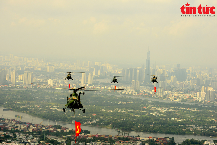
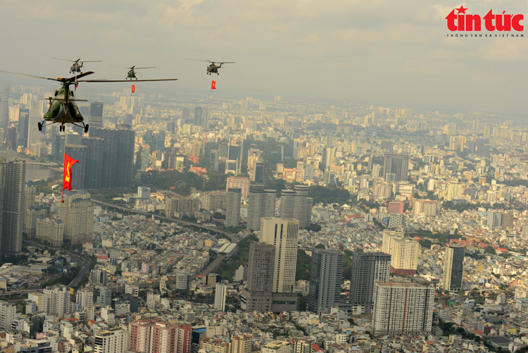
Helicopter squadrons practice flying with the national flag and the Party flag in the sky of Ho Chi Minh City, preparing for the 50th anniversary of the Liberation of the South and National Reunification Day (April 30, 1975 - April 30, 2025).
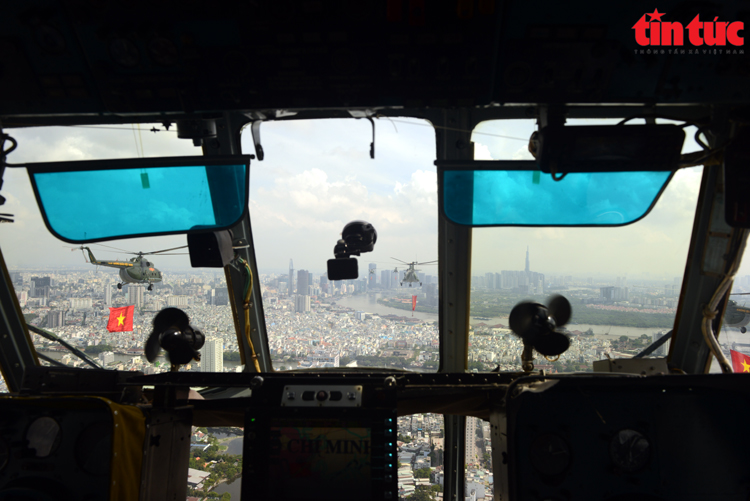
View of Ho Chi Minh City from the cockpit of a helicopter.
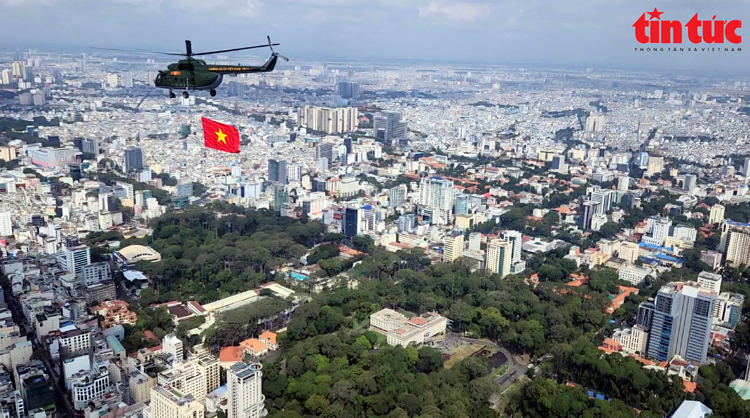
Helicopters carrying the national flag fly over the city.
The Air Defense - Air Force helicopter formation with modern aircraft flew over many typical landmarks of the city such as Independence Palace, Notre Dame Cathedral, Ben Thanh Market, Landmark 81 building and along the winding Saigon River. Each flight was carried out in a uniform, precise formation, carrying the national flag and the Party flag, creating a strong, sacred and spirited image.
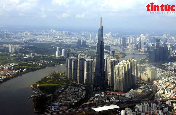
Helicopter flies over Landmark 81 building.
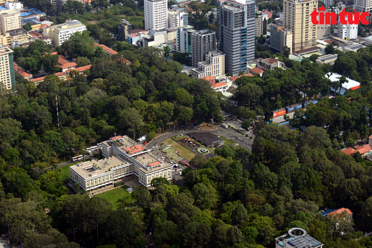
Historical site of Independence Palace seen from above.
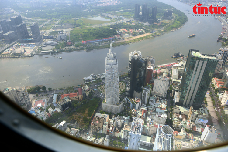
Skyscrapers appear through the helicopter window.
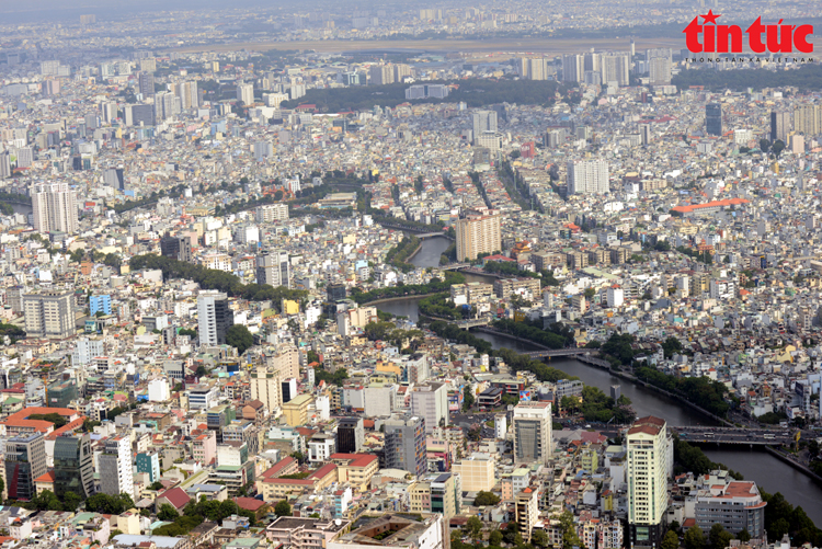
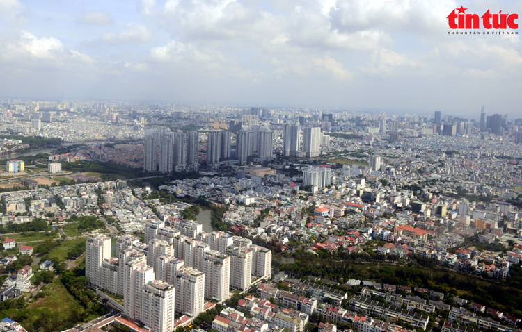
From above, Ho Chi Minh City appears as a vibrant and colorful urban picture. The green of parks and canals interspersed between modern residential areas; busy roads; architectural works... blending in an open space, bringing a feeling of both awe and pride.
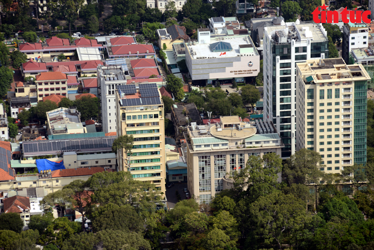
From the helicopter, you can observe the War Remnants Museum and the VNA Information Center building in the Southern region...
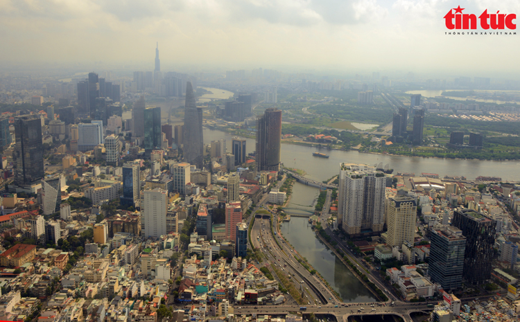
After 50 years of liberation, Ho Chi Minh City has now become a modern city with hundreds of high-rise buildings.
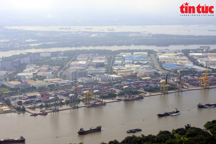
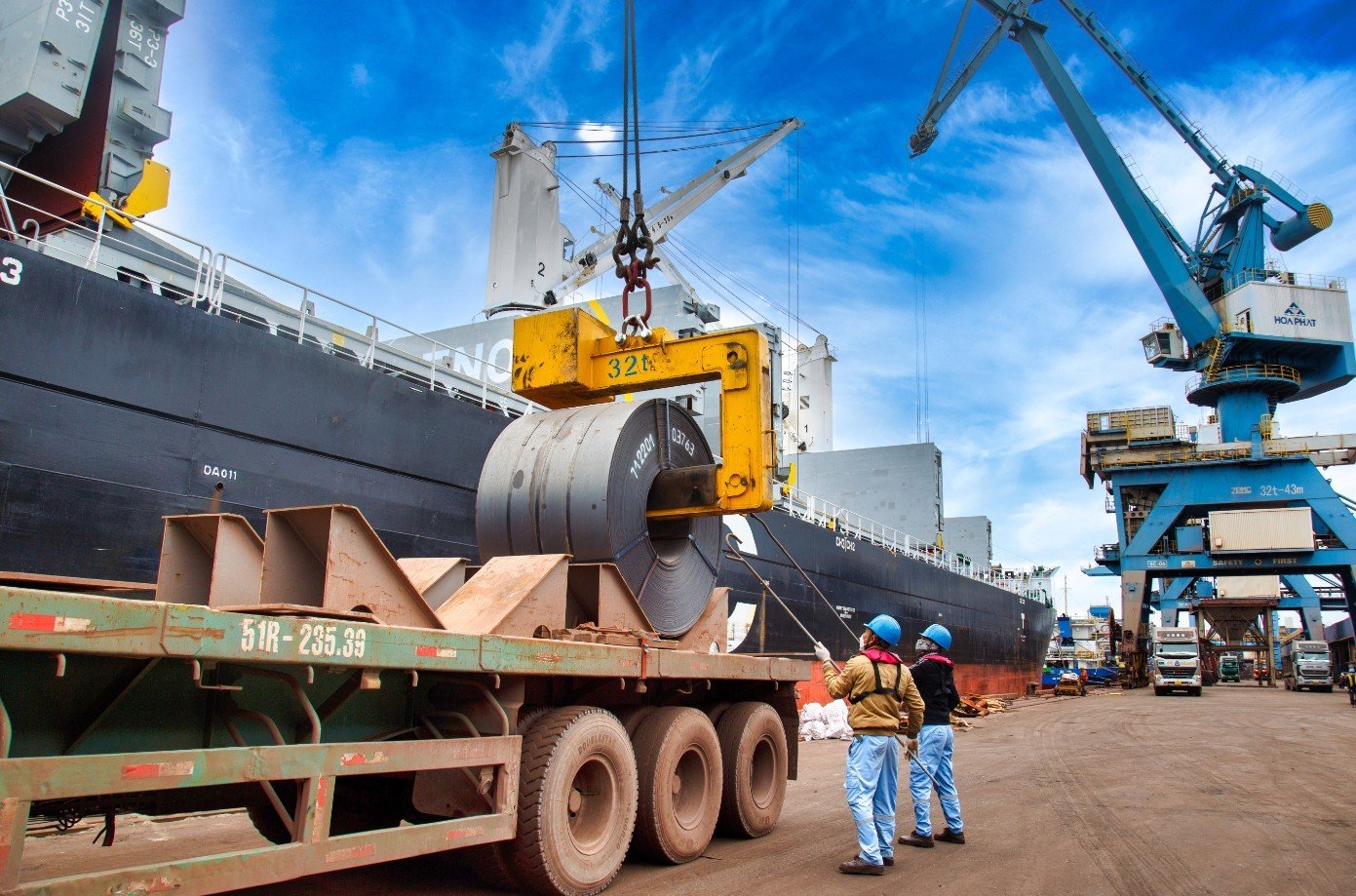
Tan Thuan Cargo Port.
In particular, the moment the helicopter formation tilted its wings to salute the Independence Palace - the place marking the end of the war and the reunification of the country - left a deep impression on the witnesses. For many, this was not only a flight training session but also an emotional journey, taking them back to the nation's historical journey from the sky of the city named after Uncle Ho.
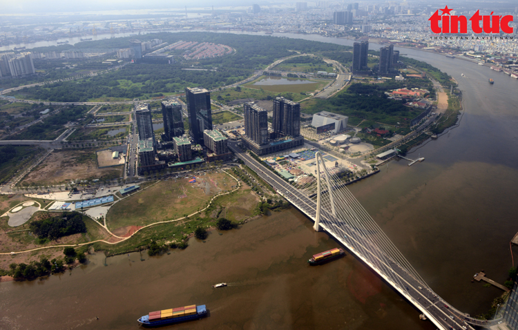
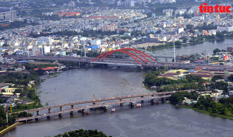
Ba Son Bridge is a modern traffic project, inaugurated in April 2022. Ba Son Bridge crosses the Saigon River, creating a connection between District 1 and Thu Duc City.
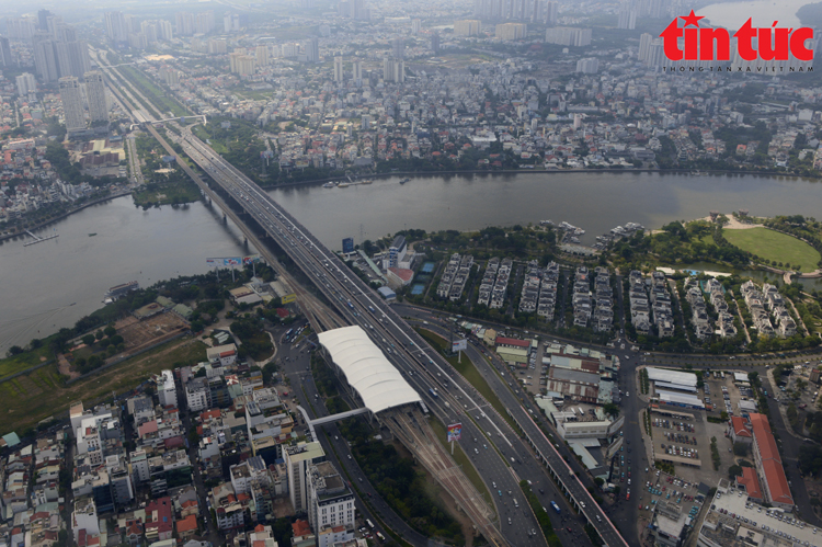
The urban railway line is parallel to Saigon Bridge, connecting traffic from the city center to Suoi Tien.
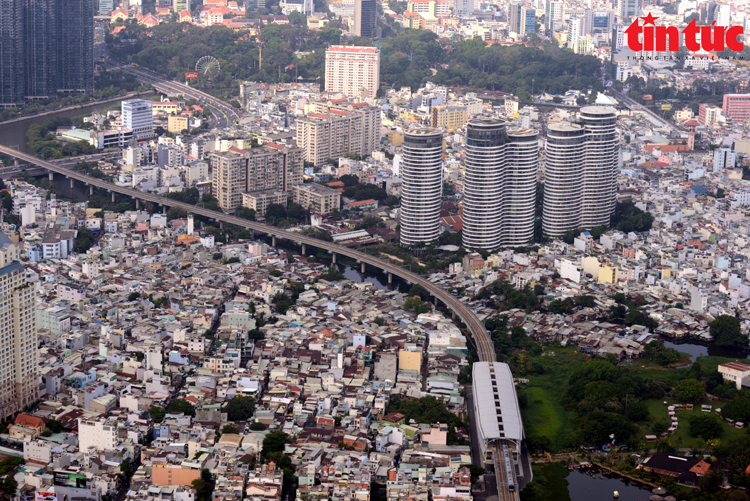
The urban railway line passing through skyscrapers brings vitality and a new look to Ho Chi Minh City.
Binh Loi Bridge is an architectural highlight located on Pham Van Dong Avenue.
Pham Van Dong Avenue is considered the most beautiful inner-city street in Ho Chi Minh City.
Helicopters carrying national flags and party flags flew over skyscrapers.
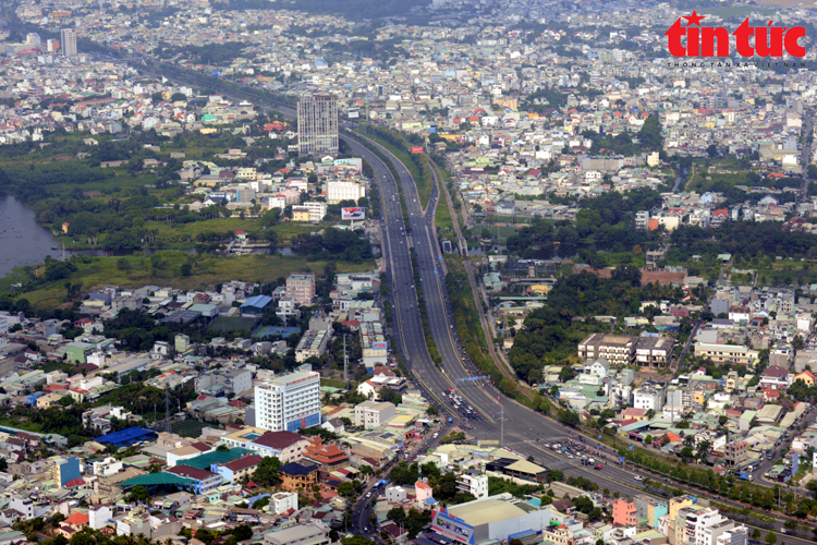
Traffic infrastructure at Cat Lai intersection (Thu Duc city). The project is located at the end of the East-West Highway (including Vo Van Kiet and Mai Chi Tho streets) connecting with Vo Nguyen Giap street. This is the most important route in the Eastern gateway area, connecting Ho Chi Minh City with the Southeast and Northern provinces.
Vo Nguyen Giap Road is the most important route in the Eastern gateway area, connecting Ho Chi Minh City with the Southeast and Northern provinces.
Nhieu Loc - Thi Nghe Canal The canal is nearly 9 km long, starting from the intersection of Le Binh and Ut Tich streets (Tan Binh district), flowing through the districts: Tan Binh, District 3, Phu Nhuan, District 1, Binh Thanh and pouring into the Saigon River.
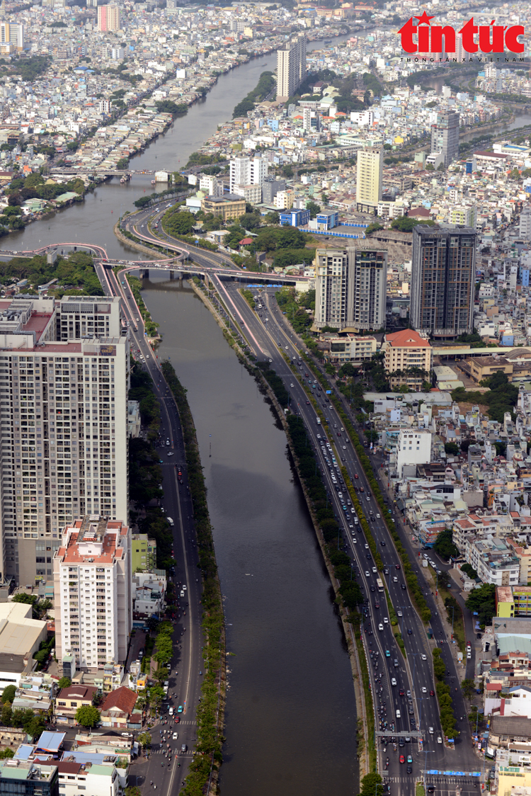
Vo Van Kiet Avenue along Tau Hu - Ben Nghe canal is a radial axis of Ho Chi Minh City, connecting the western gateway with the city center.
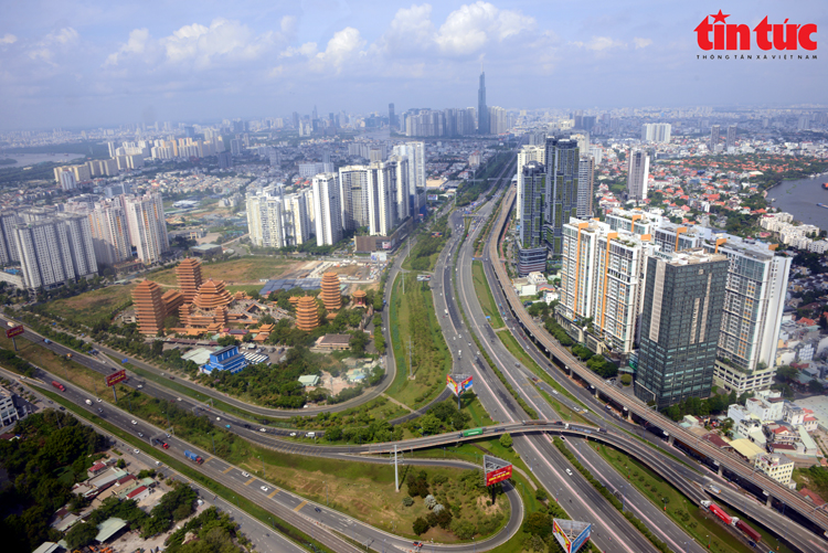
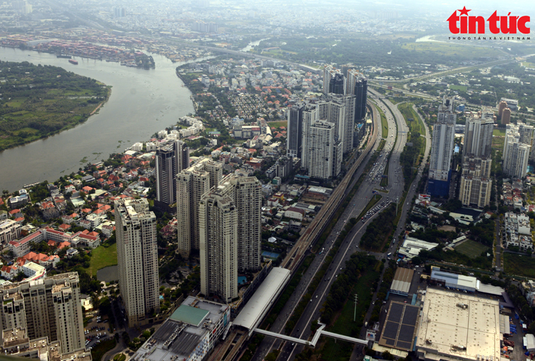
High-rise buildings are located on the District 7 side.
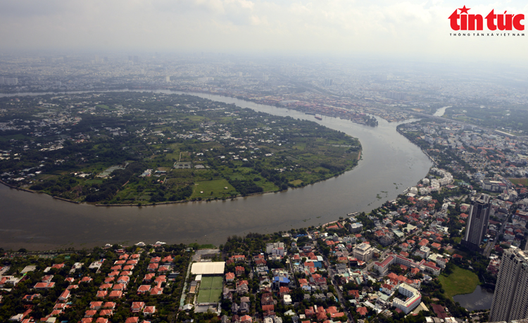
The Saigon River, 80km long, winds through Ho Chi Minh City and its intricate canal system, and is considered the "lifeblood" of the city.
Photo series: Manh Linh/Tin Tuc Newspaper
Source: https://baotintuc.vn/anh/ngam-toan-tp-ho-chi-minh-tu-truc-thang-huan-luyen-20250423142835355.htm


Comment (0)