
BEAUTIFUL MEMORIES OF THE RED BOOT MEMORIAL
Nearly 6 years ago, on the evening of May 15, 2019, the Ministry of Culture, Sports and Tourism and the People's Committee of Thua Thien-Hue province (now Hue city) celebrated the 60th anniversary of the opening of the Ho Chi Minh trail and received the certificate of ranking as a special national relic "Truong Son Road - Ho Chi Minh Trail" in HA Luoi. The Ho Chi Minh trail passing through Hue is classified as having the intersection of Road 72 - Road 14B and the Red Fort location (in the communes of Phu Vinh, Hong Thuong and Son Thuy). As a resident of the A Luoi border area, perhaps everyone knows about the Red Fort, because to get to the center of Hue city, you have to go through this intersection.
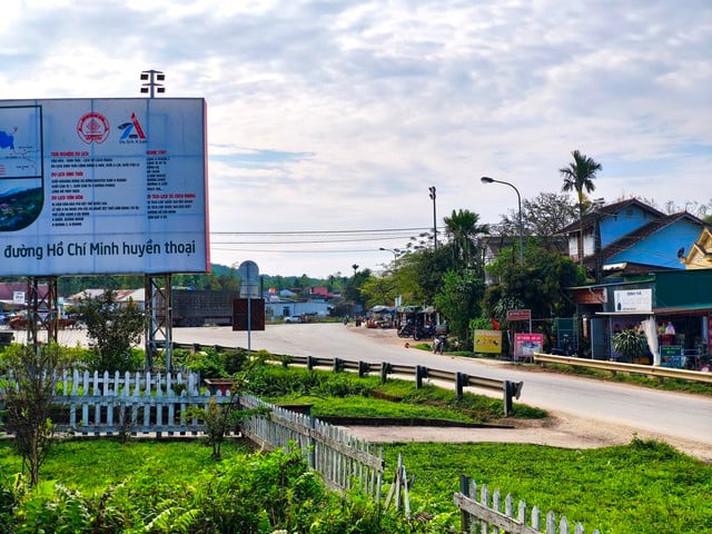
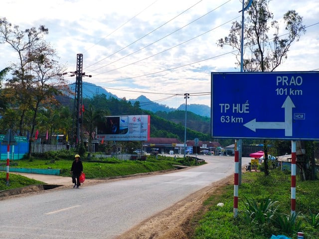
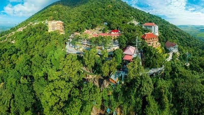
Red Bot Junction is part of the special national monument of Ho Chi Minh Trail - Truong Son Trail.
Photo: Hoang Son
Many documents record that during 16 years (1959-1975), our army formed a complete traffic network on the Truong Son mountain range. In HA Luoi, route 14B (now Ho Chi Minh road) is the backbone running from the mountains and forests of Quang Tri to Quang Nam. Of which, route 72 is the crossroad leading to Hue, intersection 14B at Bot Do junction. This location is also Km 0 of route 72. Route 72 was once called by locals as route 12 (because there was a section of route 12 in the midlands) before being officially named QL 49 - the main artery connecting the center of Hue City today.
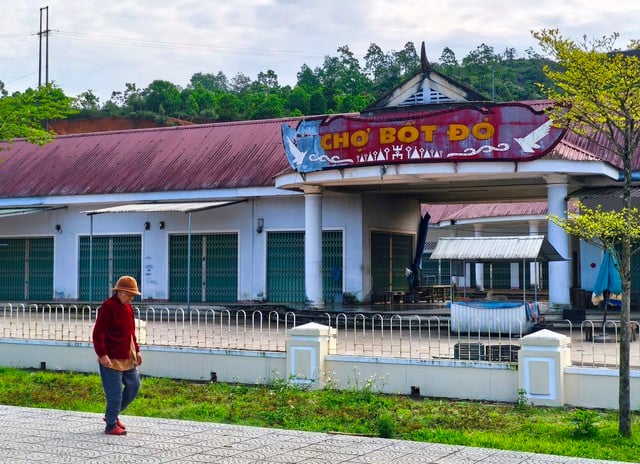
The name of the Red Bot intersection is associated with the market built next to it.
Photo: Hoang Son
According to local people, more than 30 years ago, right at Bot Do, there was a memorial designed to soar high, with a beautiful star on top. On the memorial, there was a stele clearly engraved with the meaning of the crossroads in the history of the resistance war. Next to it was a signpost. "After the country was reunified, the superiors built a beautiful 4-sided memorial to commemorate the sacrifice of the Truong Son troops - Group 559 in the work of opening roads to support the battlefield. Then, the opening of roads for local development demolished this memorial. The stele next to it also no longer exists, leaving many people with regrets...", said Mr. Le Phuc Tai (85 years old, former Head of the Planning Department of HA Luoi from 1976 to 1979, former Secretary of the Party Cell of Quang Hop village, Son Thuy commune).
RED BOOT IS A BOOT PAINTED RED ?
Many people living near the intersection said that in the past, in the area of Tran Hung Dao Secondary School (in Hong Thuong Commune), there was an armed company of the province stationed for several years. "The local people often called it the "red army" post, is it because of this popular name that people called this intersection the Red Post?", said a local.
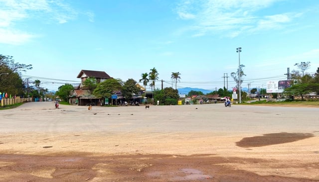
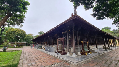
Today, the Red Bot intersection has been expanded but still has no monument symbol.
Photo: Hoang Son
Some documents indicate that the relic of the junction of Road 72 - 14B was originally a trail from the French colonial period. During the resistance war against the US, we advocated taking advantage of this existing road to mobilize forces and attack Hue when conditions permit. According to the Hue City History Museum, on the night of March 21, 1975, Regiment 217 and Regiment 6 broke through the enemy's defense line and captured the two villages of Dinh Mon and Kim Ngoc (on the left bank of the Huong River, opposite Nam Hoa district) as a springboard to directly threaten the Hue triangle. At this time, Road 72 was open to traffic, connecting with Road 12 to enter Hue.
Means of transport from Ho Chi Minh road to Hue city via National Highway 49 (old Highway 72)
Photo: Hoang Son
"About 300 meters from the intersection of Highway 72 and Highway 14B, on a low hill, the enemy built a military post and stationed troops here along with the system of military posts and airports in A Luoi in the years 1957 - 1959. At the end of 1960, we liberated most of the mountainous area of Thua Thien and continued to besiege and force the enemy to withdraw from these posts (Red Post) and A Luoi Post in 1964. After the Mau Than campaign in 1968, the enemy sent troops to Red Post again to attack and block our Highway 72, but our army and people drove them out here, firmly maintaining the strategic transportation and campaign area", according to information from the Hue City History Museum.
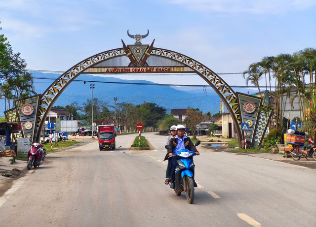
The intersection of the legendary Ho Chi Minh trail and Highway 49 (Route 72) at Red Fort
Photo: Hoang Son
From this information, it can be seen that the Red Fort intersection was most likely formed from the name of the Red Fort area. Was this Fort area once painted red? That is a question that needs to be clarified to increase the value of this special relic. (continued)
What makes people and tourists wonder is that although the intersection of Road 72 - 14B and the Red Box site has been recognized as a special national monument for the past 6 years, there is still no monument symbol. According to Thanh Nien reporters' investigation, according to the plan, at this intersection there will be a fairly large traffic island, on which there will be a monument symbol about 10 meters high. Mr. Nguyen Van Hai, Vice Chairman of the People's Committee of Ha Luoi, said that the district has deployed measurements and placed markers to demarcate the protected area of the monument, but the progress is stuck due to land clearance problems. The district has to temporarily suspend the project to study the solution.
Source: https://thanhnien.vn/dia-danh-la-buoc-ra-tu-cuoc-chien-chuyen-ke-o-nga-ba-bot-do-185250503200110527.htm


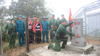
![[Photo] Solemn opening of the 9th Session, 15th National Assembly](https://vphoto.vietnam.vn/thumb/1200x675/vietnam/resource/IMAGE/2025/5/5/ad3b9de4debc46efb4a0e04db0295ad8)
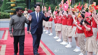
![[Photo] President Luong Cuong presided over the welcoming ceremony and held talks with Sri Lankan President Anura Kumara Dissanayaka](https://vphoto.vietnam.vn/thumb/1200x675/vietnam/resource/IMAGE/2025/5/5/bbb34e48c0194f2e81f59748df3f21c7)


![[Photo] National Assembly delegates visit President Ho Chi Minh's Mausoleum](https://vphoto.vietnam.vn/thumb/1200x675/vietnam/resource/IMAGE/2025/5/5/9c1b8b0a0c264b84a43b60d30df48f75)


Comment (0)