

On the morning of August 22, updates from world meteorological forecast models showed that the low pressure area in the East of the Philippines is moving rapidly, preparing to enter the East Sea and has a 60-70% probability of strengthening into a storm.
 according to ECMWF model. Source: WINDY")
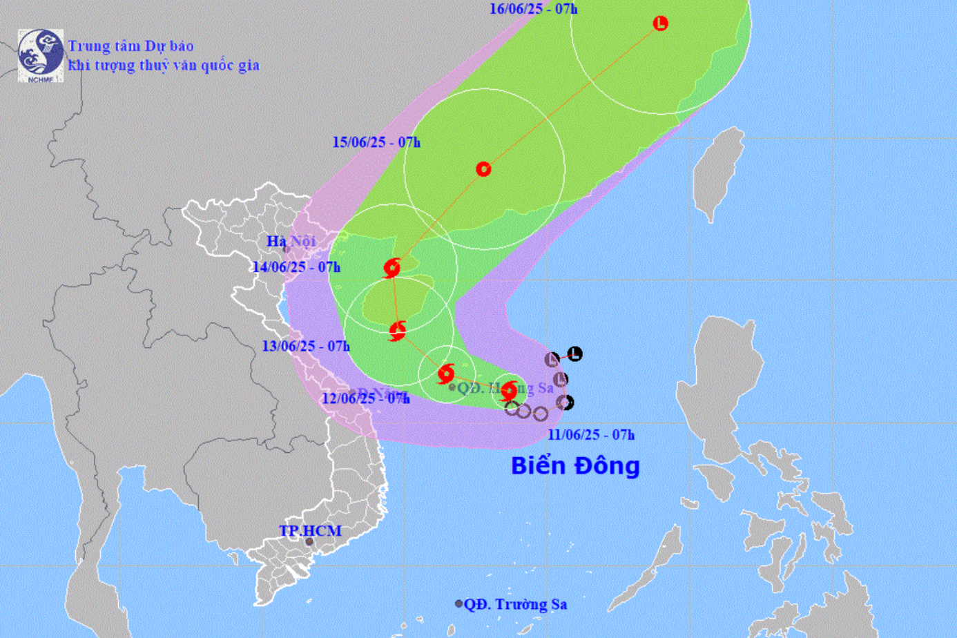
These models predict that the storm's eye will likely head towards the North Central region, possibly directly affecting mainland Vietnam on August 24 and 25.
")
")
The circulation of this system will cause the North and Central East Sea, including the Paracel Islands and the Gulf of Tonkin, to have increasingly strong winds and bad weather. Ships in the dangerous area should urgently seek safe shelter.
From August 25, the North and provinces from Thanh Hoa to Hue may experience widespread moderate to heavy rain, with the potential risk of flash floods and landslides.

According to the National Center for Hydro-Meteorological Forecasting, this low pressure area formed at noon on August 21 in the sea east of the Philippines, moving west-northwest at a speed of 15-20km/hour. The Vietnam Meteorological Agency advised people, especially in the coastal provinces of the North and North Central regions, to closely monitor forecast information to proactively respond.
Source: https://www.sggp.org.vn/bao-sap-vao-bien-dong-xac-suat-cao-do-bo-dat-lien-nuoc-ta-post809540.html


Comment (0)