
According to the National Center for Hydro-Meteorological Forecasting, there is currently a tropical depression active in the sea east of Luzon Island (Philippines).
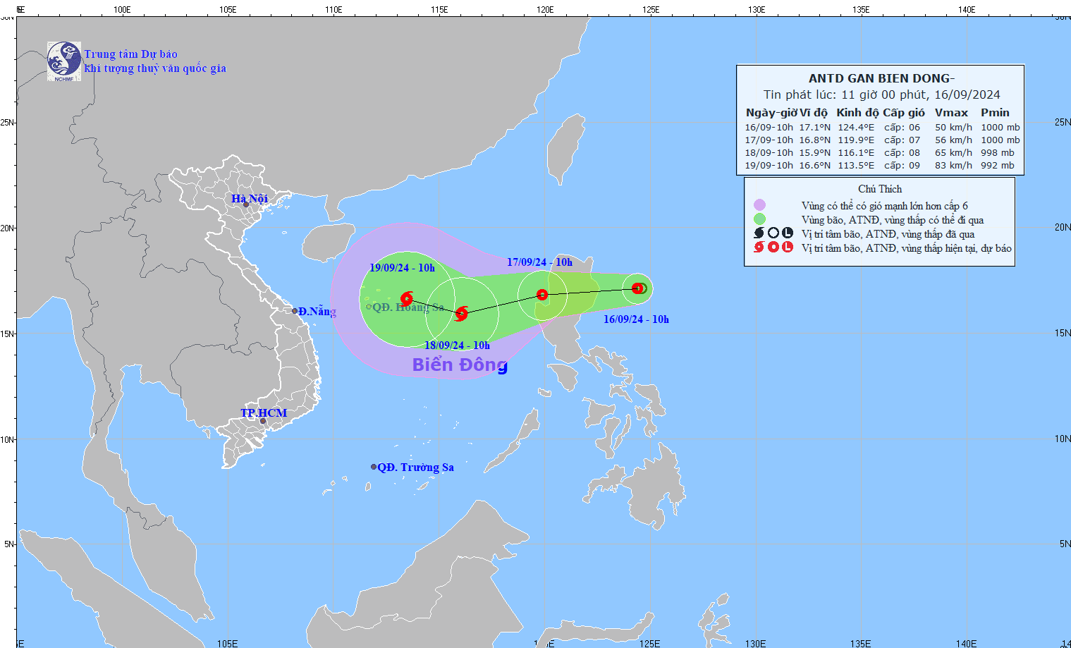
At 10:00 a.m. on September 16, the center of the tropical depression was at about 17.1 degrees North latitude; 124.4 degrees East longitude. The strongest wind near the center of the tropical depression was level 6-7 (39-61 km/h), gusting to level 9; moving mainly west at about 15 km/h.
Forecast of tropical depression developments in the next 24 to 48 hours: Tropical depression moves mainly in a westerly direction and strengthens into a storm .
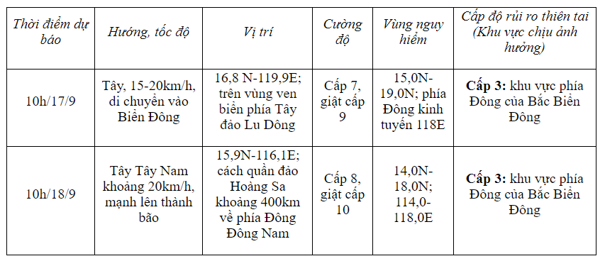
In the next 48 to 72 hours, the storm is likely to change direction, moving in a West Northwest direction, traveling 10-15km per hour.
Forecast of tropical depression causing strong winds at sea: From the morning of September 17, the eastern sea area of the North East Sea will have showers and strong thunderstorms, strong winds of level 7 (50-61km/h), gusts of level 9 (75-88km/h), rough seas.
In addition, the tropical depression caused the eastern sea area of the North East Sea to have waves 2 - 4m high.
Assessing natural disasters from now until the end of 2024, the meteorological agency said that from now until the end of September, the East Sea is likely to see 1-2 storms (likely concentrated in the last 10 days of September) and may affect the North and North Central regions. Warning of a high risk of heavy rain and floods in the Central region during the flood season in October - November 2024.
Source: https://vietnamnet.vn/xuat-hien-ap-thap-nhiet-doi-gan-bien-dong-du-bao-manh-thanh-bao-2322630.html


![[Photo] Bustling construction at key national traffic construction sites](https://vphoto.vietnam.vn/thumb/1200x675/vietnam/resource/IMAGE/2025/5/2/a99d56a8d6774aeab19bfccd372dc3e9)


![[Photo] Binh Thuan organizes many special festivals on the occasion of April 30 and May 1](https://vphoto.vietnam.vn/thumb/1200x675/vietnam/resource/IMAGE/2025/5/1/5180af1d979642468ef6a3a9755d8d51)
![[Photo] "Lovely" moments on the 30/4 holiday](https://vphoto.vietnam.vn/thumb/1200x675/vietnam/resource/IMAGE/2025/5/1/26d5d698f36b498287397db9e2f9d16c)


Comment (0)