 |
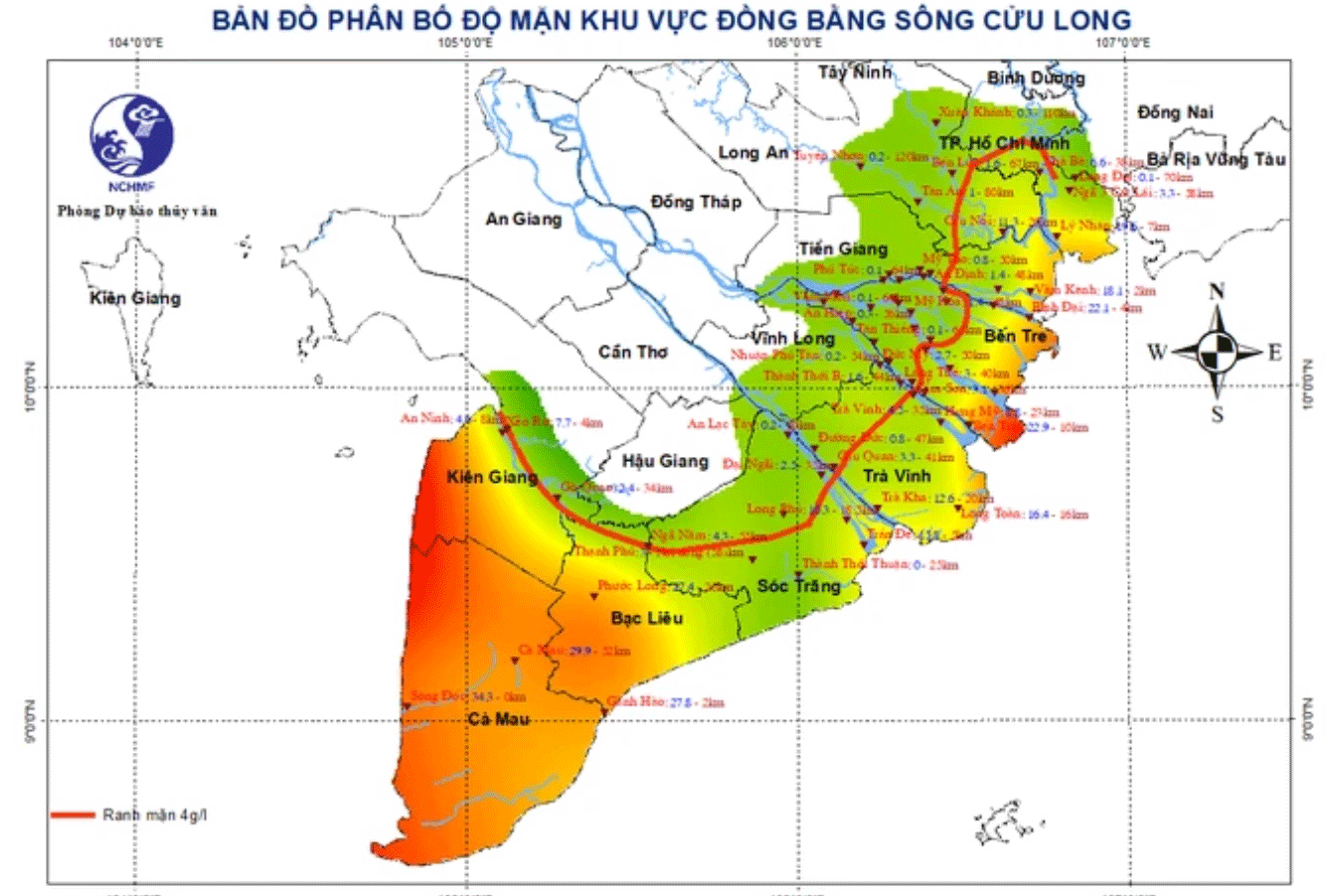
| Map of areas affected by salinity intrusion in the southern coastal region. Source: National Center for Hydro-Meteorological Forecasting. |
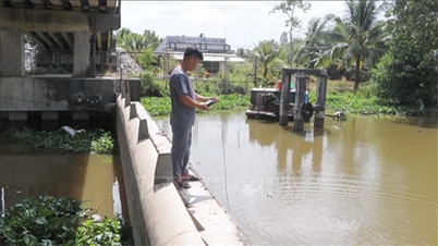
On the afternoon of April 30, the National Center for Hydro-Meteorological Forecasting reported that the tide level in the coastal area of the Southeast region is at a high level. Recorded at the Vung Tau hydrographic station at 3:30 a.m. the same day, the water level reached 4.12m (one of the highest levels of the month).
In the next 24-48 hours, the tide level in the South is forecast to remain high, occurring during two peak hours: from midnight to 5am and from 1pm to 7pm daily. Coastal areas from Vung Tau to Ca Mau, especially low-lying areas and outside the dyke, are at risk of localized flooding, affecting people's daily life, travel and production.
In addition to high tides, saline intrusion in the Mekong Delta is also becoming more complicated. The National Center for Hydro-Meteorological Forecasting said that the 4‰ salinity line has penetrated 30-50km along the two branches of the Tien and Hau rivers in the first 20 days of April.
In the last 10 days of April, the trend of saltwater intrusion tended to decrease slightly, but the saltwater boundary still penetrated 25 - 50km deep.
The Department of Irrigation (Ministry of Agriculture and Environment) warned that salinity levels in the Mekong Delta region could reach level 2 in the coming days, seriously affecting freshwater sources for farming and daily life.
The Meteorological and Hydrological Agency recommends that people and local authorities in the Mekong Delta proactively store fresh water during low tides; at the same time, it is necessary to check and reinforce the system of sluice gates, dams and irrigation works to minimize damage when high tides and saltwater intrusion occur at the same time.
( According to www.sggp.org.vn )
Source: https://baoapbac.vn/xa-hoi/202504/trieu-cuong-len-cao-ket-hop-xam-nhap-man-ven-bien-nam-bo-1041367/


![[Photo] Bustling construction at key national traffic construction sites](https://vphoto.vietnam.vn/thumb/1200x675/vietnam/resource/IMAGE/2025/5/2/a99d56a8d6774aeab19bfccd372dc3e9)


![[Photo] "Lovely" moments on the 30/4 holiday](https://vphoto.vietnam.vn/thumb/1200x675/vietnam/resource/IMAGE/2025/5/1/26d5d698f36b498287397db9e2f9d16c)
![[Photo] Binh Thuan organizes many special festivals on the occasion of April 30 and May 1](https://vphoto.vietnam.vn/thumb/1200x675/vietnam/resource/IMAGE/2025/5/1/5180af1d979642468ef6a3a9755d8d51)


Comment (0)