

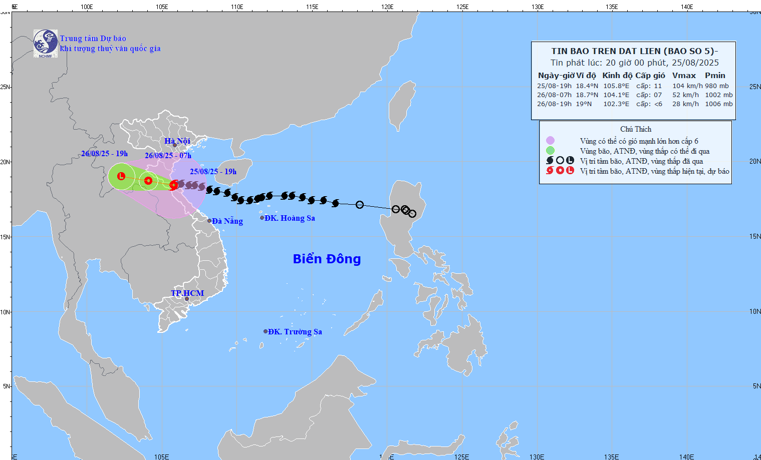
Storm status
Due to the influence of storm No. 5, at Dien Chau station, strong winds of level 6, gusts of level 7 were recorded; at Hon station, strong winds of level 8, gusts of level 11 were recorded.
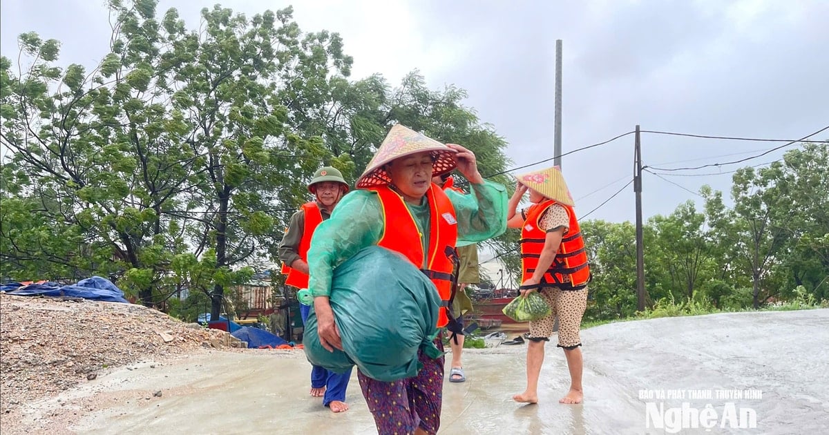
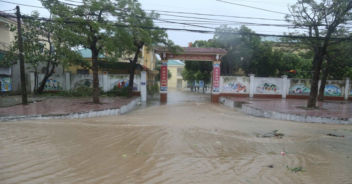
The coastal plain area of Nghe An has moderate to heavy rain, with common rainfall of 50-99mm.
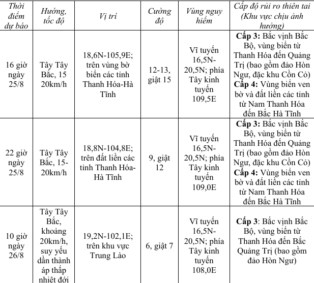
Forecasting the impact of storms
Strong winds, high waves, rising water:
At sea:
The sea area of Nghe An province (including Hon Ngu island) has winds gradually increasing to level 7-9, then increasing to level 10-12, near the storm center level 13-14, gusting to level 17; waves 5.0-7.0m high, near the center 8.0-10.0m. The sea is very rough.
Storm surge and coastal flood warnings:
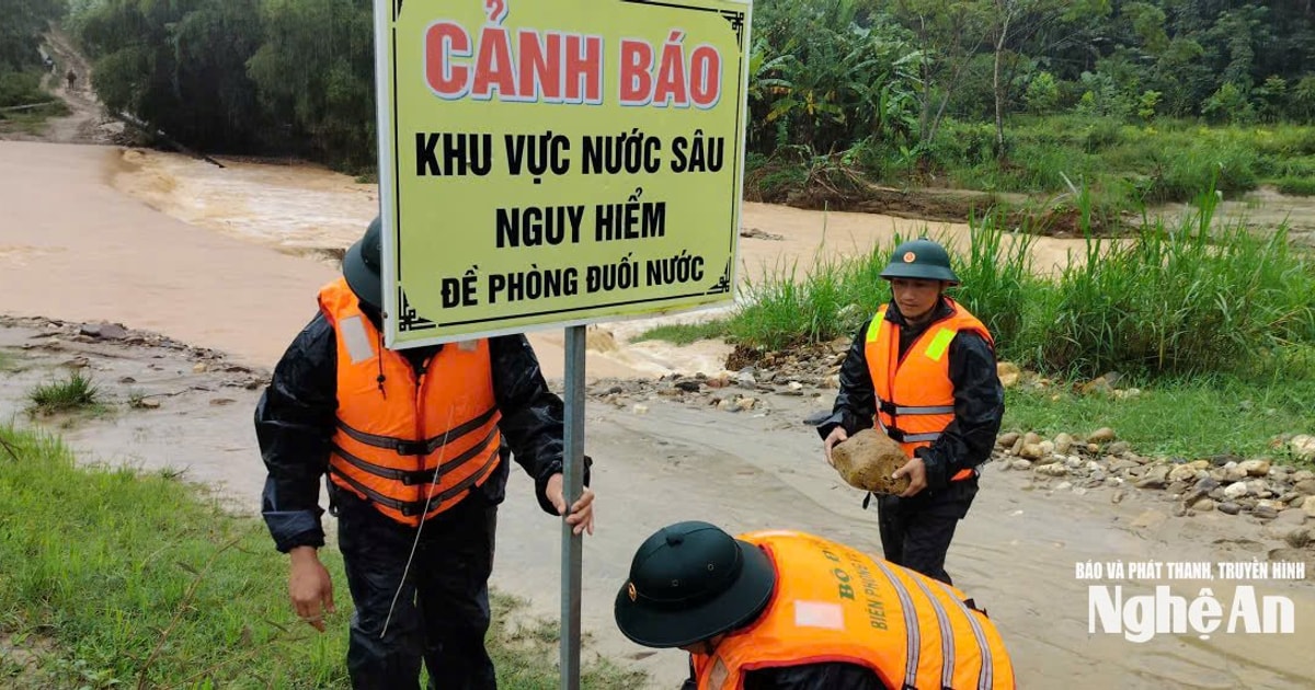
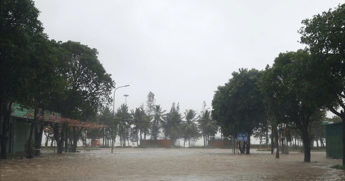
Coastal areas of Nghe An province have storm surges of 0.5-1.8m high. Water levels at Hon Ngu (Nghe An) are 3.4-3.8m high. There is a high risk of flooding in low-lying coastal and river mouth areas due to surges and big waves in the afternoon and evening of August 25.
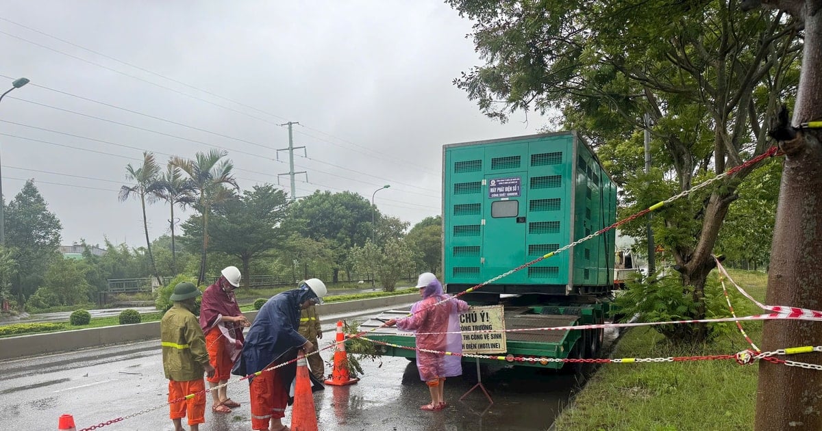
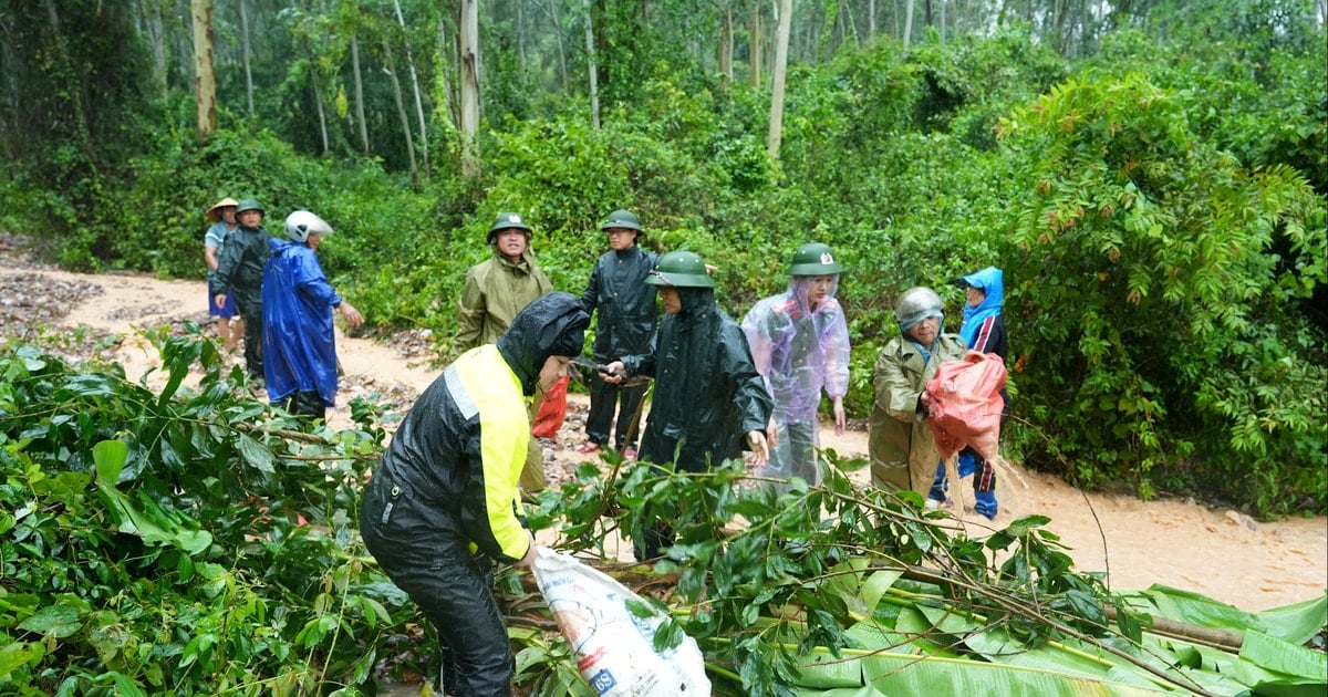
Warning: The weather at sea and in coastal areas during the storm is extremely dangerous and unsafe for any vehicles or structures operating in the danger zone such as: cruise ships, passenger ships, cargo ships, cages, rafts, aquaculture areas, dykes, embankments, coastal routes. Vehicles are at high risk of capsizing, destruction, and flooding due to strong winds, large waves, and rising sea levels.
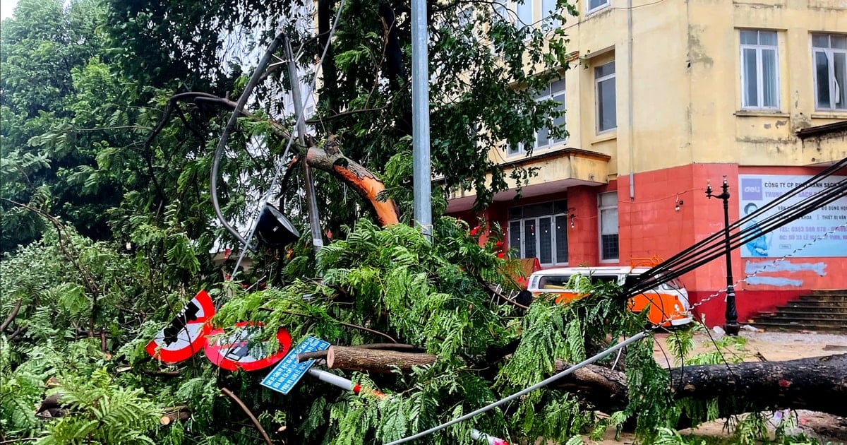
On land: From August 25, on land in Nghe An province, winds will gradually increase to level 12-14, gusting to level 15-16.
Heavy rain:
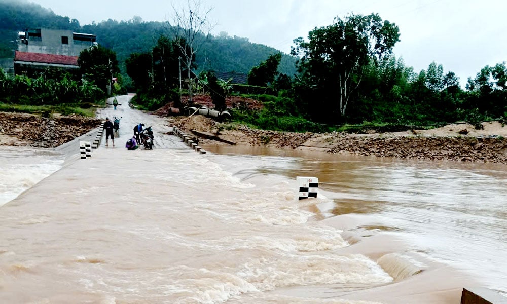
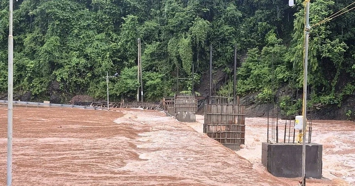
From this afternoon (August 25) to August 26, Nghe An province will have heavy to very heavy rain, some places will have especially heavy rain and thunderstorms. Rainfall in mountainous areas is common: 150 - 250mm, some places over 300mm.
Common midlands and plains: 150-250 mm, some places over 500mm such as Cua Lo, Truong Vinh, Hung Nguyen...
Next news will be broadcast at 2:00 p.m. on August 25.
Source: https://baonghean.vn/tin-bao-so-5-luc-11h-ngay-25-8-cach-nghe-an-120km-ve-phia-dong-dong-nam-gio-giat-cap-17-10305177.html

![[Photo] General Secretary To Lam attends the 80th anniversary of Vietnam's diplomacy](https://vstatic.vietnam.vn/vietnam/resource/IMAGE/2025/8/25/3dc715efdbf74937b6fe8072bac5cb30)


Comment (0)