

DNO - The City People's Committee has just approved partial adjustments to the General Planning of Da Nang City to 2030, with a vision to 2045, regarding some contents on land use in subdivisions such as high-tech, hillside urban, innovation, Da Nang Bay, Lien Chieu seaport, and green core center.
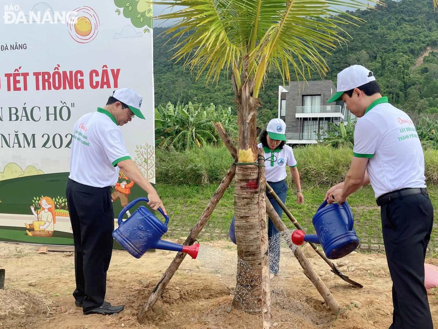 |
| After the partial adjustment of the General Planning of Da Nang City to 2030, with a vision to 2045, the area of urban green trees in the planning subdivisions has been increased. In the photo: Permanent Vice Chairman in charge of the City People's Council Tran Phuoc Son (left) plants trees in the early spring of Giap Thin, contributing to the creation of green parks. Photo: HOANG HIEP |
Accordingly, the high-tech zone (Hoa Khanh Bac, Hoa Hiep Nam, Hoa Hiep Bac wards of Lien Chieu district and Hoa Lien and Hoa Son communes of Hoa Vang district) has a locally adjusted planning area of about 404 hectares due to the allocation of social infrastructure clusters (swapping locations) in accordance with the actual situation and existing residential areas.
The planned location for the construction of the northern bus station has been adjusted to the intersection area of the southern bypass of Hai Van tunnel and the western beltway 2.
The hillside urban subdivision (Hoa Son, Hoa Ninh, Hoa Nhon, Hoa Phu communes of Hoa Vang district) has a locally adjusted planning area of 457 hectares due to the organization and reallocation of 3 lake locations, adding more green spaces with the target of using new residential land units reduced by 20 hectares, mixed-use land reduced by 12 hectares, agricultural land reduced by 23 hectares, urban-level public green land combined with water surface increased by 48 hectares, production forest land increased by 108 hectares.
The production forest area at Truoc Dong Lake is adjusted into a thematic park; the mixed-use land position is swapped to develop a non-tariff complex project at the intersection of Ba Na - Suoi Mo road and the 29m planned road axis; the industrial land west of the southern bypass of Hai Van tunnel is adjusted into warehouse land to expand the logistics area in Hoa Nhon commune and the land of key technical infrastructure works to arrange Hoa Nhon dry port...
The innovation zone (Khue Trung, Hoa Xuan, Hoa Tho Tay wards of Cam Le district and Hoa Phuoc commune of Hoa Vang district) has a local planning adjustment area of 34 hectares due to the reallocation of social infrastructure clusters (swapping locations) in the area west of Tran Nam Trung street with the target of using urban public land increasing by 9 hectares, high school land increasing by 2 hectares, agency land decreasing by 11 hectares; adjusting urban public service land into urban public green land combined with underground parking lot in the land northwest of the intersection of the road leading to Nguyen Tri Phuong bridge and Thang Long street.
The Danang Bay coastal subdivision (Hoa Minh, Hoa Khanh Bac, Hoa Khanh Nam wards of Lien Chieu district and Thanh Khe Tay ward of Thanh Khe district) has a local planning adjustment area of 31 hectares due to the allocation of social infrastructure clusters (swapping locations) in the area west of Hue intersection overpass to suitable areas, in which, the current residential land is retained and increased by about 5 hectares.
The area of 29/3 Textile Joint Stock Company (5ha) was adjusted from urban public service land to mixed-use land to arrange social infrastructure and high school; the Coca-Cola factory area (4ha) was adjusted from residential land to medical center land; the old railway station planning area (12ha) was adjusted from mixed-use land to urban public service land (9ha) and arranged high school land (3ha) adjacent to Me Suot street; additional public green space land was added to expand the central square in the northwest area of the city.
Lien Chieu seaport subdivision (Hoa Hiep Bac ward of Lien Chieu district and Hoa Lien commune of Hoa Vang district) has a locally adjusted planning area of 49 hectares due to adjusting the planning area of warehouse land into residential land to retain the current stable residential area (3 hectares); land for technical infrastructure works increased by 46 hectares...
The green core central subdivision (Hoa Nhon commune, Hoa Vang district) has a locally adjusted planning area of about 11 hectares due to the expansion of the medical center land in the Hoa Vang district medical center area to form a medical center and research and development of medical technology, training, and technology transfer.
HOANG HIEP
Source
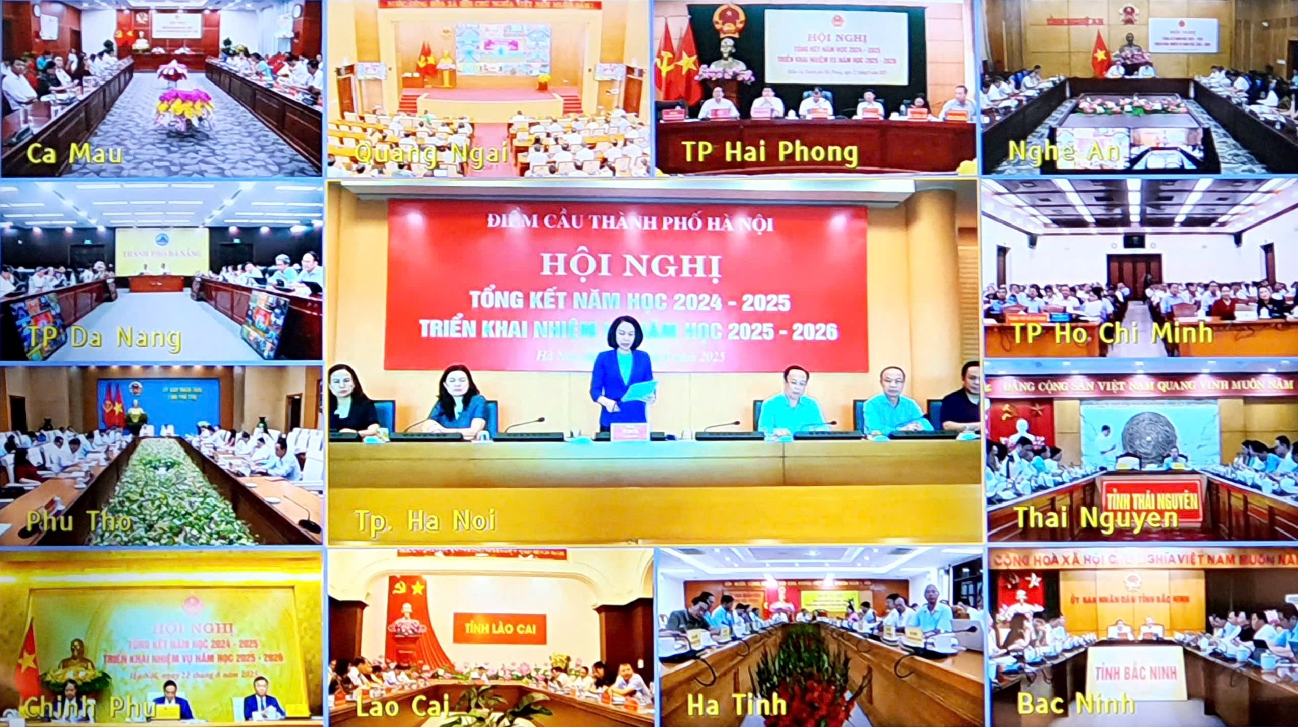
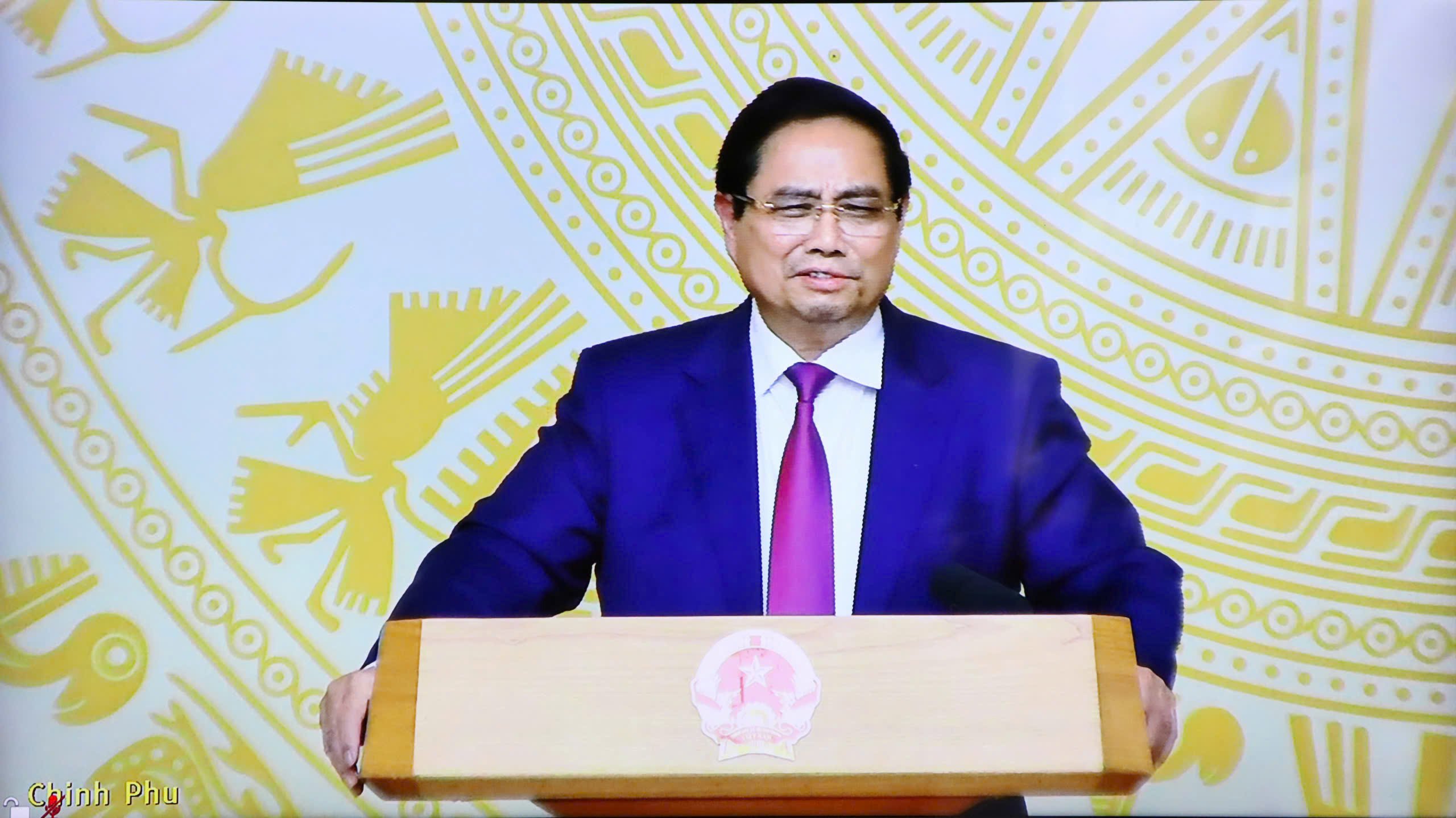
![[Photo] Prime Minister Pham Minh Chinh chairs the conference to review the 2024-2025 school year and deploy tasks for the 2025-2026 school year.](https://vstatic.vietnam.vn/vietnam/resource/IMAGE/2025/8/22/2ca5ed79ce6a46a1ac7706a42cefafae)
![[Photo] President Luong Cuong receives delegation of the Youth Committee of the Liberal Democratic Party of Japan](https://vstatic.vietnam.vn/vietnam/resource/IMAGE/2025/8/22/2632d7f5cf4f4a8e90ce5f5e1989194a)


Comment (0)