

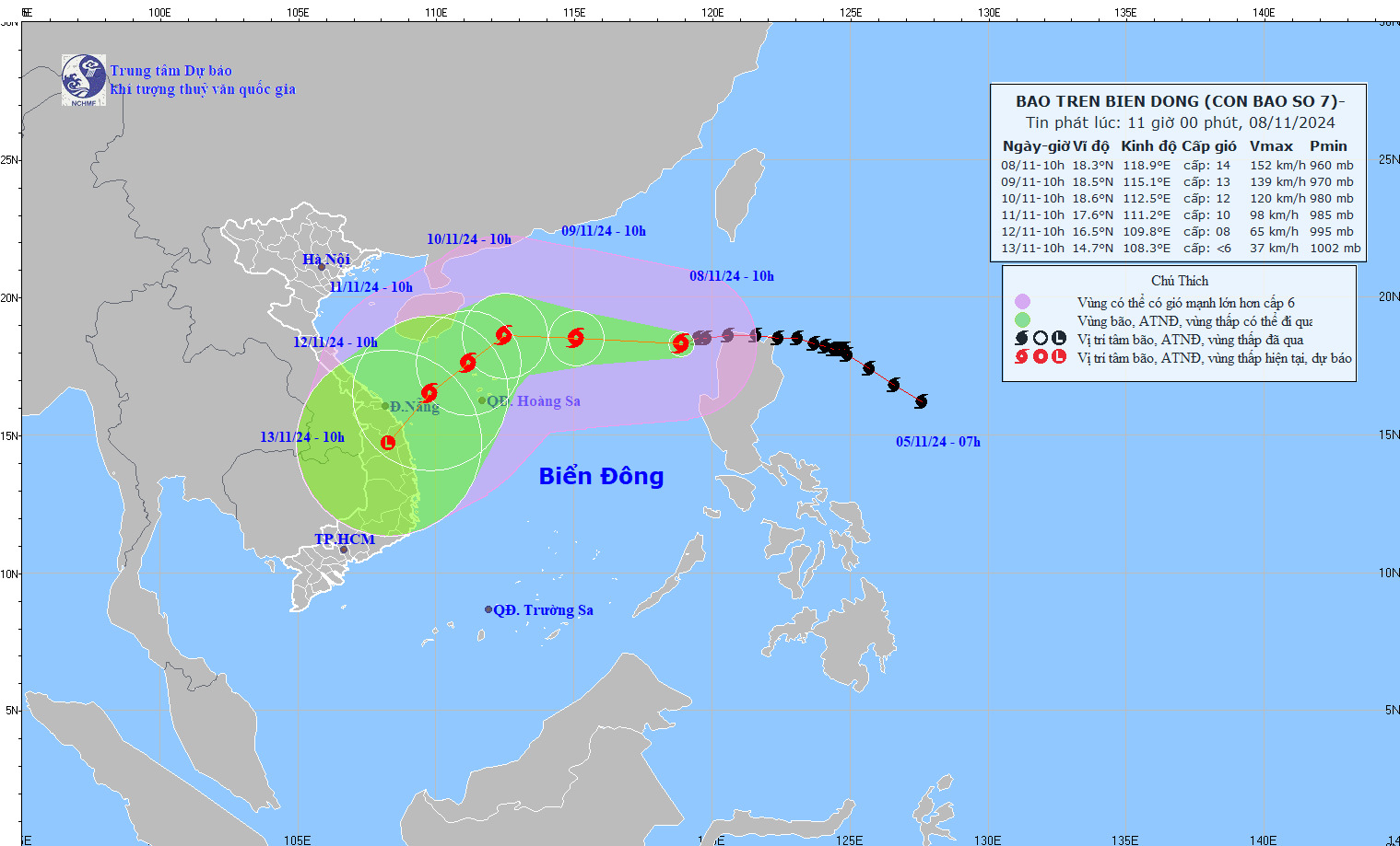
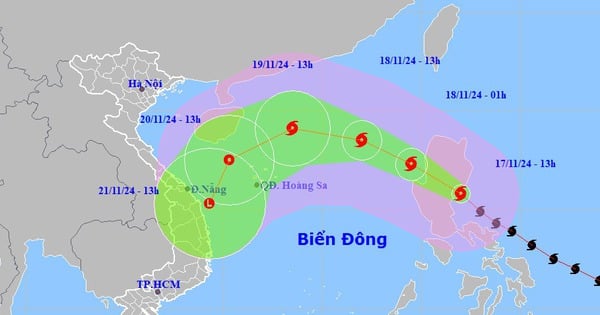
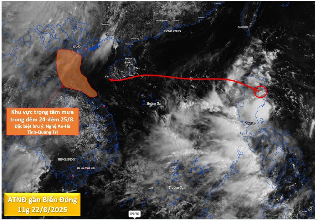
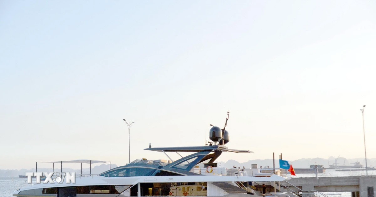
Latest storm news: At 10:00 a.m. (November 8), the center of storm No. 7 Yinxing was located at about 18.3 degrees North latitude; 118.9 degrees East longitude, in the eastern sea of the North East Sea area.
Direction of movement of storm No. 7 Yinxing
At 10:00 a.m. (November 8), the center of storm No. 7 Yinxing was at about 18.3 degrees North latitude; 118.9 degrees East longitude, in the eastern sea of the North East Sea. The strongest wind near the center of the storm was level 13-14 (134-166 km/h), gusting to level 17. Moving in the West Southwest direction, speed about 15 km/h.
Latest storm news: Latest forecast on the movement of storm No. 7 Yinxing. Photo: NCHMF
Forecast of storm No. 7 Yinxing in the next 24 to 72 hours
Forecast time | Direction, speed | Location | Intensity | Danger zone | Disaster Risk Level (Affected Area) |
10:00/09/11 | West Northwest, 15-20km/h | 18.5N-115.1E; in the North East Sea area, about 430km northeast of Hoang Sa archipelago | Level 12-13, jerk level 16 | Latitude 16.0N-21.0N; East of longitude 113.5E | Level 3: North East Sea area (including Hoang Sa archipelago waters); East only level 4 |
10h/10/11 | West Northwest, about 10km/h, weakening | 18.6N-112.5E; about 270km North Northeast of Hoang Sa archipelago | Level 12, jerk level 15 | Latitude 16.0N-21.5N; longitude 111.0E-116.5E | Level 3: North East Sea area (including Hoang Sa archipelago waters) |
10h/11/11 | Southwest, 5-10km/h, further weakening | 17.6N-111.2E; about 140km North Northwest of Hoang Sa archipelago | Level 10, jerk level 13 | Latitude 16.0N-21.0N; longitude 109.0E-115.5E | Level 3: North East Sea area (including Hoang Sa archipelago waters) |
From the next 72 to 120 hours, the storm moved in a southwest direction, traveling 10-15km per hour, and continued to weaken.
On the impact of storm No. 7 Yinxing
The National Center for Hydro-Meteorological Forecasting warns of strong winds and high waves due to the storm.
The eastern sea area of the North East Sea has strong winds of level 8-11, near the storm's eye level 12-14, gusts of level 17, waves 4.0-6.0m high, near the eye 6.0-8.0m high; rough seas.
Ships operating in the above mentioned dangerous areas are likely to be affected by storms, whirlwinds, strong winds and large waves.
Given the above situation, tourists planning to visit the South Central Coast in the near future should be on guard against the complicated developments of storm No. 7 Yinxing.
Although the impact of the storm on the mainland is still unclear, do not be subjective, constantly update weather information, consider adjusting your schedule to ensure your safety and have a complete travel experience.
Source: https://danviet.vn/tin-bao-moi-nhat-cap-nhat-moi-nhat-ve-huong-di-chuyen-cua-bao-so-7-yinxing-2024110811341727.htm
![[Photo] President Luong Cuong receives delegation of the Youth Committee of the Liberal Democratic Party of Japan](https://vstatic.vietnam.vn/vietnam/resource/IMAGE/2025/8/22/2632d7f5cf4f4a8e90ce5f5e1989194a)
![[Photo] President Luong Cuong attends special political-artistic television show "Golden Opportunity"](https://vstatic.vietnam.vn/vietnam/resource/IMAGE/2025/8/22/44ca13c28fa7476796f9aa3618ff74c4)


![[Photo] Prime Minister Pham Minh Chinh chairs the conference to review the 2024-2025 school year and deploy tasks for the 2025-2026 school year.](https://vstatic.vietnam.vn/vietnam/resource/IMAGE/2025/8/22/2ca5ed79ce6a46a1ac7706a42cefafae)


Comment (0)