


According to the National Center for Hydro-Meteorological Forecasting, in the past 24 hours, provinces from Quang Tri to Hue, the South Central Coast, the Central Highlands and the Southeast have had showers, with some places experiencing heavy rain. Rainfall measured at some stations such as Ho Hoa My (Hue) 114mm, Phuoc Cat 2 (Lam Dong) 89.4mm and Bom Bo ( Dong Nai ) 90.2mm.
The National Center for Hydro-Meteorological Forecasting predicts that today, August 14, showers and thunderstorms will continue to appear in the North, from Thanh Hoa to Hue and the South Central Coast, with common rainfall of 20-40mm, locally over 100mm.
The Central Highlands and the South will also have scattered rain, locally heavy to very heavy rain with rainfall of 10-30mm, some places over 100mm. These areas need to be on guard for heavy rain over 80mm within 3 hours, with the risk of tornadoes, lightning, hail and strong gusts of wind.

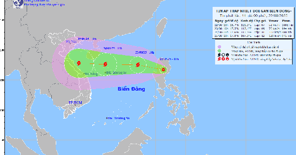
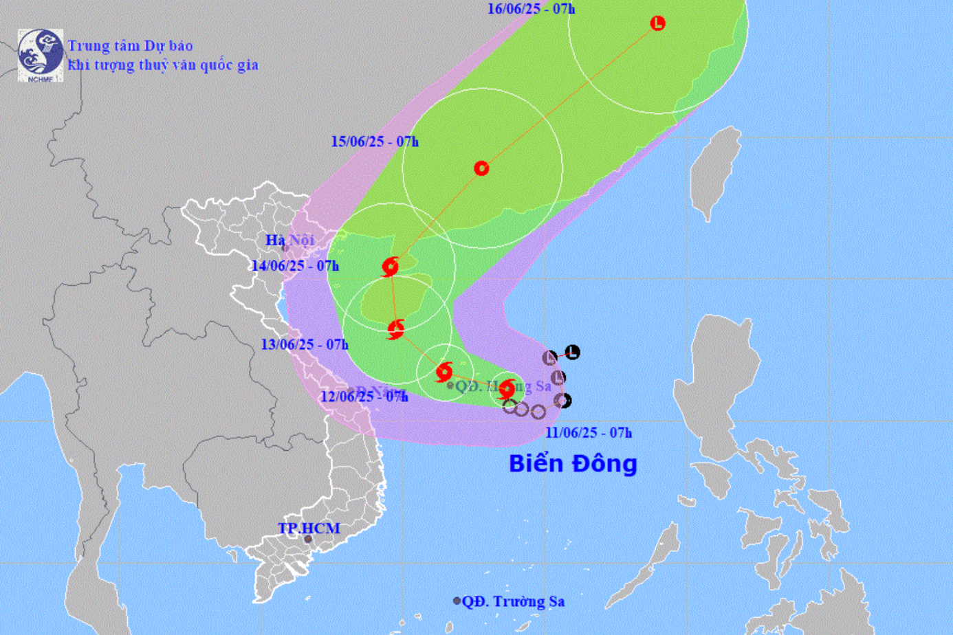
Mr. Nguyen Van Huong, Head of Weather Forecast Department, National Center for Hydro-Meteorological Forecasting, said that a tropical convergence zone is forming in the central East Sea, which is likely to develop into a low pressure area, and then become a tropical depression.
Due to the impact of these patterns, from August 15 to 19, the North, from Thanh Hoa to Hue, the Central Highlands and the South are likely to experience a widespread period of moderate to heavy rain, with the potential risk of flash floods, landslides and localized flooding.
Source: https://www.sggp.org.vn/bien-dong-co-the-xuat-hien-vung-ap-thap-post808254.html


Comment (0)