

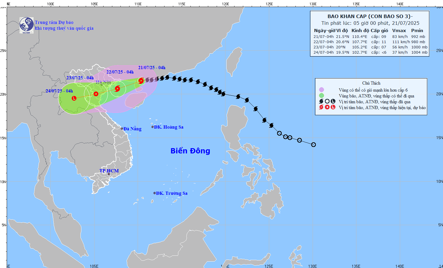
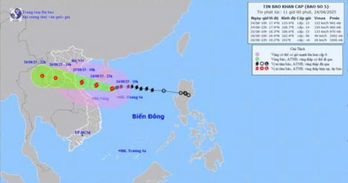
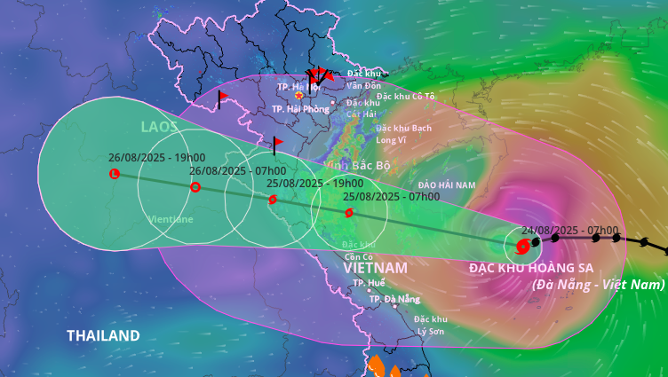
The National Center for Hydro-Meteorological Forecasting said that at 4:00 a.m. on July 21, the center of the storm was at about 21.5 degrees North latitude; 110.4 degrees East longitude, in the northern area of Leizhou Peninsula (China), about 275km east of Quang Ninh - Hai Phong . The strongest wind near the center of the storm is level 9, gusting to level 11. The storm is moving in a West-Southwest direction at a speed of 15-20km/h.
In the next 24 hours, the storm will continue to move in a West-Southwest direction and is likely to strengthen. It is forecasted that by 4:00 a.m. on July 22, the storm will be at about 20.6 degrees North latitude; 107.7 degrees East longitude, in the Northern Gulf of Tonkin, with winds of level 10-11, gusting to level 14. After that, the storm will gradually weaken and make landfall in the provinces from Hung Yen to Thanh Hoa on July 23 with winds of level 6-7, gusting to level 9. By dawn on July 24, the storm will weaken into a low pressure area in the Upper Laos region.
The sea areas directly affected include the Northwest of the East Sea, the North and South of the Gulf of Tonkin. The strongest wind gusts reach level 14 with waves 4-6m high, and the sea is very rough.
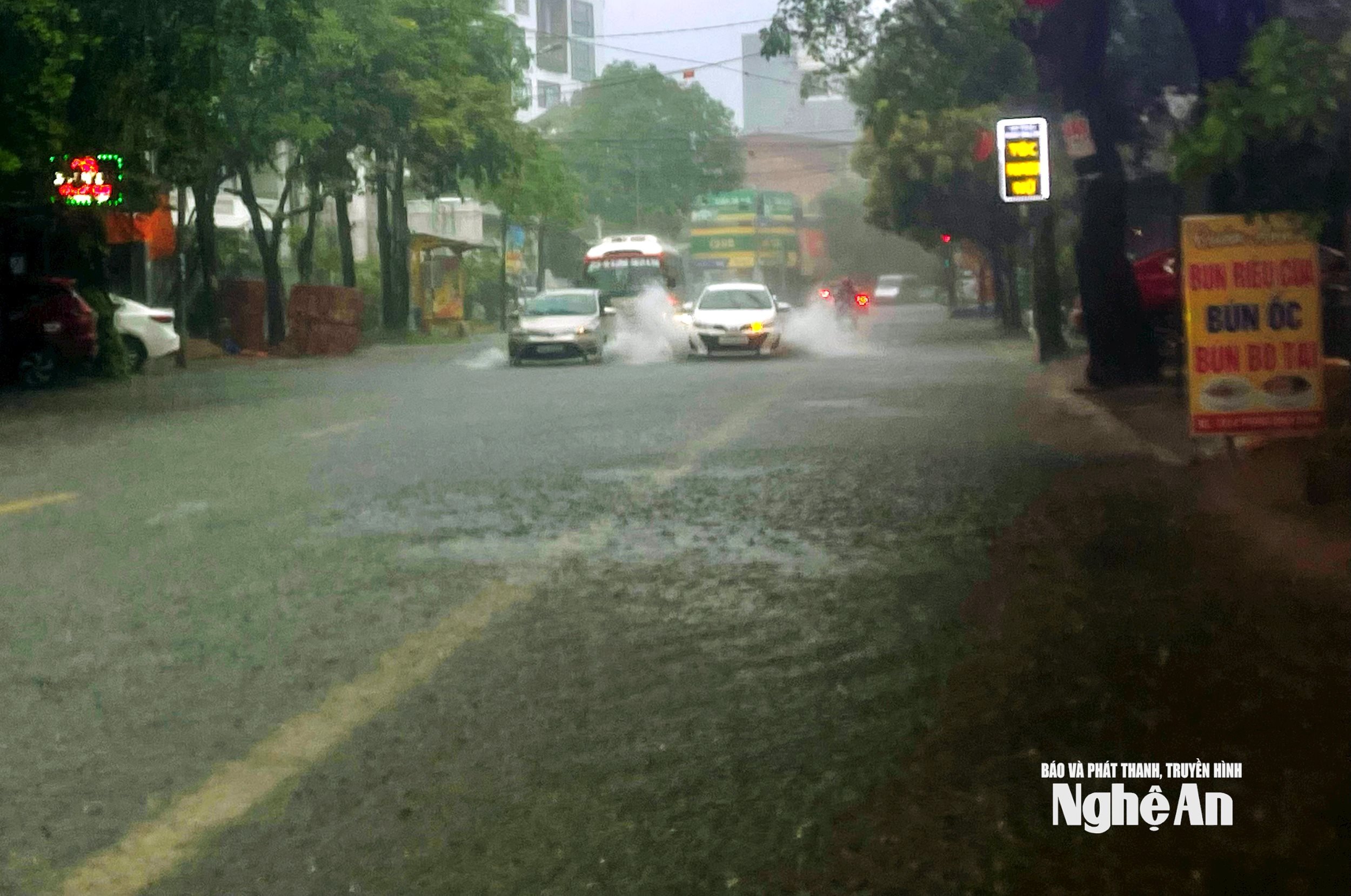
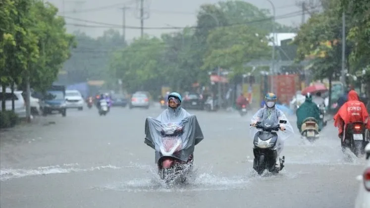
On land, from the evening of July 21, coastal areas from Quang Ninh to Nghe An will have winds gradually increasing to level 7-9, with winds near the storm center reaching level 10-11, gusting to level 14. Deeper inland, winds will also reach level 6, gusting to level 7-8. With such strong winds, there is a high possibility of falling trees, electric poles, and roofs being blown off, especially in vulnerable areas.
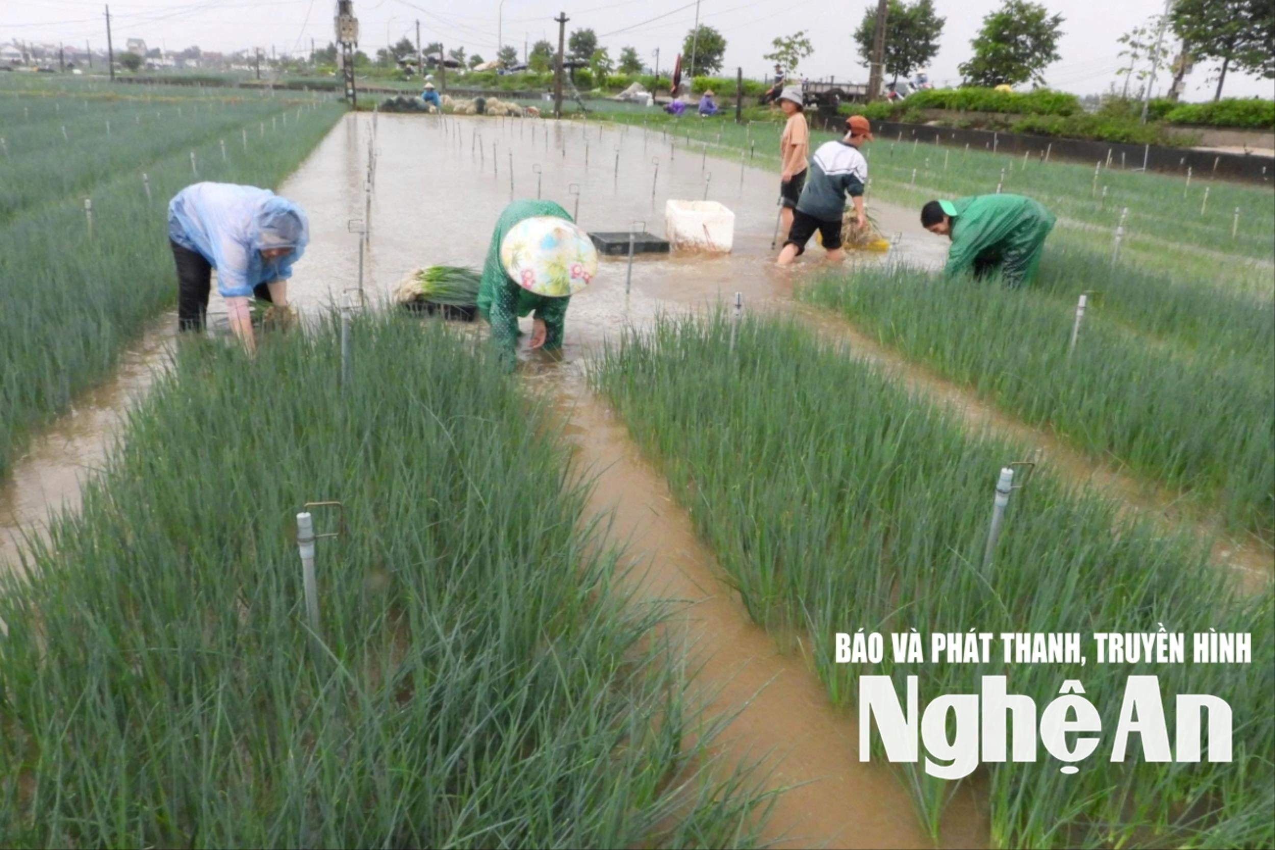
From July 21 to 23, the storm circulation combined with the southwest monsoon will cause widespread heavy rain. The Northeast, the Northern Delta, Thanh Hoa and Nghe An will have widespread rain of 200-350mm, with some places having over 600mm. Other provinces in the North and Ha Tinh will have rainfall of 100-200mm, with some places having over 300mm.
Heavy rain in a short period of time (over 150mm/3h) can easily cause flash floods, landslides in mountainous areas and deep flooding in low-lying areas. Local authorities and people need to be especially vigilant against dangerous situations that may suddenly occur, especially in mountainous provinces such as Lao Cai, Yen Bai, Hoa Binh, Thanh Hoa, Nghe An.
It is forecasted that the coastal areas of Hai Phong - Quang Ninh will experience storm surges of 0.5 to 1.0 m. Water levels at stations such as Hon Dau (3.7-4.1 m), Cua Ong (4.4-4.8 m), Tra Co (3.6-4.0 m) are all high. The risk of coastal and estuary flooding on the afternoon of July 22 is very high.
Source: https://baonghean.vn/bao-so-3-wipha-co-kha-nang-manh-them-tu-quang-ninh-den-nghe-an-nguy-co-ngap-ung-va-lu-quet-10302734.html
![[Photo] Impressive image of 31 planes taking flight in the sky of Hanoi during their first joint training](https://vstatic.vietnam.vn/vietnam/resource/IMAGE/2025/8/24/2f52b7105aa4469e9bdad9c60008c2a0)


Comment (0)