

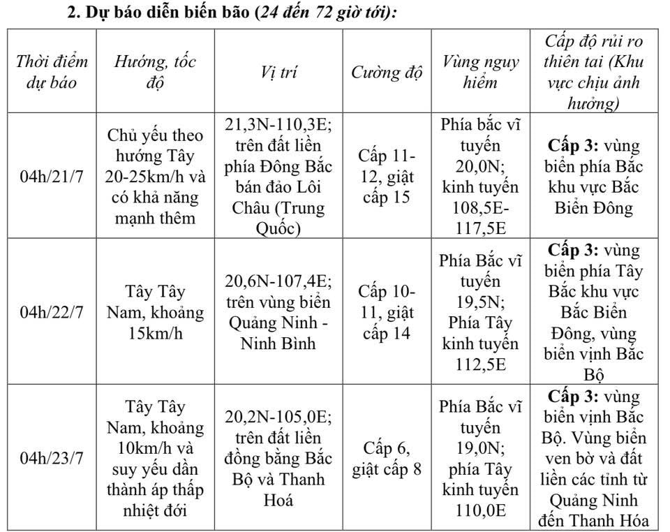
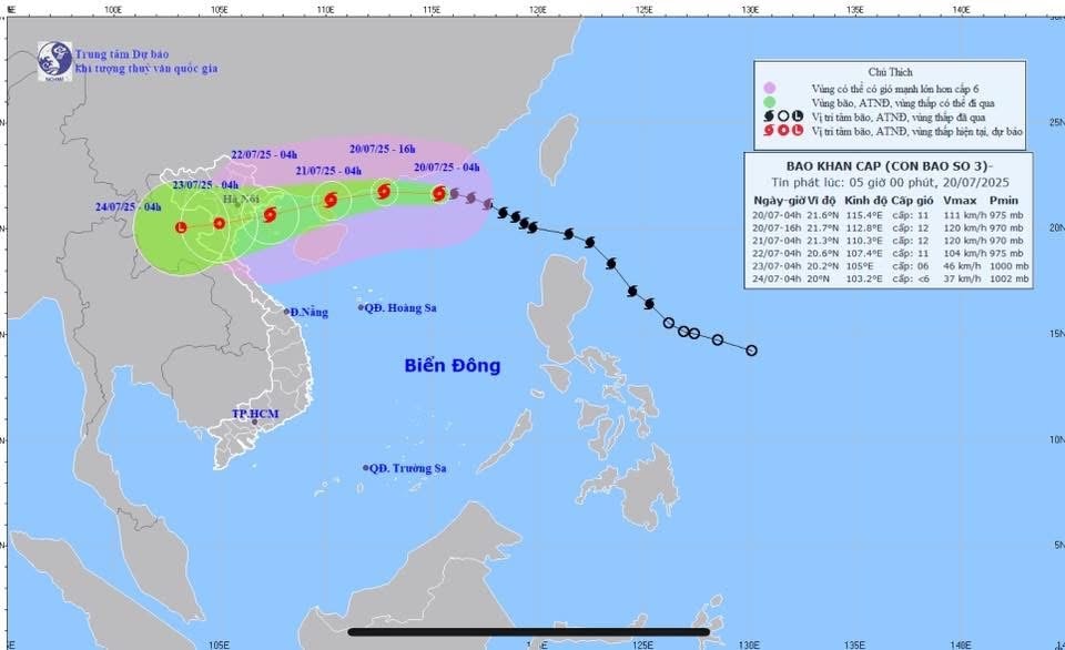
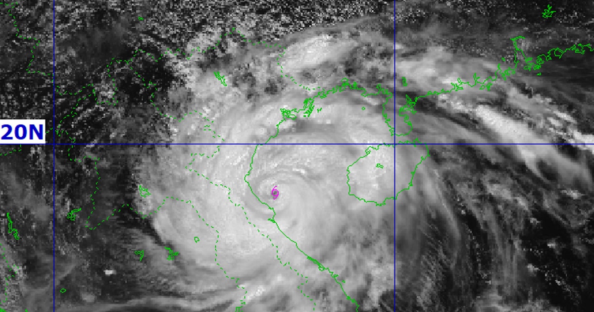
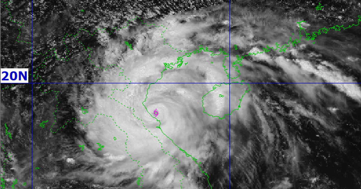
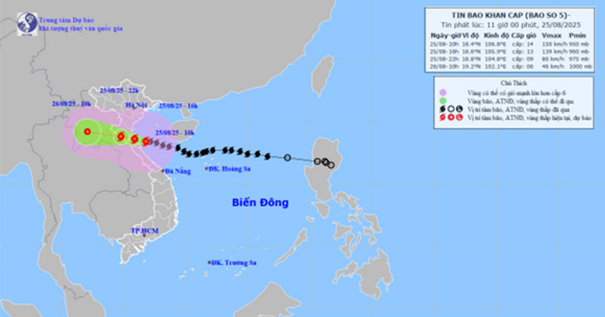
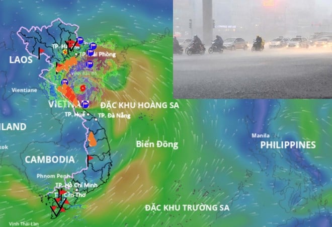
At 4:00 a.m. on July 20, the center of the storm was located at about 21.6 degrees North latitude; 115.4 degrees East longitude, in the northern sea area of the North East Sea, about 830 km east of Quang Ninh - Hai Phong . The strongest wind near the center of the storm was level 11 (103-117 km/h), gusting to level 14; moving in the West Northwest direction at a speed of about 20-25 km/h.
From the next 72 to 96 hours, the storm will move mainly in the West Southwest direction, traveling 5-10km per hour and continue to weaken further.
At sea:
- The northern sea area of the North East Sea has strong winds of level 8-10, near the storm's eye it has level 11-12, gusts of level 15; waves 5.0-7.0m high. The sea is very rough. From the night of July 20, the northern sea area of the Gulf of Tonkin (including the special zones of Bach Long Vi, Co To, and Cat Hai) has winds gradually increasing to level 6-7, then increasing to level 8-9, near the storm's eye it has level 10-11, gusts of level 14; waves 2.0-4.0m high, near the eye it has 3.0-5.0m. The sea is very rough. From July 21, the southern sea area of the Gulf of Tonkin has winds gradually increasing to level 6-7, near the storm's eye it has level 8-9, gusts of level 11, waves 2.0-4.0m high. The sea is very rough.
- Ships/boats operating in the above mentioned dangerous areas are likely to be affected by storms, whirlwinds, strong winds and large waves.
Storm surge and coastal flood warnings:
- The coastal areas of Hai Phong - Quang Ninh provinces had storm surges from 0.5m (Hai Phong) to 0.8m (Quang Ninh), combined with tides creating a total water level from 4.1m (at Hon Dau, Hai Phong city) to 5.0m (at Bai Chay, Quang Ninh province), causing flooding in low-lying areas along the coast and river mouths at noon and afternoon on July 22.
Forecast for the evening and night of July 21, on the mainland from Quang Ninh to Thanh Hoa , winds will gradually increase to level 7-9, gusting to level 10-11; further inland, winds will increase to level 6-7, gusting to level 8-9; near the storm center, winds will increase to level 10-11, gusting to level 14.
About heavy rain:
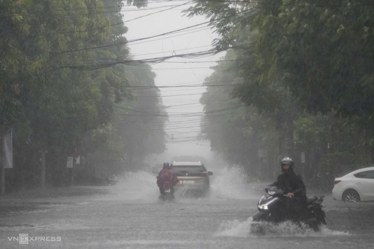
From July 21 to July 23, in the Northern and North Central regions, there is a possibility of widespread heavy rain with common rainfall of 100-200mm, locally over 300mm; in the Northeast, Northern Delta, Thanh Hoa and Nghe An , there will be heavy to very heavy rain with common rainfall of 200-350mm, locally over 600mm.
Warning of risk of heavy rain (>150mm/3h).
Source: https://baonghean.vn/bao-so-3-cap-10-11-giat-cap-14-nghe-an-canh-bao-mua-co-cuong-suat-lon-10302663.html

![[Photo] General Secretary To Lam attends the 80th anniversary of Vietnam's diplomacy](https://vstatic.vietnam.vn/vietnam/resource/IMAGE/2025/8/25/3dc715efdbf74937b6fe8072bac5cb30)


![[E-Magazine] Petrovietnam – Strong steps to realize the “Epochal Transformation”](https://vstatic.vietnam.vn/vietnam/resource/IMAGE/2025/8/25/e745baade70f4e1e96f5314f65eac658)


Comment (0)