

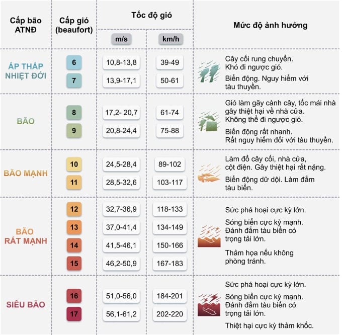
12:40 Wind above level 12 in southern Thanh Hoa - northern Ha Tinh starting from 15:00.
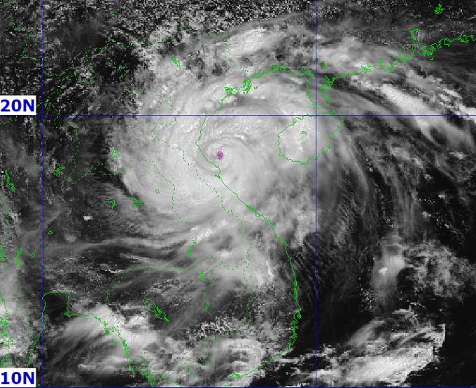
According to the National Center for Hydro-Meteorological Forecasting, at 1 p.m. the storm's eye was in the coastal waters of Nghe An - Ha Tinh, with winds of 149 km/h, level 13, gusting to level 16, down one level from two hours ago. It is forecasted that in the next three hours, the storm will head west-northwest at a speed of about 15 km/h, making landfall in Nghe An - Ha Tinh.
According to the typhoon scale, a level 13 storm with maximum winds of 149 km/h is very strong, equivalent to Yagi making landfall in Quang Ninh and Hai Phong in September 2024. The storm's winds can blow away trees, completely destroy fragile structures, and cause severe damage even to large buildings. Small ships, if not anchored carefully, can be broken and sunk at ports and docks.
Mr. Mai Van Khiem, Director of the National Center for Hydro-Meteorological Forecasting, said that in the past two hours, the storm has been moving at a speed of 10-15 km/h, a little slower than in the early morning. Through analysis of satellite cloud images and meteorological radar, it is shown that storm Kajiki is starting to show signs of weakening, and may decrease to 13 km/h in the next 1-2 hours.
According to Mr. Khiem, the storm will make landfall, with the focus being on the north of Ha Tinh - Nghe An at around 3-4pm. This is also the time when the wind is strong at level 12, gusting to level 14-15 with a radius of 50km around the storm's center. Therefore, the areas of northern Ha Tinh, Nghe An and southern Thanh Hoa will be extremely dangerous due to the wind, with the natural disaster risk level at level 4 on the 5-level scale.
"According to the direction of movement, the storm's southern part will have a weaker impact than the northern part, so strong winds in Hue and Quang Tri will gradually decrease," Mr. Khiem added.

Mr. Khiem assessed that with other storms, the rain might only be concentrated on the coast, but this storm will cause rain in all areas from the coast, plains to the western mountains of Thanh Hoa, Nghe An, Ha Tinh and even expand to southern Phu Tho and Lao Cai.
"Even if the storm weakens in Laos, the risk of landslides and flash floods still needs to be guarded against in the next 2-3 days because Central and Upper Laos will have heavy rain and floods from some rivers with upstream flows from here to Vietnam," said Mr. Khiem.
12:30 Nghe An continues to evacuate
In coastal communes of Nghe An, from morning to noon today, the authorities continued to evacuate people to avoid storm Kajiki. In coastal commune of Quynh Phu, authorities organized the evacuation of 1,705 people from dangerous areas, settling them in solid houses to ensure safety of life and property. The authorities mobilized forces to support each household in moving, minimizing risks when the storm makes landfall.
In Cua Lo ward, which is expected to be directly affected by Typhoon Kajiki, more than 2,500 people from 380 households have been taken to schools, hotels and high-rise buildings. The forces have checked each family, absolutely not allowing people to stay at sea or in cages. "Being taken to a safe place by the officers and militia, I feel secure and very grateful to the government for taking care of the people," said Ms. Hoang Thi Hanh, 90 years old.
Thanh Vinh and Truong Vinh wards also urgently evacuated thousands of households in old apartment buildings, collective housing areas and vulnerable areas. By noon of the same day, all residents in danger had been moved to concentrated shelters, ensuring temporary living conditions.


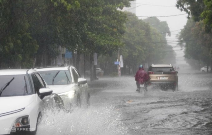
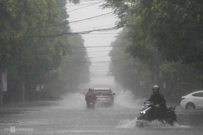
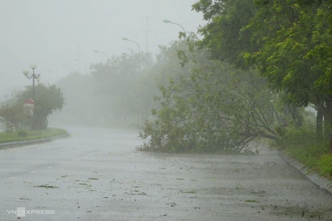
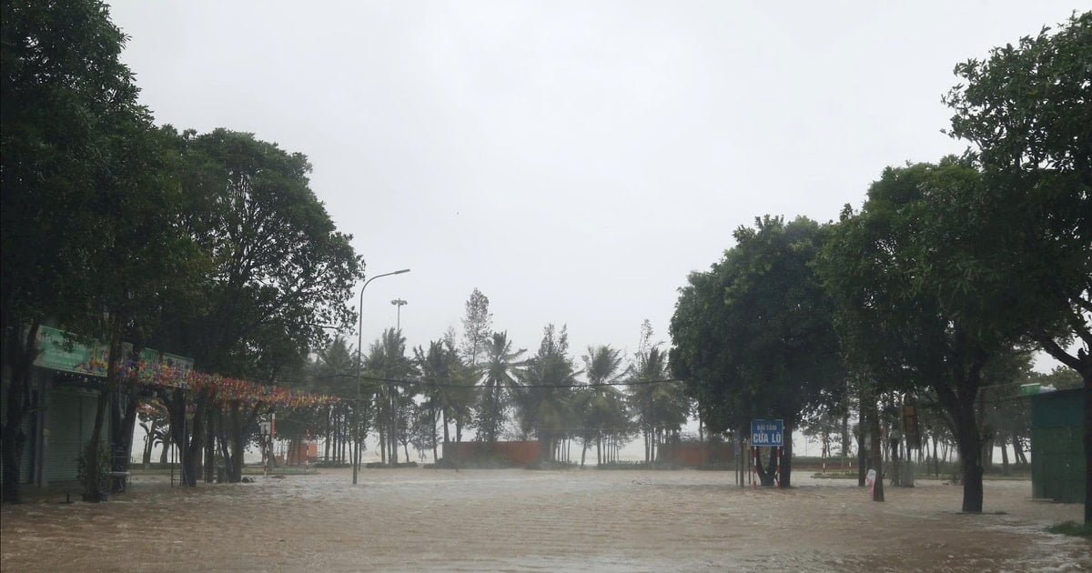
12:20 Many roads in central wards of Nghe An are deeply flooded
In Thanh Vinh ward, Nghe An province, strong winds and heavy rain lasting 20-30 minutes caused many roads to be partially flooded. On Nguyen Truong To and Nguyen Thai Hoc streets, water rose 30-40 cm, causing traffic congestion and difficulty for vehicles to move.
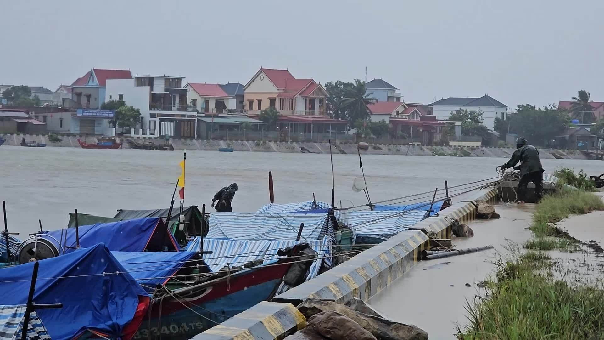
12:10 Quang Tri fishermen anchor their boats in the rain
Although not in the eye of the storm, the northern part of Quang Tri province, bordering Ha Tinh, has been raining heavily since noon today. On the Roon River, Hoa Trach Commune, heavy rains have forced upstream water to flow strongly, many fishermen braved the rain to bring ropes to reinforce their boats.
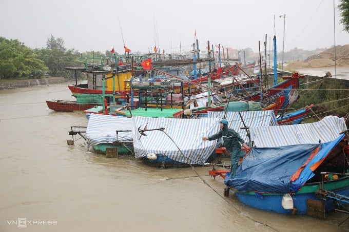
Quang Tri Province has advised people to stay off the streets since last night to ensure safety. The province has 8,725 boats with 24,198 workers, of which 8,711 fishing boats with more than 24,100 workers are anchored to avoid the storm. Currently, there are only 14 fishing boats with 72 workers operating in the southern sea, including 10 boats (42 workers) in Quang Ngai and 4 boats (30 workers) in the Lam Dong - Ca Mau area.
12:00 Road closures may occur during storms
The Traffic Police Department on the afternoon of August 25 advised vehicles to limit their movement on National Highway 1 and the North-South Expressway passing through Nghe An and Ha Tinh provinces; if necessary, road closures will be organized, and vehicles will proactively find suitable routes.
Previously, from 6:00 a.m., Cua Hoi bridge across Lam river connecting Nghe An and Ha Tinh provinces was closed to vehicles, and authorities assigned people to organize warnings and traffic flow from a distance.
11:45 Thanh Hoa continues to evacuate people
Directly affected by the storm, Thanh Hoa has evacuated nearly 2,000 households in coastal areas, where the risk of landslides is high. However, this afternoon the storm is likely to shift, causing risks of flooding and damage to houses.
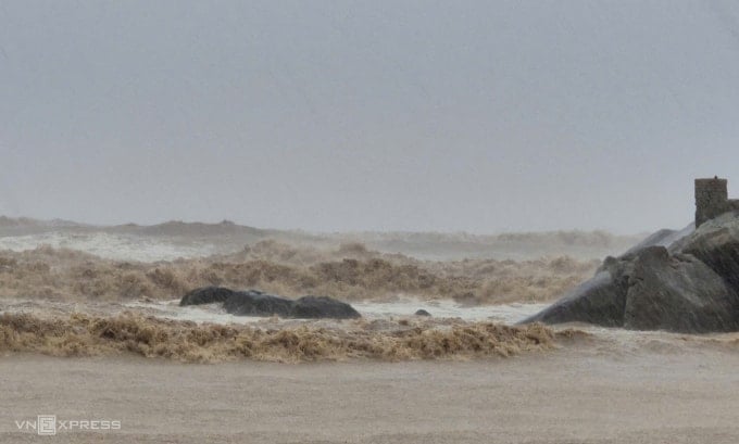
11:25 Sam Son strong waves combined with high tide
The tourist sea area of Thanh Hoa is raining heavily. The turbid waves are 1-2 meters high and crash into the shore. "The waves gradually increase and can reach their peak when the storm comes at the same time as the high tide," fisherman Tran Van Huu, 70 years old, said.
Source: https://baohaiphong.vn/bao-giam-con-cap-13-do-bo-nghe-an-ha-tinh-trong-chieu-nay-519070.html


![[Photo] General Secretary To Lam attends the 80th anniversary of Vietnam's diplomacy](https://vstatic.vietnam.vn/vietnam/resource/IMAGE/2025/8/25/3dc715efdbf74937b6fe8072bac5cb30)


Comment (0)