

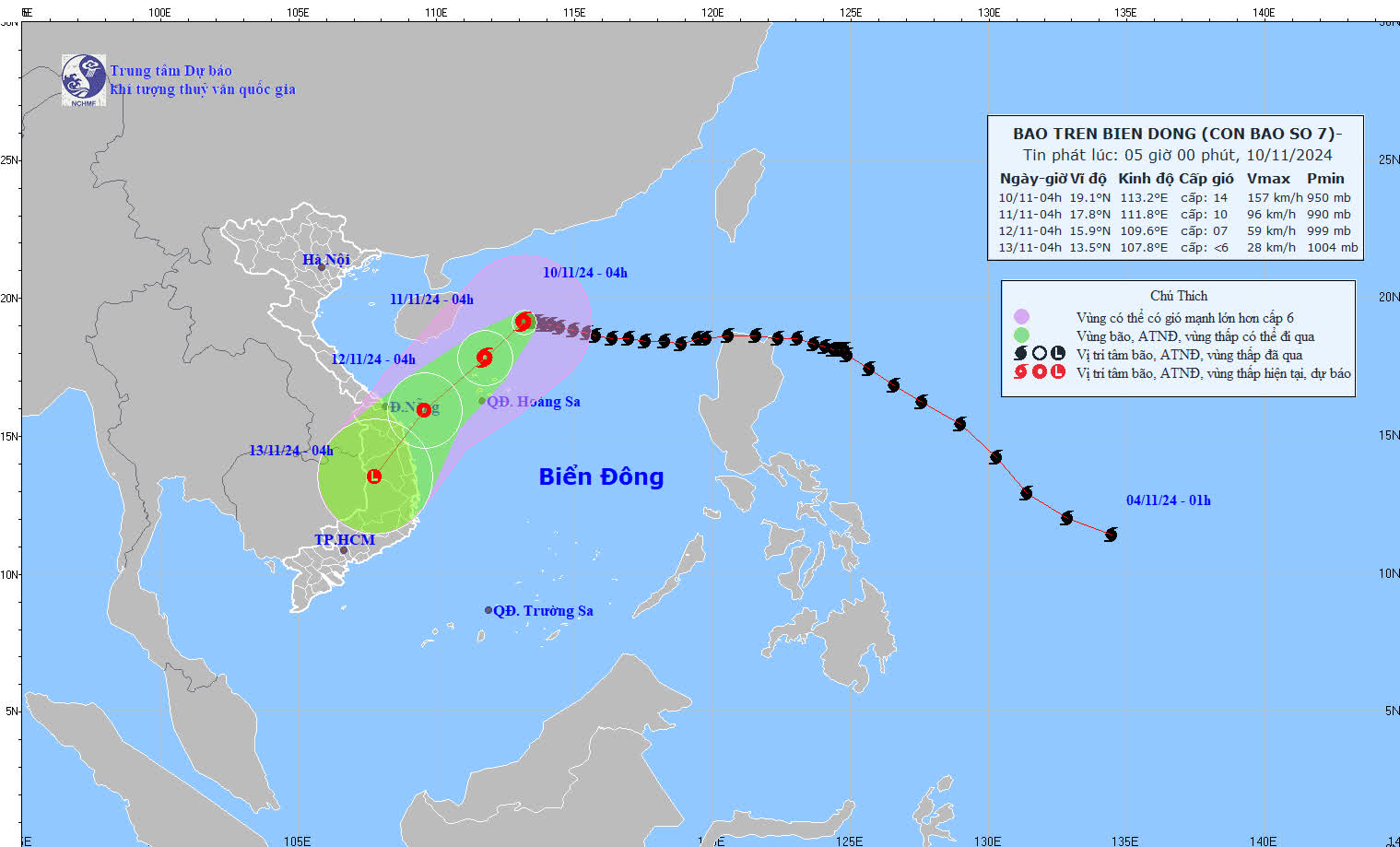
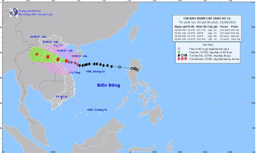
At 4:00 a.m. (November 10), the center of the storm was at about 19.1 degrees North latitude; 113.2 degrees East longitude, in the northwest sea of the North East Sea, about 335km North Northeast of Hoang Sa archipelago.
Update latest news on storm number 7
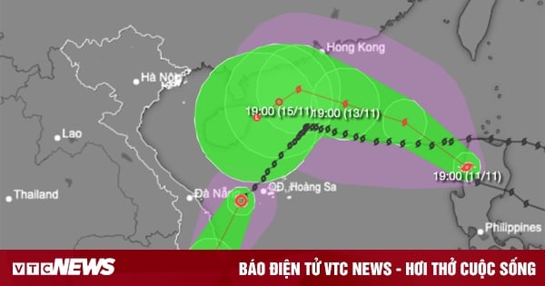
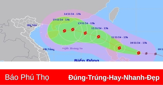
At 4:00 a.m. (November 10), the center of storm No. 7 was at about 19.1 degrees North latitude; 113.2 degrees East longitude, in the northwest sea of the North East Sea, about 335km North-Northeast of Hoang Sa archipelago. The strongest wind near the center of the storm was level 14 (150-166km/h), gusting to level 17. Moving west, speed about 5km/h.
At 4:00 a.m. on November 11, storm No. 7 in the northwest sea of the North East Sea, about 145km north of Hoang Sa archipelago, reached level 10, gusting to level 13.
At 4:00 a.m. on December 11, storm No. 7 gradually weakened into a tropical depression in the sea area from Quang Tri to Quang Ngai .
By November 13, it weakened into a low pressure area over the Central Highlands.
Detailed forecast of storm developments ( in the next 24 to 72 hours):
Direction of storm number 7. Photo: nchmf
| Forecast time | Direction, speed | Location | Intensity | Danger zone | Disaster Risk Level (Affected Area) |
| 04h/11/11 | Southwest, 5-10km/h, weakening | 17.8N-111.8E; in the northwest sea of the North East Sea, about 145km north of Hoang Sa archipelago | Level 10, jerk level 13 | Latitude 15.5N-21.5N; longitude 109.5E-115.5E | Level 3: the western sea area of the North East Sea (including the sea area of Hoang Sa archipelago); the area from latitude 17.0N-21.0N; longitude 111.0E-114.5E level 4 |
| 04h/12/11 | Southwest, 10-15km/h, weakening into a tropical depression | 15.9N-109.6E; on the sea from Quang Tri to Quang Ngai | Level 7, level 9 jerk | Latitude 14.5N-20.0N; longitude 108.5E-114.0E | Level 3: Western sea area of the North East Sea (including Hoang Sa archipelago sea area), sea area from Quang Tri to Quang Ngai |
| 04h/13/11 | Southwest, 10-15km/h, weakening into a low pressure area | 13.5N-107.8E; in the Central Highlands region |
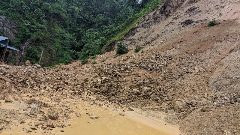
Warning of the impact of storm number 7
The western sea area of the North East Sea has strong winds of level 7-10, near the storm center, level 11-14, gusts of level 17, waves 4.0-6.0m high, near the center 7.0-9.0m; rough seas.
Ships operating in the above mentioned dangerous areas are likely to be affected by storms, whirlwinds, strong winds and large waves.
Source: https://danviet.vn/tin-bao-so-7-bao-so-7-dang-tien-thang-vung-bien-quang-tri-quang-ngai-vao-dat-lien-manh-the-nao-2024111005362437.htm


Comment (0)