

Bien Hoa - Vung Tau, Khanh Hoa - Buon Ma Thuot, Chau Doc - Can Tho - Soc Trang expressways and Ho Chi Minh City Ring Road 3 were all started, expected to help increase regional connectivity.
On the morning of June 18, the Ho Chi Minh City Ring Road 3, Bien Hoa - Vung Tau, Khanh Hoa - Buon Ma Thuot expressways projects were simultaneously started. The groundbreaking ceremony was connected online from the main bridge in Ho Chi Minh City to the points in Ba Ria - Vung Tau and Dak Lak.

Perspective of Tan Van intersection of Ring Road 3 project when completed. Photo: Traffic Department
Of which, Ho Chi Minh City Ring Road 3 is the project with the largest budget of nearly 75,400 billion VND, more than 76 km long. The route passes through Ho Chi Minh City, Binh Duong, Dong Nai, Long An , divided into 8 component projects, each province and city carries out two projects including site clearance and construction.
Ho Chi Minh City is the locality that started the project the earliest, and it is also the place where the longest section of the beltway passes through, with more than 47 km and a total investment of more than 41,400 billion VND. The three provinces of Binh Duong, Dong Nai, and Long An also plan to start construction on the remaining sections of the route in June.
Beltway 3 starts at the Ben Luc - Long Thanh expressway intersection (Nhon Trach district, Dong Nai); ends at the Ben Luc - Long Thanh expressway intersection (Ben Luc district, Long An province). When completed, this beltway and Ben Luc expressway will create a traffic axis surrounding the Ho Chi Minh City area, limiting vehicles having to run through the inner city.
In phase 1, the project will first build 4 expressway lanes in the middle, parallel roads on both sides through residential areas. The entire route is expected to be completed in 2026, opening up space for the development of industrial corridors, connecting many seaport clusters, reducing travel time, logistics costs... The project is expected to create regional connectivity, promoting the development of the Southern Key Region.
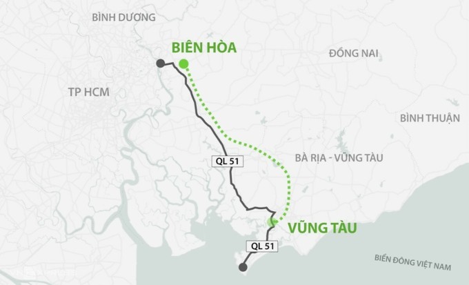
Bien Hoa - Vung Tau expressway route. Graphics: Thanh Nhan
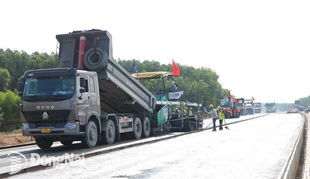
Bien Hoa - Vung Tau Expressway is about 53.7 km long, passing through Dong Nai and Ba Ria - Vung Tau provinces. The starting point of the route connects with the National Highway 1 bypass, the section passing through Bien Hoa City (Dong Nai Province); the end point is at the intersection of National Highway 56 in Ba Ria City (Ba Ria - Vung Tau Province).
The project has a total investment of 17,837 billion VND from the state budget, divided into three components, implemented by the localities along the route and the Ministry of Transport. In the first phase, this expressway will be built with 4-6 lanes, expected to be completed in 2026. When put into operation, the route will connect with the Eastern North-South expressway, Long Thanh airport, seaports, and economic centers, contributing to the development of the entire Southeast region.
The Khanh Hoa - Buon Ma Thuot Expressway has a total investment of VND21,935 billion, about 117.5 km long, connecting the two provinces of Khanh Hoa and Dak Lak. The route is divided into three component projects, assigned to the Ministry of Transport and the two localities through which the route passes. The project starts from the intersection of National Highway 26B - National Highway 1 (Ninh Hoa town, Khanh Hoa) and ends at the intersection with Ho Chi Minh Road, east of Buon Ma Thuot City (Dak Lak).
The project is built with 4 lanes, 17 m wide, and is expected to be operational in 2027. When completed, this expressway will create a horizontal axis connecting the Central Highlands region with the South Central Coast and connecting the North-South Expressway, Ho Chi Minh Road, National Highway 1, coastal roads, etc., contributing to promoting regional development.
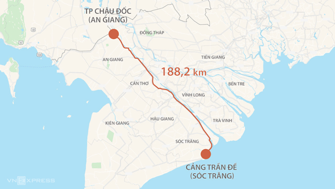
Route of Chau Doc - Can Tho - Soc Trang expressway. Graphics: Thanh Huyen
A day before, the Chau Doc - Can Tho - Soc Trang expressway, over 188 km long, passing through 4 provinces in the West, with a total investment of nearly 44,700 billion VND, was also started. The route starts at National Highway 91 in Chau Doc City, An Giang Province; the end point is at Tran De Port, Soc Trang. Of which, the section through An Giang is nearly 57 km long, Can Tho is nearly 38 km, Hau Giang is about 37 km and more than 56 km through Soc Trang.
In phase one, the project will first build 4 lanes, 17 m wide, allowing cars to travel at 80 km/h. When completed, the road surface will be expanded to more than 32 m with 6 lanes. The entire route is expected to be completed in 2027, forming a key horizontal traffic route in the Mekong Delta region.
This route will connect the North-South expressway along the vertical axis, reducing the load on National Highway 1, Route N1, National Highway 91... At the same time, the project also contributes to completing the regional traffic network, connecting the economy and society of the Western provinces with Cambodia and Southeast Asian countries.
Gia Minh
Source link


![[Photo series] Entering August, let's see the 'shape' of Bien Hoa - Vung Tau highway through Dong Nai](https://vstatic.vietnam.vn/vietnam/resource/IMAGE/2025/8/5/7ed0d72355204aaeb52af9e9362fa2b9)


Comment (0)