(NLDO) – Dak Nong authorities said that the construction of the U-shaped road was due to the water gathering point, not to direct the road to any individual's land.
The People's Committee of Gia Nghia City, Dak Nong Province has just decided to spend 8 billion VND to connect the U-shaped curve (Y Bih Aleô Street, Nghia Trung Ward). Currently, this 130m long connecting road is in the process of notifying households whose land is included in the project to carry out land recovery, compensation and clearance.
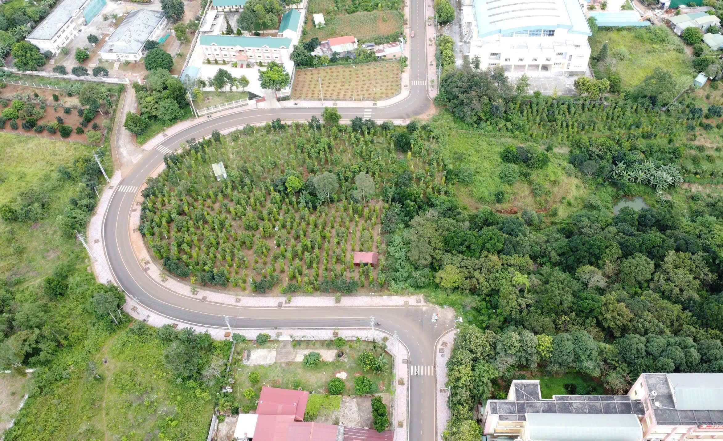
Gia Nghia City People's Committee has decided to spend 8 billion VND to connect the U-shaped road.
Mr. Ha Sy Son, Deputy Director of Dak Nong Department of Transport, said that the unit was the investor of the U-shaped road section since 2010 and completed it in 2013 along with 3 other projects.
Regarding the question of why many people were wondering why the U-shaped road was built, Mr. Son said that the investor was required to follow the planning. At that time, the project was implemented according to the detailed construction plan of the functional area in the Southeast of Gia Nghia urban area approved by the Gia Nghia Town People's Committee in 2007.
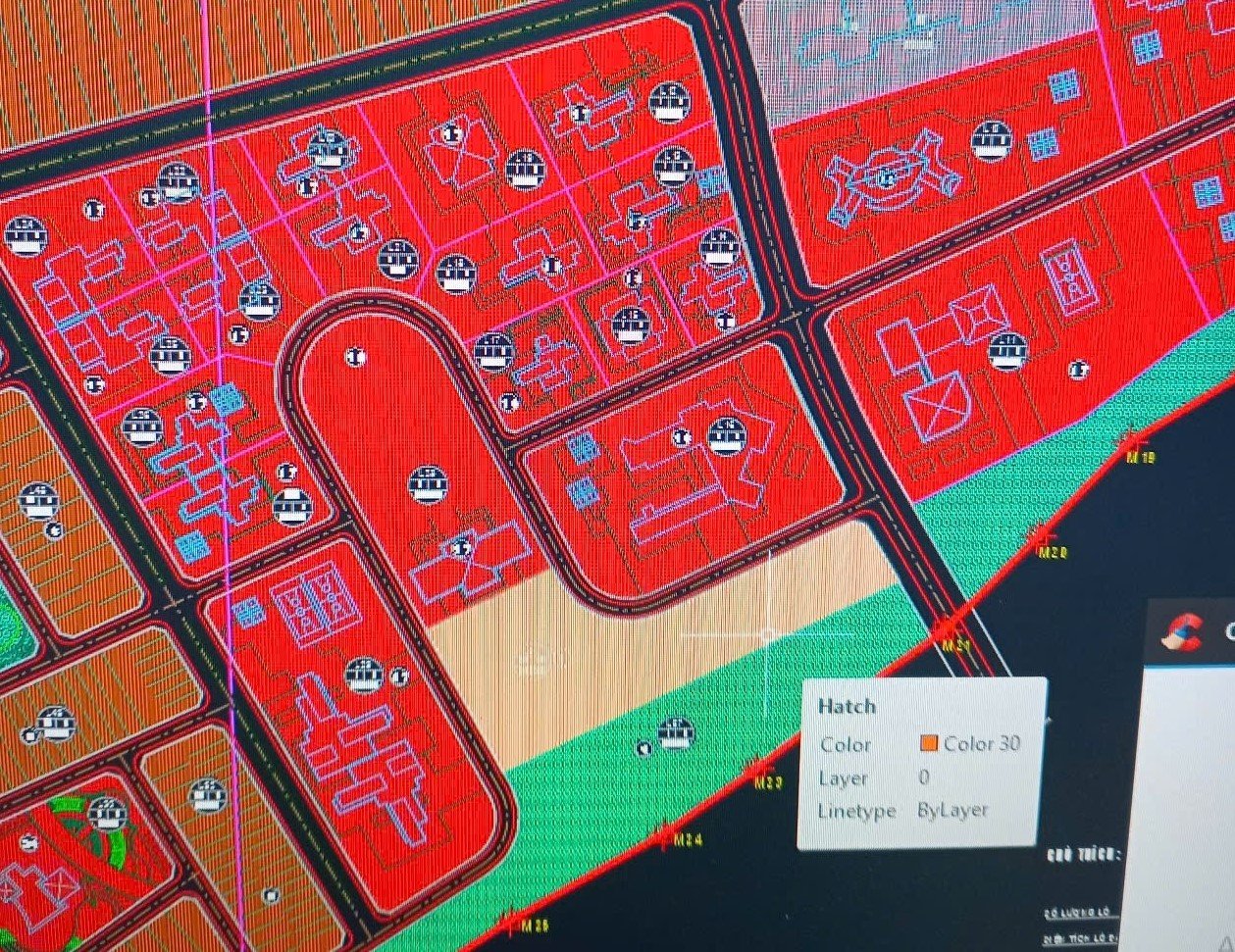
The U-shaped road is located in the administrative planning area.
According to Mr. Nguyen Hong Ha, Head of the Department of Architectural Planning and Urban Development, Dak Nong Department of Construction - the unit that has established a detailed construction plan for the functional area in the Southeast of Gia Nghia urban area, including Y Bih Aleô road and U-shaped road.
According to Mr. Ha, in 2007, in the area where the Y Bih Aleô road was to be built, there was a water gathering point (a large, very deep water gap), so it was impossible to straighten the road across it, but it was forced to bend the road according to the terrain into a U shape.
Over time, the water gathering area was silted up and became flatter than before, so Gia Nghia City People's Committee decided to invest in connecting the road straight for convenient traffic.
According to Mr. Ha, Gia Nghia City People's Committee has sent 2 documents to the Department of Construction to suggest adjustments to the detailed planning for the construction of the functional area in the Southeast of Gia Nghia urban area. In which, there is the content of adjusting some administrative agency land locations to residential land and commercial service land. However, the Department of Construction responded that this area still retains the administrative agency land planning as the previous general planning.
"The existence of the U-shaped road is due to the terrain, not because it curves around any individual's land. When the new road is completed, this area will still be administrative planning land, not residential land," Mr. Ha affirmed.
Source: https://nld.com.vn/co-quan-chuc-nang-dak-nong-noi-gi-ve-viec-nan-duong-thanh-hinh-chu-u-196250213111306586.htm



















![[Photo] Scientific workshop "Trade unions with the task of participating in state management and building a socialist rule of law state"](https://vstatic.vietnam.vn/vietnam/resource/IMAGE/2025/8/22/789f6384ec37466098a8bcb531deb281)










































Comment (0)