

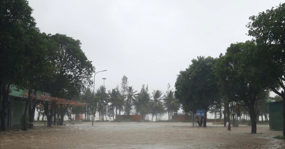
At 7:00 p.m. tonight (October 5), in response to storm No. 4, Nghe An issued Official Dispatch No. 08/CD-VPTT, directing proactive response measures.
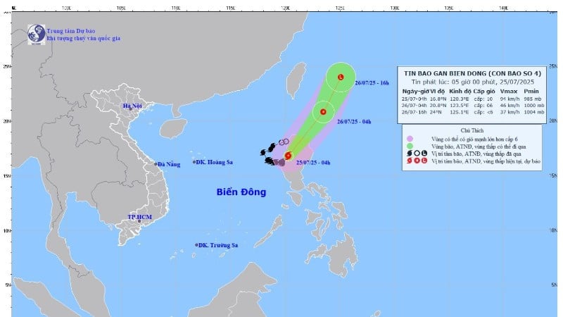
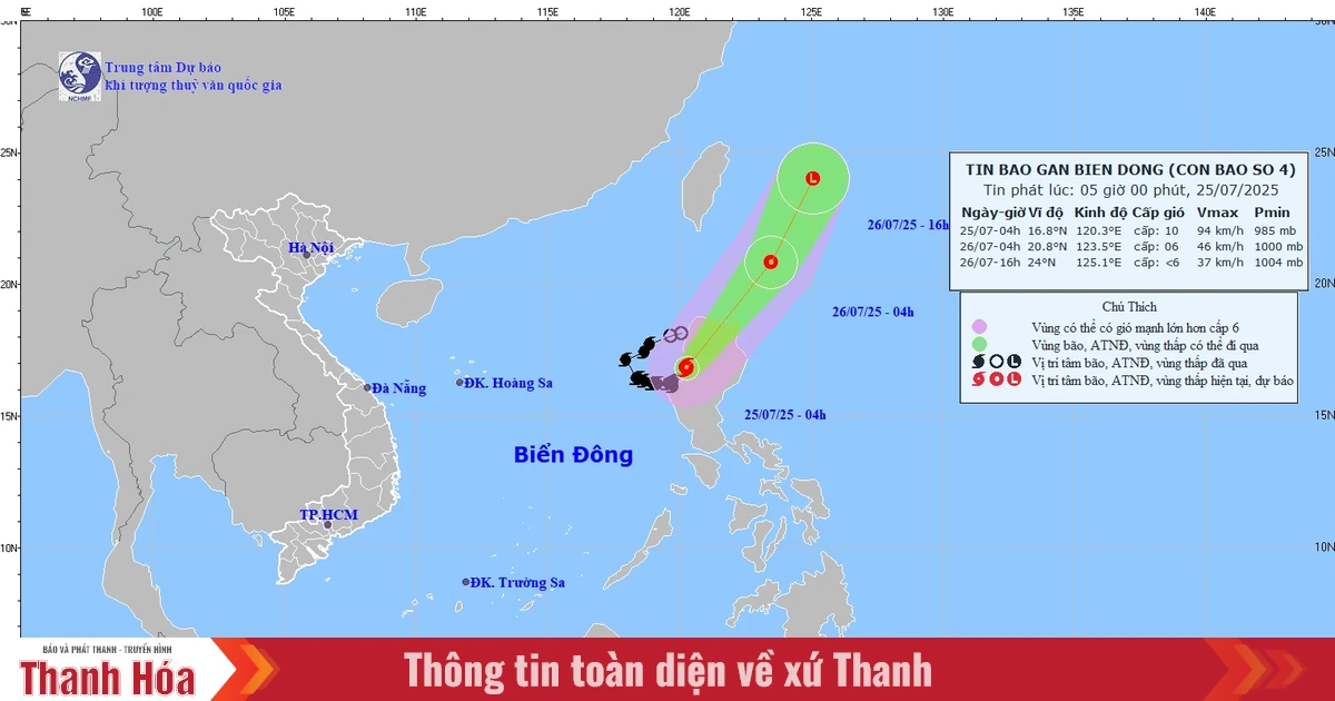
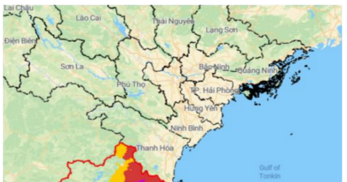
According to the National Center for Hydro-Meteorological Forecasting: At 4:00 p.m. on October 5, the center of storm No. 4 (international name KOINU) was at about 22.0 degrees North latitude, 119.7 degrees East longitude, about 370km East Southeast of Guangdong (China), the strongest wind was level 12, gusting to level 15; the storm is forecast to move west and gradually weaken; at 4:00 p.m. on October 6, the strongest wind was level 10, gusting to level 13.
At 7:00 p.m. on October 5, the center of storm No. 4 (KOINU) was located at approximately 22.0 degrees North latitude; 119.2 degrees East longitude, in the northeastern sea of the North East Sea, approximately 560km East Southeast of Hong Kong (China).

Forecast: The northeastern sea area of the North East Sea has strong winds of level 7-10, the area near the storm's eye has strong winds of level 11-12, gusting to level 15; the sea is very rough. The northern East Sea area has waves 2-4m high, the northeastern area has waves 4-6m high, the area near the storm's eye has waves 6-8m high.
To proactively respond to the storm's developments, the Standing Office of the Provincial Steering Committee for Natural Disaster Prevention, Search and Rescue and Civil Defense requests the Steering Committees for Natural Disaster Prevention, Search and Rescue of coastal districts, cities and towns; relevant departments, branches and agencies:
Regularly and closely monitor the storm's developments; organize the counting and strict management of vehicles going out to sea, notify owners of vehicles and captains of ships and boats operating at sea of the location, direction of movement and developments of the storm so that they can proactively avoid, escape or not move into dangerous areas.
Dangerous areas in the next 24 hours: North of latitude 20.0, East of longitude 115.8; in the next 48 hours: North of latitude 20.0, East of longitude 114.0 (dangerous areas are adjusted in forecast bulletins).
At the same time, prepare forces and means for rescue when required.

Units: Provincial Radio and Television Station, Nghe An Newspaper, Ben Thuy Coastal Information Station and mass media agencies strengthen measures to inform about the storm's developments to authorities at all levels, owners of means of transport operating at sea and people to proactively prevent and respond. Organize serious on-duty shifts, regularly report to the Standing Office of the Provincial Steering Committee for Natural Disaster Prevention, Search and Rescue and Civil Defense.
Source


![[Photo] General Secretary To Lam attends the 80th anniversary of Vietnam's diplomacy](https://vstatic.vietnam.vn/vietnam/resource/IMAGE/2025/8/25/3dc715efdbf74937b6fe8072bac5cb30)


Comment (0)