

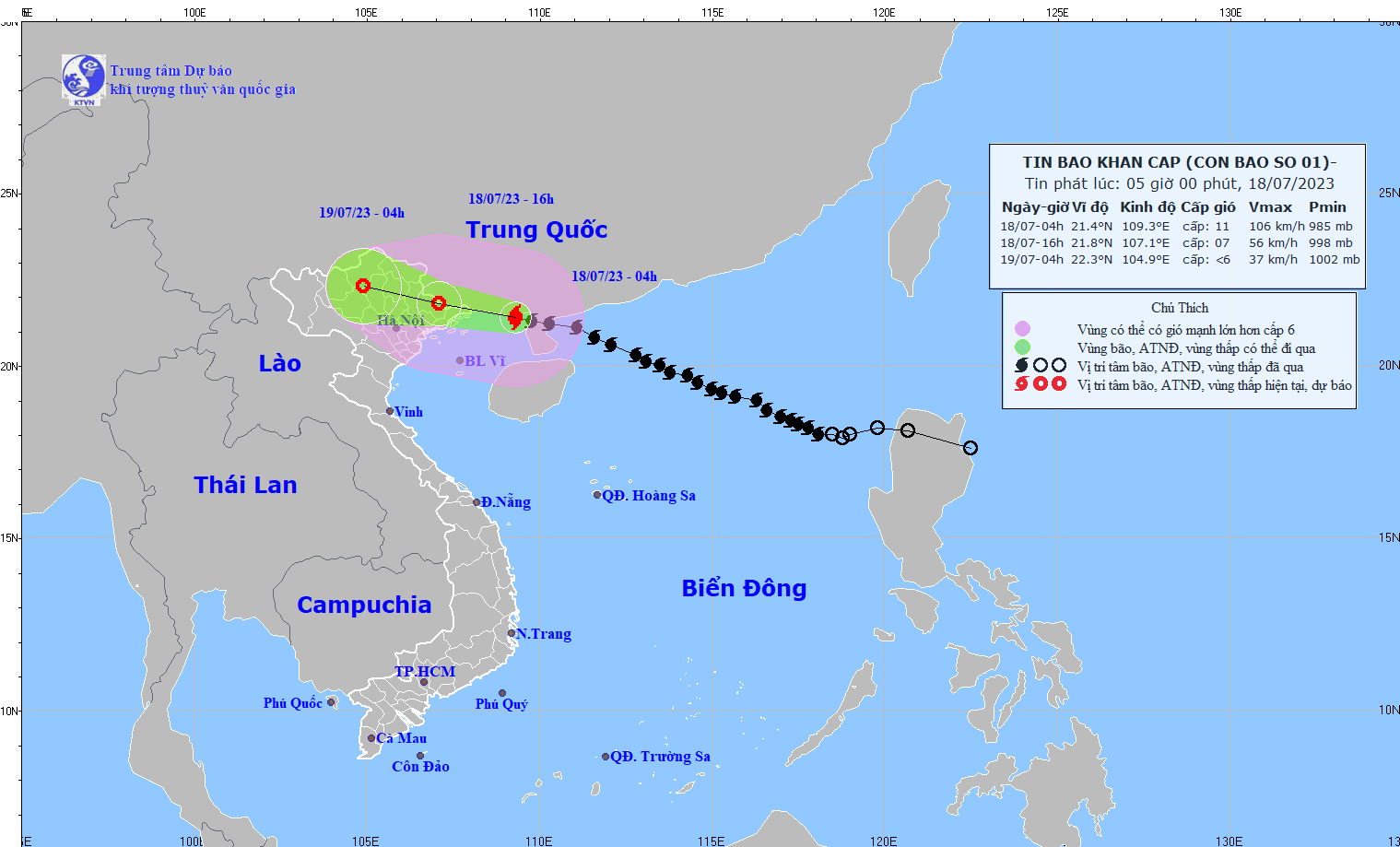
Storm status
At 4:00 a.m. on July 18, the center of the storm was located at about 21.4 degrees North latitude; 109.3 degrees East longitude, in the northeastern area of the Gulf of Tonkin, about 140km East Southeast of Mong Cai (Quang Ninh). The strongest wind near the center of the storm was level 10-11 (89-117km/h), gusting to level 14.
Storm forecast (in the next 12 to 24 hours):
| Forecast time | Direction, speed | Location | Intensity | Danger zone | Disaster Risk Level (Affected Area) |
| 16h/18/7 | West Northwest at about 20 km/h and weakening | 21.8N-107.1E, on the mainland of the Northeastern provinces of the North | level 7, jerk level 9 | North latitude 19.0N; West longitude 112.0E | Level 3: North Gulf of Tonkin, coastal areas of the Northeast |
| 04h/19/7 | West Northwest, 20-25 km/h moving inland, continuing to weaken and dissipate | 22.3N-104.9E; on land in the mountainous region of the North | North of latitude 20.0N; West of longitude 110.0E | Level 3: North Gulf of Tonkin, Northeast region |
Forecasting the impact of storms
| Strong wind | |
| At sea: -The northern area of Bac Bo Gulf (including Bach Long Vi and Co To island districts) has strong winds of level 6-7, then increasing to level 8-9, near the storm center level 10-11, gusting to level 13-14. The sea is very rough. On land: -Coastal areas from Quang Ninh and Hai Phong have winds gradually increasing to level 6-7, areas near the storm center have winds of level 8-9, gusting to level 11; areas in Lang Son, Bac Giang and Thai Binh provinces have winds of level 8. | |
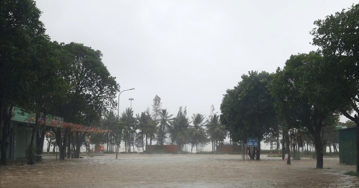
| Rising water, big waves | |
| Ocean Waves: - The sea area north of the North East Sea has waves 3.0-5.0m high. - The Gulf of Tonkin has increasing waves, 2.0-4.0m high. The coastal areas of Quang Ninh- Thai Binh provinces have waves 2.0-3.0m high. Storm surge, coastal flooding risk: - Coastal areas of Quang Ninh- Hai Phong provinces have storm surges of 0.3-0.5m. - Risk of flooding in low-lying areas in coastal areas, river mouths, and coastal erosion due to the combined impact of high tides, big waves, and storm surges on the afternoon of July 18. | |
| Heavy rain | |
| From July 18 to July 19, in the Northeast and Viet Bac regions, there will be heavy to very heavy rain with common rainfall of 200-300mm, locally over 350mm; in the Northwest and the Northern Delta regions, there will be heavy rain with total rainfall of 100-200mm, Thanh Hoa and Nghe An will have moderate rain, heavy rain, and very heavy rain in some places with common rainfall of 70-120mm. Beware of heavy rain causing urban flooding. Warning of high risk of flash floods and landslides in the provinces of Quang Ninh, Lang Son, Cao Bang, Ha Giang, Lao Cai, Yen Bai . | |
| Thunderstorm, tornado | |
| Beware of the risk of thunderstorms, tornadoes and strong gusts of wind in the storm circulation area, both before and during the storm's landfall. |
Source


![[Photo] General Secretary To Lam attends the 80th anniversary of Vietnam's diplomacy](https://vstatic.vietnam.vn/vietnam/resource/IMAGE/2025/8/25/3dc715efdbf74937b6fe8072bac5cb30)


Comment (0)