

According to Dr. Tran Ngoc Chinh, the Saigon River is a special resource that few places have. Ho Chi Minh City needs to plan and exploit its advantages to develop the economy , tourism, and serve the community.
"The Saigon River is a special landscape that nature has bestowed upon Ho Chi Minh City, but planning studies to develop urban spaces along the river are very vague," said Dr. Tran Ngoc Chinh, Chairman of the Vietnam Urban Planning and Development Association, at the conference reporting the initial period of adjusting the general planning of Ho Chi Minh City to 2040, with a vision to 2060 , on September 12.
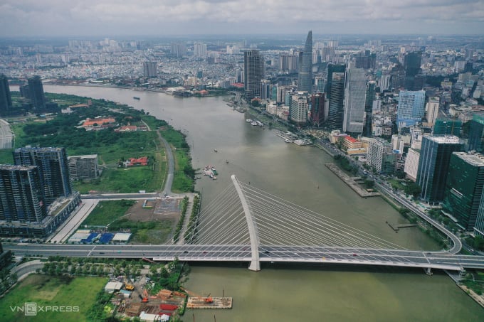
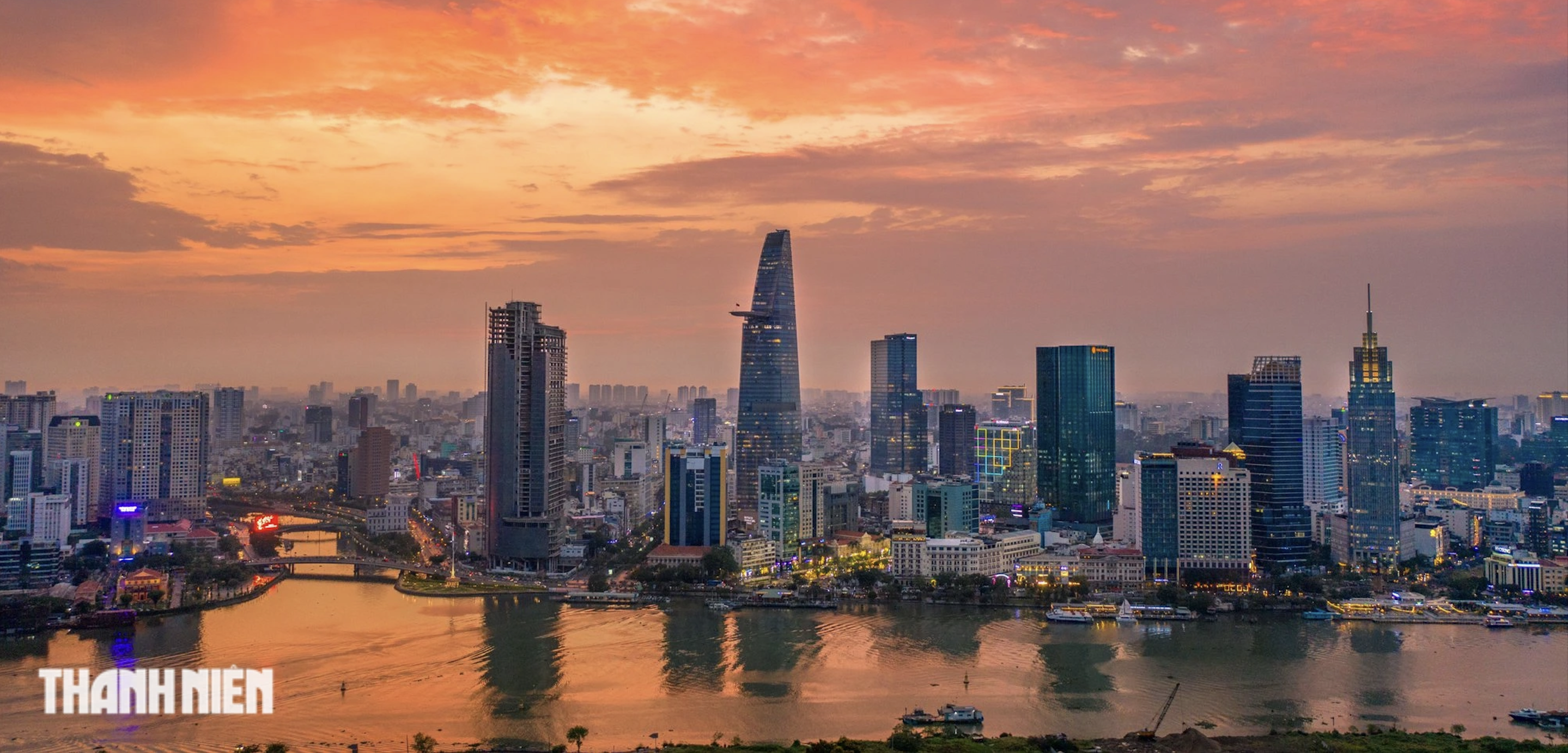
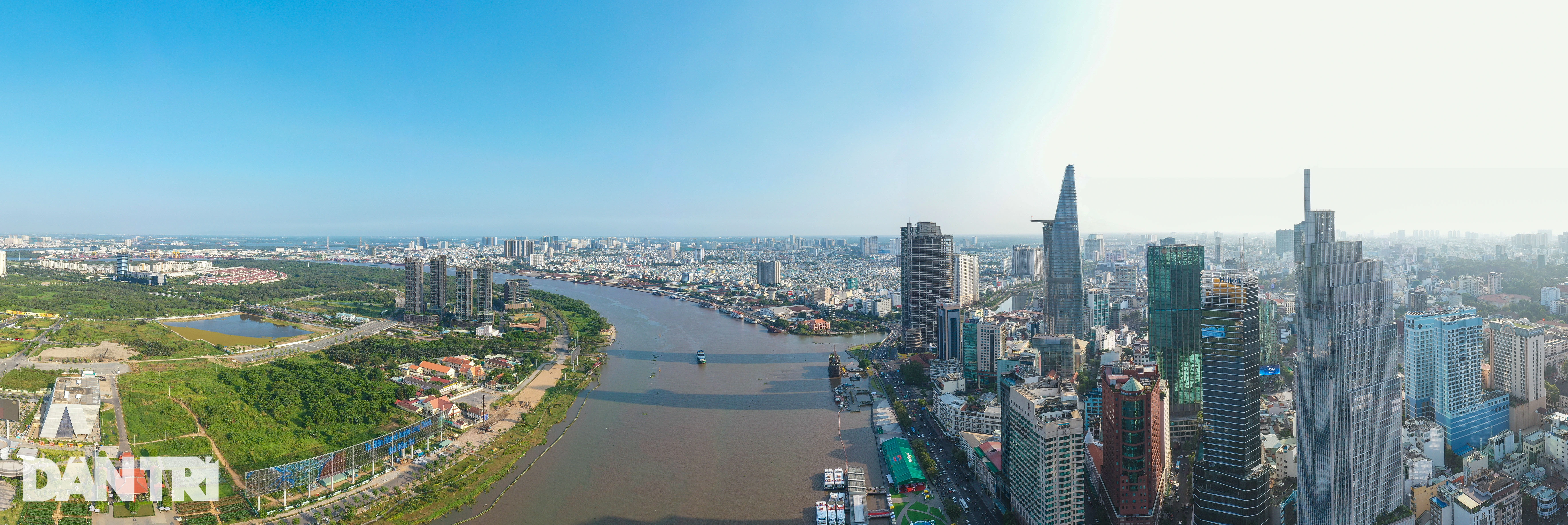
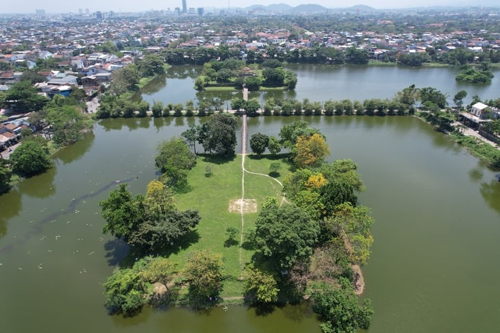
The two banks of the Saigon River through the center of Ho Chi Minh City, September 2023. Photo: Quynh Tran
According to Mr. Chinh, the river winds through Ho Chi Minh City like a "silk strip", something that is rare in other places, but its full potential has not been exploited. He compared it to Da Nang , where the Han River flows through the city center for about 7 km, but is very well exploited, including the urban space along the banks and the bridges across. This helps Da Nang gain the brand name of "the city of bridges".
The Chairman of the Vietnam Urban Planning and Development Association added that in the world , many rivers such as Huangpu in Shanghai (China), Thames (UK)... do not have beautiful locations like Saigon but are well utilized and developed, becoming famous landscapes.
With the length of the Saigon River through Ho Chi Minh City being about 40 km and very wide, Mr. Chinh said that in the planning, we can focus on developing 15-20 km first, especially the section through Thu Thiem area and Thanh Da - Binh Quoi peninsula, because this is considered the "pearl" of the city.
"If planned and implemented well, in 10-15 years the Saigon River will not only be a highlight of the city but will also be famous in the world," Mr. Chinh said and suggested that the consulting unit needs to clarify the contents related to the planning of the development of the space along the Saigon River, to see that this is a special landscape bestowed by nature that not every place has this advantage.
In addition to the Saigon River, the spatial development of the entire river system in Ho Chi Minh City is an important content that needs to be included in this master plan, according to the leader of the Vietnam Urban Development Planning Association.
Agreeing with the above viewpoint, Associate Professor, Dr. Do Tu Lan, former Deputy Director of Urban Development, Ministry of Construction, said that Ho Chi Minh City has many rivers and canals, so in this planning adjustment, it is necessary to study and take advantage of these advantages to develop the city. At the same time, the city needs to consider including many regulating lakes in the planning to solve the increasing flooding.
At the conference, Chairman of the Ho Chi Minh City People's Committee Phan Van Mai said that the city's master plan was established in 2010, and many new problems have arisen. The study and adjustment this time is based on two principles: inheriting previous plans and updating and overcoming shortcomings and limitations for the city to develop.
"The city will review what is good and needs to be retained and promoted as well as what needs to be adjusted and supplemented," said Mr. Mai.
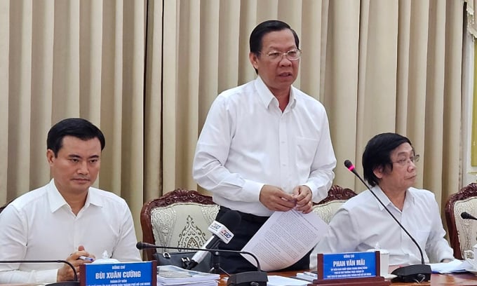
Chairman of Ho Chi Minh City People's Committee Phan Van Mai speaks at the conference on the afternoon of September 12. Photo: Ha Giang
According to the City Chairman, Resolutions 24 and 31 of the Politburo both place Ho Chi Minh City in an important position in the Southeast and the Southern Key Economic Zone, aiming towards a center with competitive capacity and international integration. Therefore, the adjustment of the master plan needs to clearly demonstrate development according to the above orientations.
In particular, the city will focus on developing according to the multi-center urban model, because over the past time, it has only focused on the existing central area (930 hectares). Mr. Mai said that new centers need a development roadmap but first and foremost, infrastructure investment, especially transportation, is required for synchronous connection.
"If we keep the existing urban area as it is now without boldly breaking through, we will still develop like an oil spill," said Mr. Mai, adding that in the upcoming planning, the city will determine the method of public transportation, not only metro but also take advantage of the canal system to develop waterway transportation.
According to Mr. Mai, Ho Chi Minh City is a large urban area, so culture and society are also advantages, so it needs enough green space. Therefore, in the study of planning adjustment, the city aims to maintain a certain proportion of agricultural land as a reserve for the future. Regarding the population issue, he said that with the current and future economic and social structure of Ho Chi Minh City, it is necessary to carefully calculate the scale and quality to ensure appropriate development.
The task of adjusting the master plan of Ho Chi Minh City to 2040, with a vision to 2060, was approved by the Prime Minister in 2021, with the goal of linking the development of the city's urban space with the surrounding area. The planning adjustment needs to meet new requirements in the economic and social development strategy as well as solve the shortcomings of the largest city in the country, including population, housing, transport infrastructure, environment, climate change adaptation, etc.
The Ho Chi Minh City master plan adjustment project, once established and approved, will be the basis for urban management, especially determining the direction of spatial development, urban functions and technical infrastructure systems, towards creativity and modernity.
Gia Minh
Source link

![[Photo] General Secretary To Lam attends the 80th Anniversary of the Cultural Sector's Traditional Day](https://vstatic.vietnam.vn/vietnam/resource/IMAGE/2025/8/23/7a88e6b58502490aa153adf8f0eec2b2)
![[Photo] Prime Minister Pham Minh Chinh chairs the meeting of the Government Party Committee Standing Committee](https://vstatic.vietnam.vn/vietnam/resource/IMAGE/2025/8/23/8e94aa3d26424d1ab1528c3e4bbacc45)


Comment (0)