

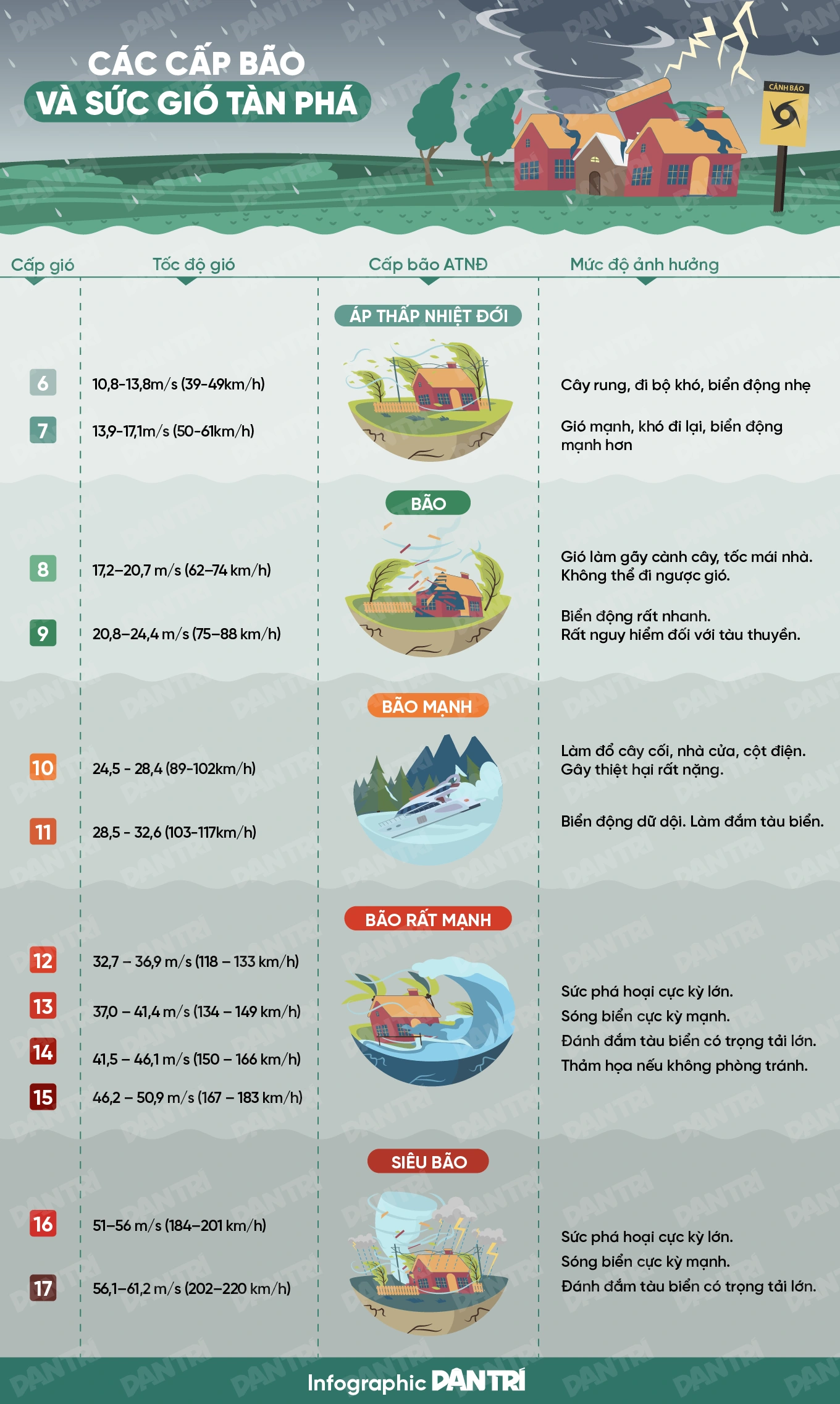
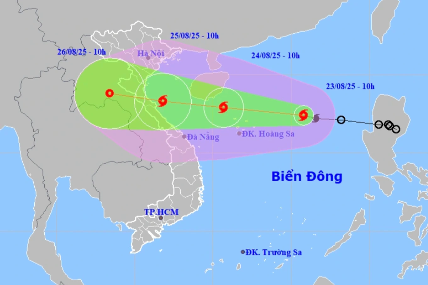
The National Center for Hydro-Meteorological Forecasting said that at 11:00 a.m. on August 23, storm No. 5 (international name Kajiki) was at level 8-9 (62-88 km/h), gusting to level 11, about 350 km east-northeast of Hoang Sa special zone. The storm was moving west-northwest at a speed of about 25 km/h.
Compared to early this morning, storm number 5 has strengthened one level.
Forecast on August 24, the storm will strengthen to level 10-11, gust level 14 and operate in the sea northwest of Hoang Sa special zone.
By August 25, the storm had strengthened to level 11-12, gusting to level 15 on the sea from Thanh Hoa to Hue and moved deep into the mainland from Nghe An to Quang Tri provinces.
It is forecasted that on August 26, the storm will gradually weaken into a tropical depression over the mainland of Central Laos.

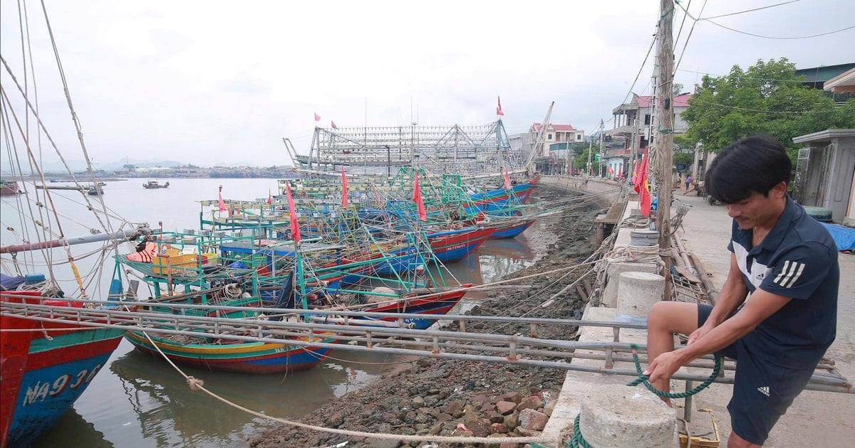
Provinces from Nghe An to Quang Tri were directly affected by storm No. 5 (Photo: NCHMF).
Due to the storm's influence, the North East Sea area (including Hoang Sa special zone) has strong winds of level 8-9, near the storm's center level 10-11, gusting to level 14, waves 4-6m high, and rough seas.
From noon and afternoon of August 24, the sea area from Thanh Hoa to Hue (including Con Co and Hon Ngu) will have winds gradually increasing to level 6-8, then increasing to level 9-10, the area near the storm's center will have winds of level 11-12, gusting to level 15.
From the afternoon of August 24, the sea area of the Northern Gulf of Tonkin (including Bach Long Vi) will have winds gradually increasing to level 6-7, gusting to level 9.
Besides, the coastal area from Thanh Hoa - Quang Tri has storm surge of 0.5-1m.
The hydrometeorological agency warns that the weather at sea and in coastal areas during the storm is extremely dangerous and unsafe for any vehicles or structures operating in dangerous areas such as cruise ships, passenger ships, transport ships, cages, rafts, aquaculture areas, dykes, embankments, and coastal routes.
On land, from the night of August 24, the mainland area of Thanh Hoa - Quang Tri has winds gradually increasing to level 7-9, near the storm center level 10-12, gusting to level 13-15.
From the night of August 24 to the end of August 26, the Northern Delta, Southern Phu Tho and Thanh Hoa - Hue will have widespread heavy rain, with rainfall ranging from 100-150mm, locally over 250mm. Thanh Hoa - Quang Tri will have heavy to very heavy rain, with rainfall ranging from 150-300mm, in some places over 600mm; risk of heavy rain over 200mm/3 hours.
According to the forecast, on August 25-26, Hanoi and Da Nang will have moderate rain, heavy rain and thunderstorms; Ho Chi Minh City will have rain, showers and thunderstorms in the late afternoon and evening. During thunderstorms, beware of tornadoes and strong gusts of wind.
On August 25-27, the Upper and Central Laos regions are likely to experience heavy rain with common rainfall of 100-250mm, and in some places in the Central Laos region, over 500mm.
Dantri.com.vn
Source: https://dantri.com.vn/xa-hoi/bao-so-5-tang-cap-co-the-giat-cap-15-khi-di-vao-dat-lien-nuoc-ta-20250823115033620.htm
![[Photo] General Secretary To Lam attends the 80th Anniversary of the Cultural Sector's Traditional Day](https://vstatic.vietnam.vn/vietnam/resource/IMAGE/2025/8/23/7a88e6b58502490aa153adf8f0eec2b2)


Comment (0)