

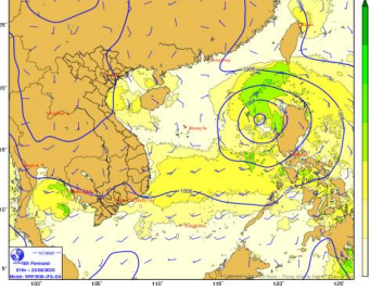
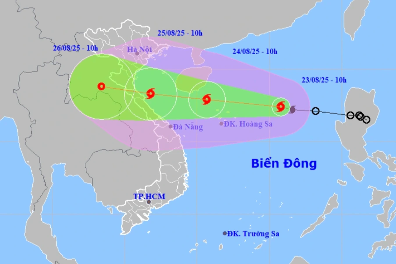
Strong wind forecast map for August 23. Photo: nchmf
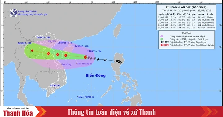
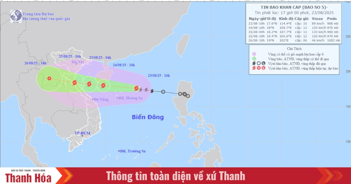
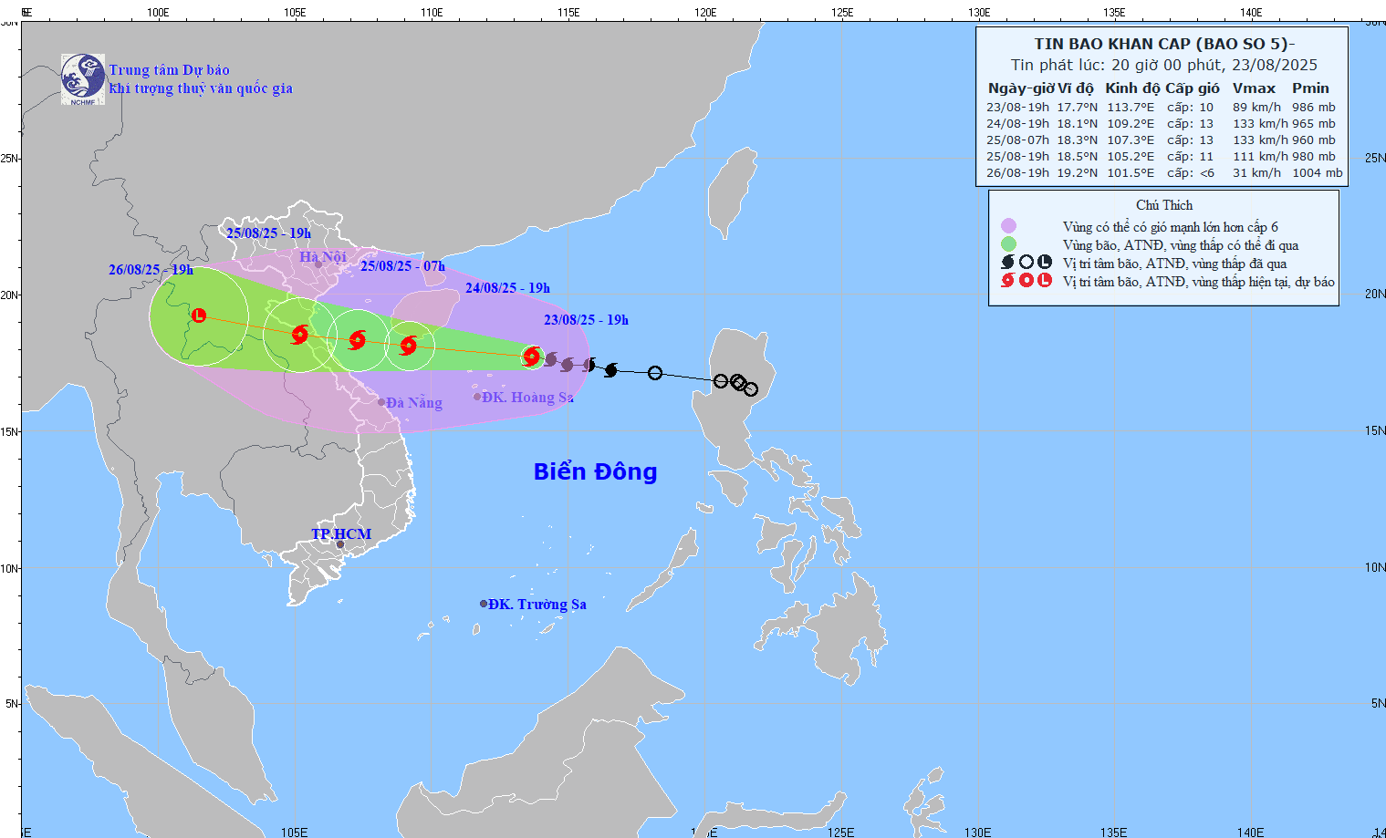
The strongest wind in the area near the center of the tropical depression is level 7 (50-61km), gusting to level 9; moving in the West Northwest direction at a speed of about 25km.
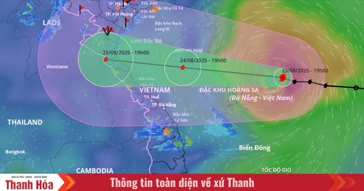
Forecast for the next 24 hours, day and night of August 23, the tropical depression will move to the North East Sea area (including Hoang Sa special zone). Strong winds at level 6-7, then increasing to level 8, near the storm center at level 9-10, gusting to level 12. Very rough seas. On the night of August 23, the tropical depression will move to the Central East Sea area, the sea area from Khanh Hoa to Lam Dong, moving in a southwest direction. Wind during the day will be level 5, sometimes level 6; at night it will strengthen to level 6, gusting to level 7-8. Rough seas.
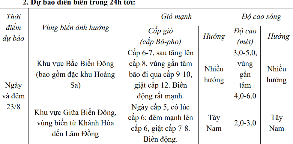
In addition, on the day and night of August 23, the North East Sea area (including Hoang Sa special zone) will have storms; the Central and South East Sea area (including Truong Sa special zone), the sea area from Gia Lai to Ca Mau, from Ca Mau to An Giang and the Gulf of Thailand will have scattered showers and thunderstorms. During thunderstorms, there is a possibility of tornadoes, strong gusts of wind of level 6-7 and waves over 2.0m high.
Warning:
Day and night 24/8:
-The western sea area of the North East Sea (including Hoang Sa special zone) has strong winds of level 8-9, near the storm's eye level 10-11, gusting to level 14; waves 3.0-5.0m high, near the storm's eye 4.0-6.0m; rough seas.
- The Central East Sea area and the sea area from Khanh Hoa to Ca Mau have strong southwest winds of level 6, gusting to level 8; waves 2.0-4.0m high; rough seas. - The sea area from Nghe An to Hue has strong winds of level 6-8, then increasing to level 9-10, the area near the storm's center has winds of level 11-12, gusting to level 15; waves 4.0-6.0m high; rough seas.
-Northern Gulf of Tonkin wind gradually increases to level 6-7, gusting to level 8-9; waves 2.0-3.0m high; rough seas.
Level of disaster risk due to strong winds at sea: Eastern sea area of the North East Sea level 3.
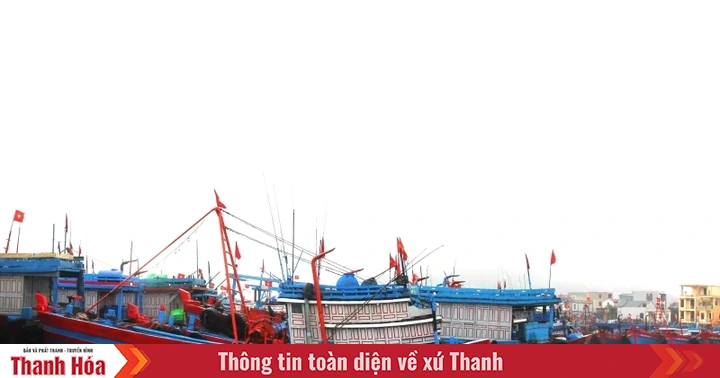
Impact Forecast: All vessels operating in the above areas are at high risk of being affected by cyclones, strong winds and large waves.
LP
Source: https://baothanhhoa.vn/ap-thap-nhiet-doi-tien-vao-vung-bien-dong-gio-giat-cap-7-cap-9-259108.htm

![[Photo] General Secretary To Lam attends the 80th Anniversary of the Cultural Sector's Traditional Day](https://vstatic.vietnam.vn/vietnam/resource/IMAGE/2025/8/23/7a88e6b58502490aa153adf8f0eec2b2)
![[Photo] Prime Minister Pham Minh Chinh chairs the meeting of the Government Party Committee Standing Committee](https://vstatic.vietnam.vn/vietnam/resource/IMAGE/2025/8/23/8e94aa3d26424d1ab1528c3e4bbacc45)


Comment (0)