

Late on the evening of August 22, Deputy Prime Minister Tran Hong Ha signed Official Dispatch No. 141/CD-TTg of the Prime Minister requesting ministries, branches and localities to proactively respond to the tropical depression that is likely to strengthen into a storm.
According to the forecast of the National Center for Hydro-Meteorological Forecasting, tonight, the tropical depression will move into the East Sea and is likely to strengthen into storm No. 5. Telegrams sent to the Chairmen of the People's Committees of the provinces and cities: Quang Ninh, Hai Phong, Hung Yen, Ninh Binh, Thanh Hoa, Nghe An, Ha Tinh, Quang Tri, Hue, Da Nang, Quang Ngai, Gia Lai; Ministries: National Defense, Public Security, Agriculture and Environment, Construction, Industry and Trade, Culture, Sports and Tourism, Science and Technology, Education and Training; Office of the National Civil Defense Steering Committee.
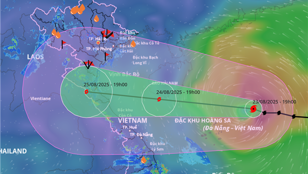
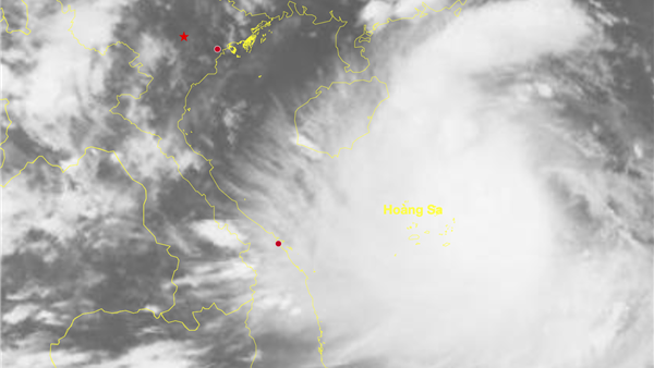
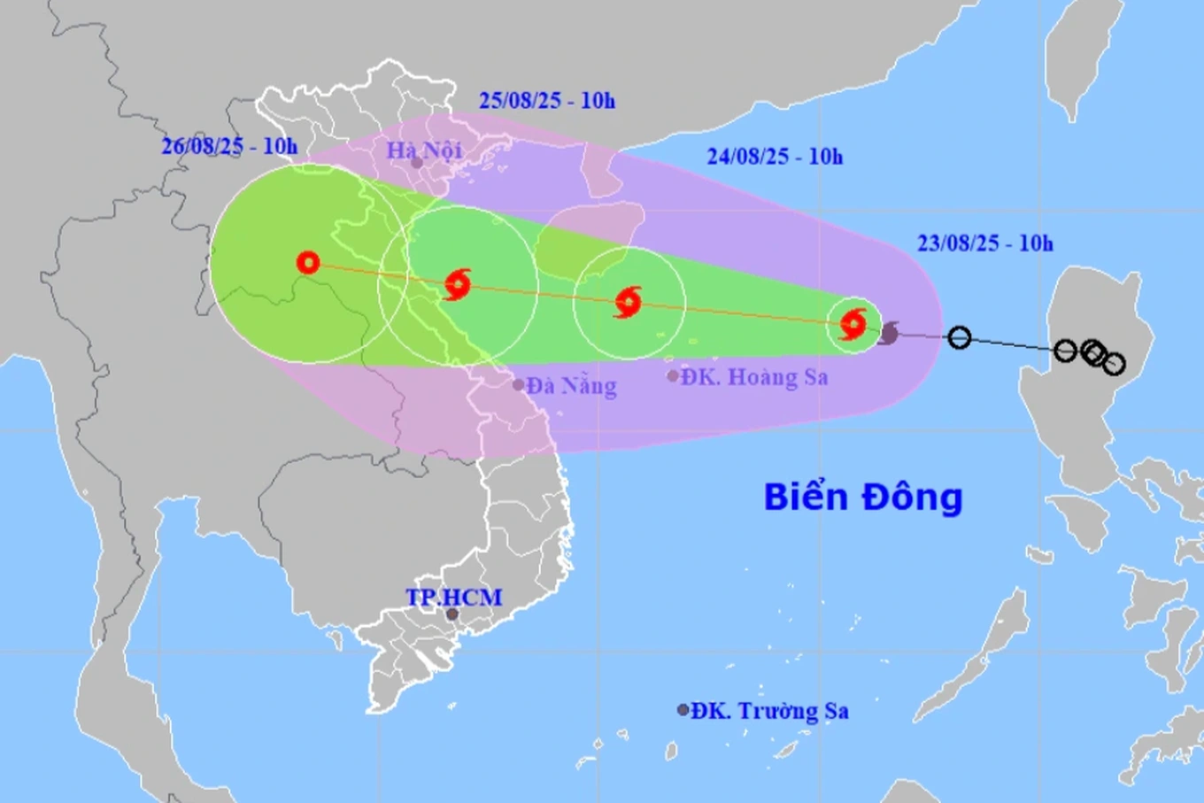
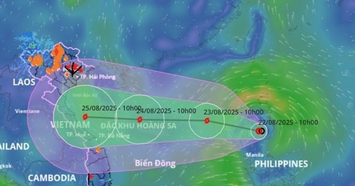
The dispatch stated that, according to the forecast of the National Center for Hydro-Meteorological Forecasting, tonight, the tropical depression will move into the East Sea and will likely strengthen into storm number 5; after entering the East Sea, storm number 5 will move quickly at a speed of about 20 km/hour, on August 24 when moving to the Hoang Sa archipelago, the intensity may reach level 10-11, gusting to level 13-14 and may even strengthen; on August 25, the storm will move into the mainland of the Central region of our country.
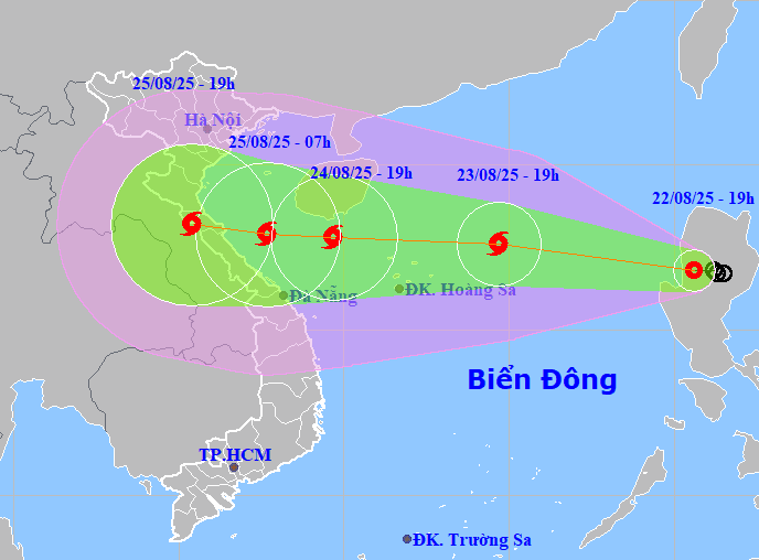
Due to the influence of the storm, in the northern area of the East Sea (including Hoang Sa special zone) from August 23, there will be strong winds of level 6-7, then increasing to level 8-9, from August 24, strong winds of level 9-10, waves from 4-6m high, the sea area from Thanh Hoa to Da Nang will have strong storm winds of level 8, the area near the storm center will have level 11-12, gusting to level 15, the coastal area from Nghe An to Quang Tri will likely have strong winds of level 10-11, gusting to level 13-14. From the night of August 24-27, in the area from Thanh Hoa to Hue, there will be heavy rain, with common rainfall of 200-300mm, in some places over 600mm, rivers from Thanh Hoa to Quang Tri will have floods, with the risk of flash floods, landslides and inundation in low-lying areas, riverbanks, and urban areas.
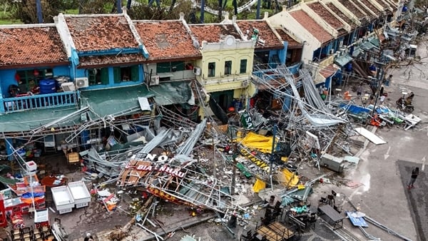
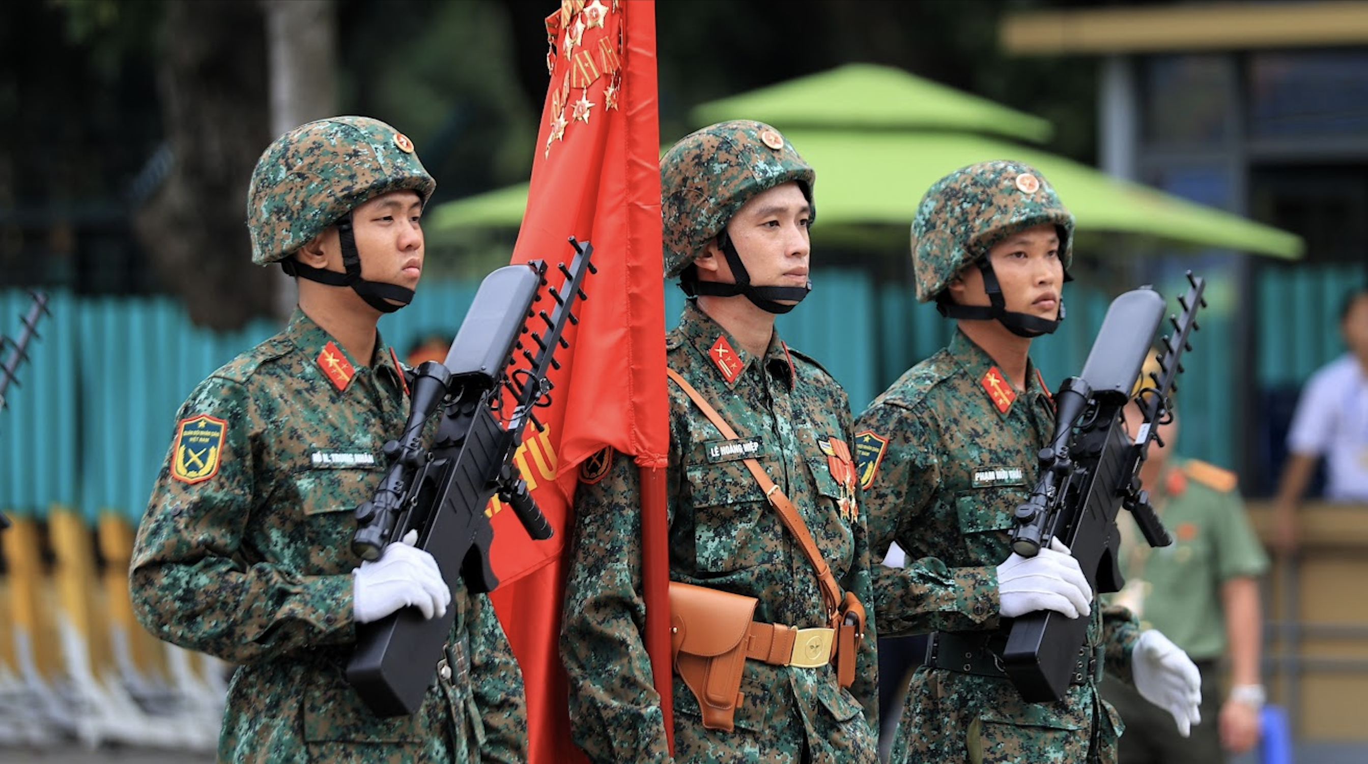
This is a strong storm, with a high possibility of making landfall directly, causing strong winds and heavy rain in the Central region of our country right during the days of preparations for the National Day on September 2. The developments of the storm and floods are still very complicated.
To proactively respond to tropical depressions that are likely to strengthen into storms, with the risk of heavy rain causing flooding, landslides, flash floods, the Prime Minister requests:
The Chairmen of the People's Committees of the above-mentioned provinces and cities shall monitor and regularly update information on developments of tropical depressions, storms, and floods, in order to proactively direct and deploy response work in accordance with specific developments in the locality, focusing on directing and immediately deploying measures to ensure safety for ships, vehicles and activities at sea and along the coast, especially to prevent storms and lightning that may cause damage before the storm directly affects them.
Review and complete scenarios and plans to respond to tropical depressions, storms, floods, landslides, flash floods, and landslides according to the 4-on-the-spot motto suitable for each locality, ward, commune, village, hamlet, and residential area, especially in mountainous areas where isolation is likely to occur; proactively evacuate people from dangerous areas to ensure safety of life and limit damage to people's property when natural disasters occur.
Proactively stock up on food, provisions, and necessities in residential areas that are prone to isolation during floods and landslides, be ready to respond to the risk of prolonged isolation, and avoid food shortages during storms and floods.
The Prime Minister requested the Minister of Agriculture and Environment to direct the hydrometeorological forecasting agency to continue to closely monitor, proactively coordinate, and consult international forecast information to forecast and provide full and timely information on the developments of tropical depressions/storms, floods and rains to authorities and people to proactively deploy response work according to regulations.
In the coming days, strengthen monitoring, regularly update weather, meteorological and hydrological forecast information in localities forecast to be affected by tropical depressions/storms; tourist centers; locations holding activities to celebrate the 80th anniversary of National Day on September 2.
The Minister of Industry and Trade directs the work of ensuring the safety of hydroelectric dams; taking proactive measures to respond to incidents in areas forecast to be at high risk of being isolated due to flooding and landslides; protecting industrial production, limiting damage caused by storms and floods; ensuring the supply of essential goods, avoiding shortages, and taking advantage of natural disasters to unreasonably increase prices.
The Ministry of National Defense directed Military Region 3, Military Region 4, Military Region 5 and relevant units to prepare plans, proactively arrange forces and mobile vehicles to support local people in areas forecasted to be at high risk of being cut off and isolated due to the impact of storms and floods; and be ready to deploy response and rescue work when requested.
The Ministry of Public Security directs relevant units and local police forces to proactively arrange forces and vehicles to key areas, ready to support local people in areas forecast to be at high risk of being cut off and isolated due to the impact of storms and floods; ready to deploy response and rescue work when requested.
Source: https://cand.com.vn/doi-song/chu-dong-ung-pho-bao-so-5-sap-hinh-thanh-co-cuong-do-manh-do-bo-truc-tiep-vao-dat-lien-i778989/

![[Photo] Prime Minister Pham Minh Chinh chairs the meeting of the Government Party Committee Standing Committee](https://vstatic.vietnam.vn/vietnam/resource/IMAGE/2025/8/23/8e94aa3d26424d1ab1528c3e4bbacc45)
![[Photo] General Secretary To Lam attends the 80th Anniversary of the Cultural Sector's Traditional Day](https://vstatic.vietnam.vn/vietnam/resource/IMAGE/2025/8/23/7a88e6b58502490aa153adf8f0eec2b2)


Comment (0)