

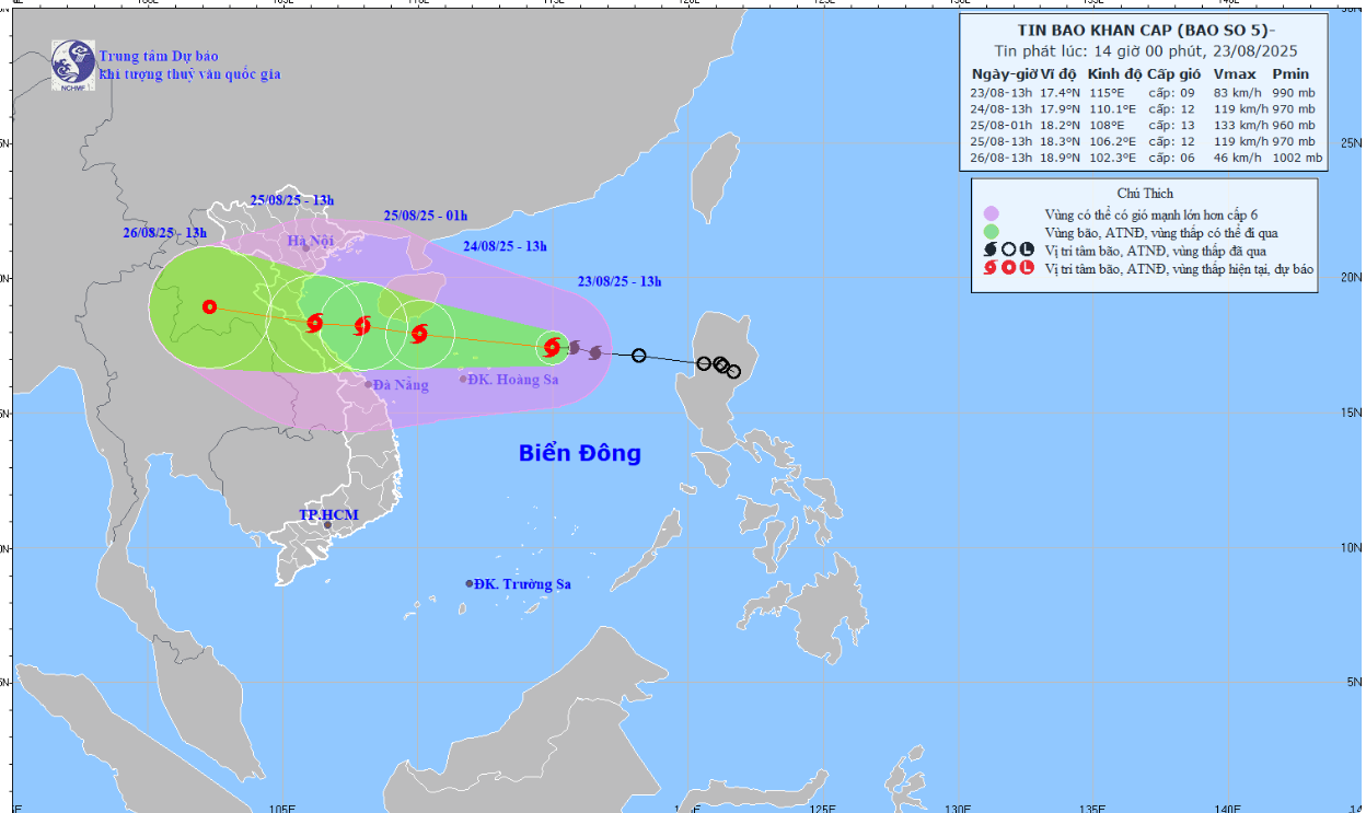
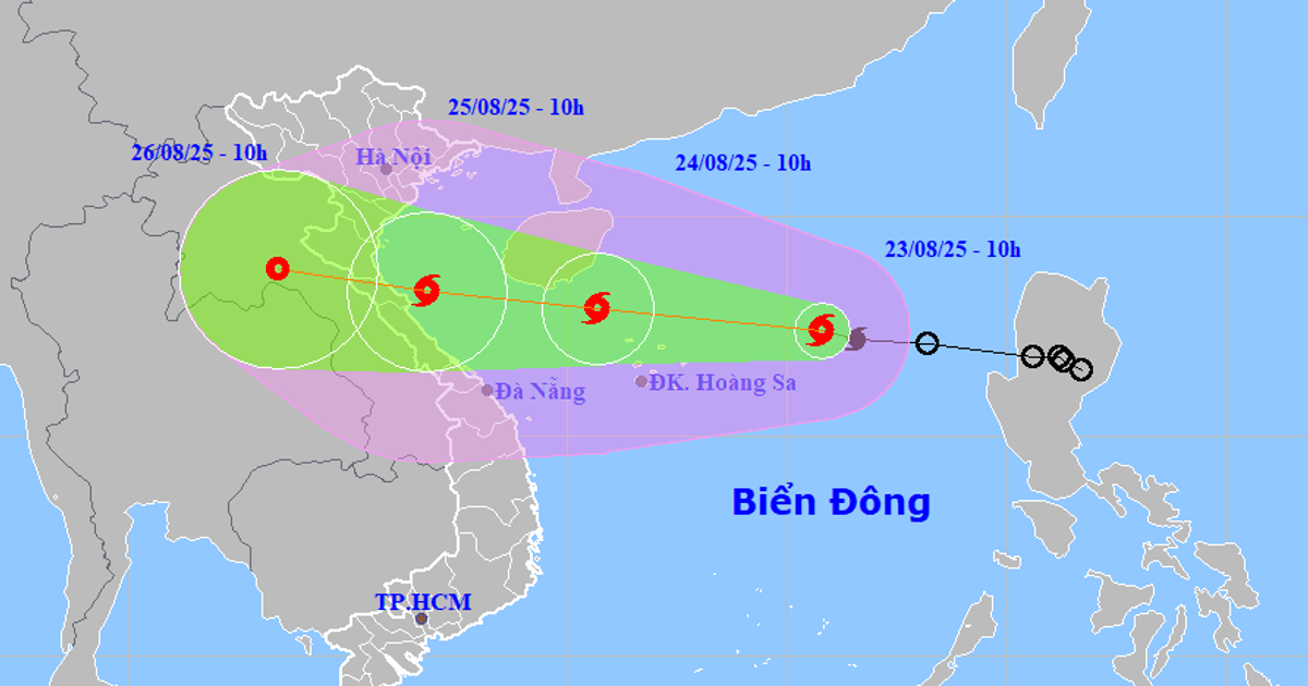
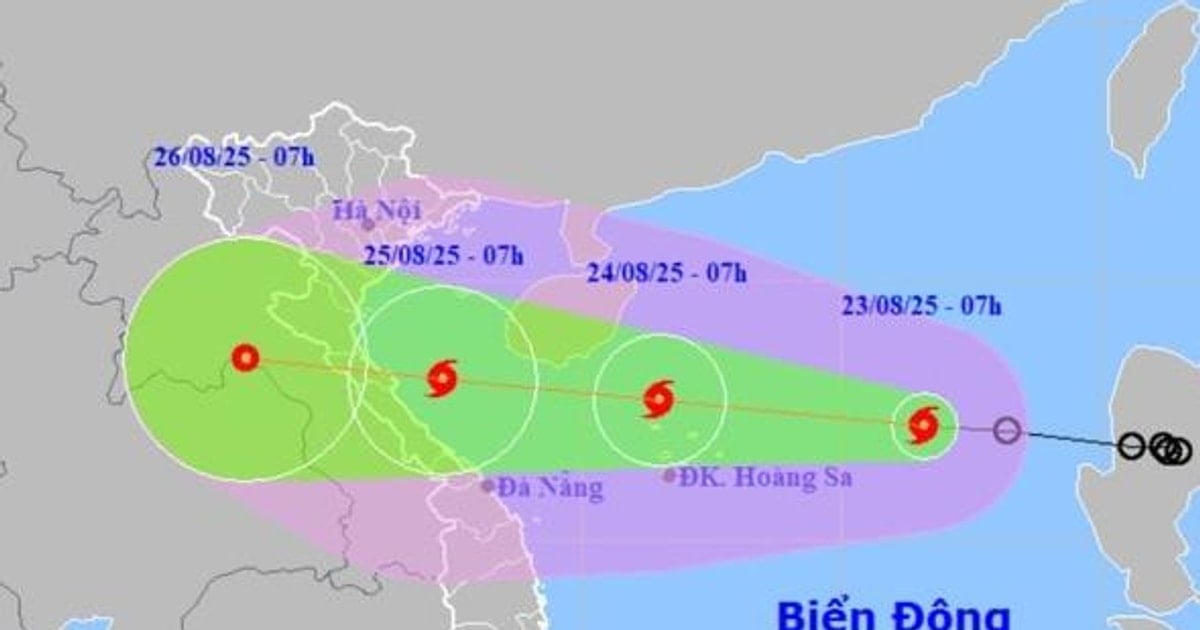
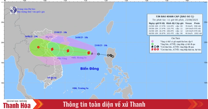
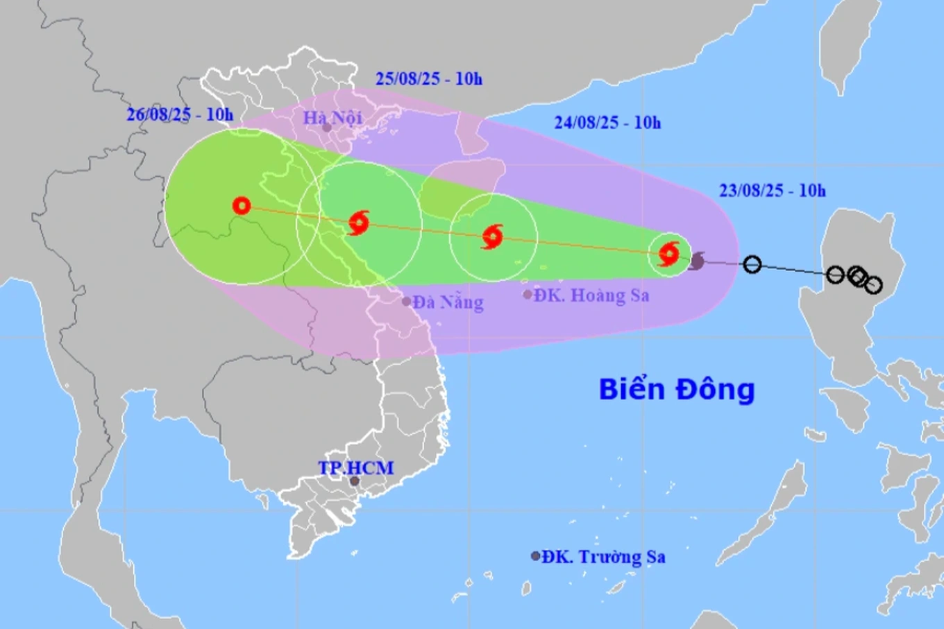
Forecast map of the trajectory and intensity of storm No. 5 released at 2:00 p.m. on August 23, 2025. Photo: nchmf
It is forecasted that in the next 24 hours, the storm will move in the West Northwest direction, at a speed of about 15-20km/h, with the center of the storm at 18.3N-106.2E; in the coastal waters from Thanh Hoa to Quang Tri .
By 1 p.m. on August 26, the storm will move west-northwest at a speed of about 15-20 km/h and gradually weaken into a tropical depression.
Forecast of storm impact:
Strong winds, big waves, rising water at sea: North East Sea area (including Hoang Sa special zone):
Strong winds of level 8-9, near the storm center of level 10-11, gusting to level 14. Waves 4.0-6.0m high. Rough seas.
From noon and afternoon of August 24, the sea area from Thanh Hoa to Hue (including Con Co, Hon Ngu):
Winds gradually increase to level 6–8, then increase to level 9–10, near the center of the storm level 11–13, gusting to level 15. Waves 4.0–6.0m high, near the center 6.0–8.0m. The sea is very rough.
From the afternoon of August 24, the northern sea area of Bac Bo Gulf (including Bach Long Vi):
Wind gradually increasing to level 6-7, gusting to level 9. Waves 2.0-4.0m high. Rough seas.
Storm surge:
Coastal areas from Ninh Binh to Northern Quang Tri: storm surge 0.5–1.2m high. Forecast water levels: Sam Son 3.2–3.6m; Hon Ngu 3.3–3.8m; Vung Ang 2.2–2.8m; Cua Gianh 1.5–2.0m.
Warning: The weather at sea and in coastal areas during the storm is extremely dangerous and unsafe for any vehicles or structures operating in the danger zone such as: cruise ships, passenger ships, cargo ships, cages, rafts, aquaculture areas, dykes, embankments, coastal routes. Vehicles are at high risk of capsizing, destruction, and flooding due to strong winds, large waves, and rising sea levels.
Strong winds on land: From the night of August 24, in the mainland area of Thanh Hoa - Quang Tri: Winds will gradually increase to level 7-9, near the storm center level 10-12, gusting to level 14-15.
Heavy rain on land: From the night of August 24 to the end of August 26: The Northern Delta, South Phu Tho and from Thanh Hoa - Hue will have widespread heavy rain, with common rainfall of 100-150mm, locally >250mm. Particularly, Thanh Hoa - Quang Tri will have heavy to very heavy rain, common rainfall of 150-300mm, in some places >600mm. Risk of heavy rain >200mm/3 hours.
Warning: This is a very strong storm, moving fast, maximum intensity can reach level 12-13, gust level 15. See detailed emergency news about storm number 5 broadcast at 2:00 p.m. on August 23 here.
LP
Source: https://baothanhhoa.vn/bao-so-5-rat-manh-di-chuyen-nhanh-cuong-do-cuc-dai-co-the-dat-cap-12-13-giat-cap-15-259154.htm

![[Photo] General Secretary To Lam attends the 80th Anniversary of the Cultural Sector's Traditional Day](https://vstatic.vietnam.vn/vietnam/resource/IMAGE/2025/8/23/7a88e6b58502490aa153adf8f0eec2b2)


Comment (0)