

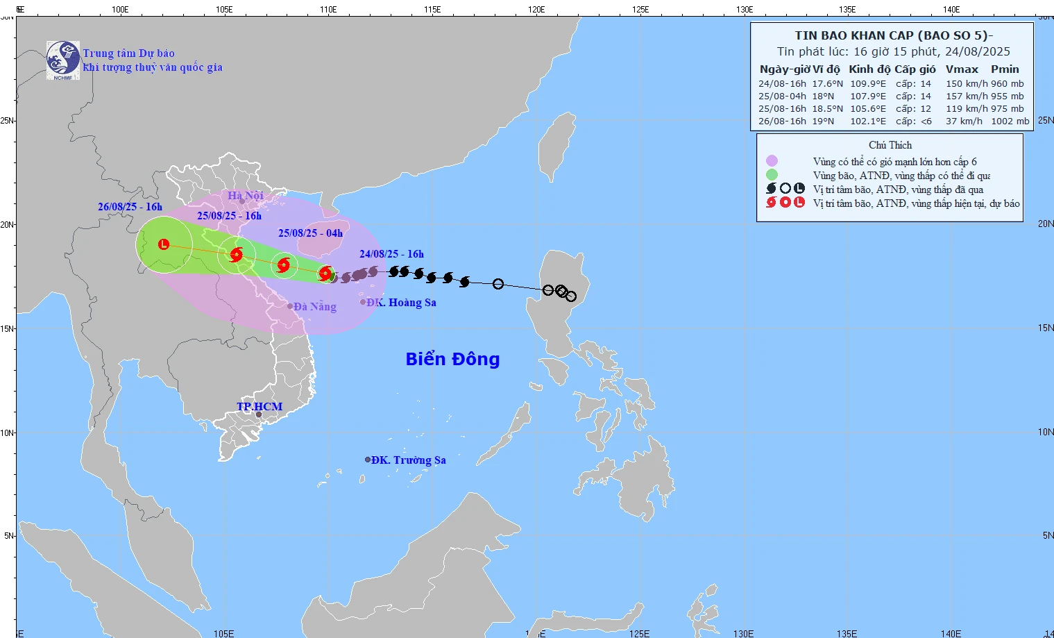
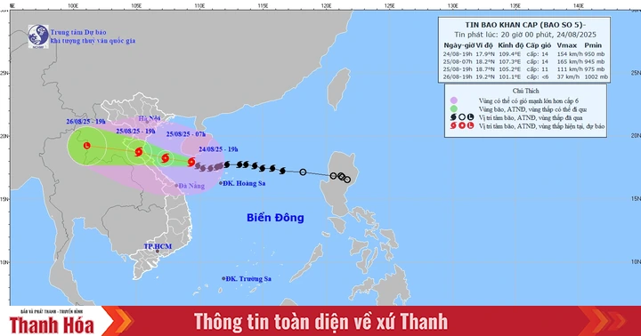
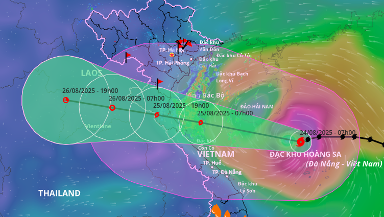
Forecast path of storm No. 5 at 4:15 p.m. on August 24, 2025.
According to the latest news from the National Center for Hydro-Meteorological Forecasting, at 4:00 p.m. on August 24, the center of storm No. 5 was at 17.6 degrees North latitude, 109.9 degrees East longitude, 470km from Nghe An, 450km from Ha Tinh , and 390km from Quang Tri to the East.
The storm is moving west at 20 km/h. The strongest wind is level 13-14 (134-166 km/h), gusting to level 16 and is likely to strengthen further.
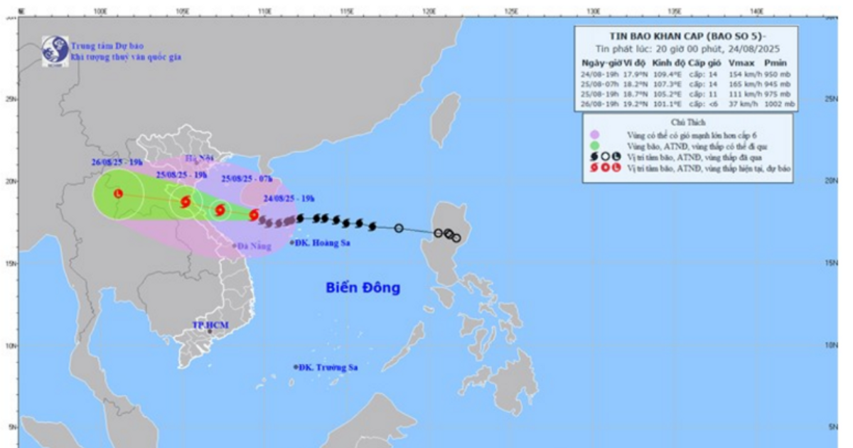
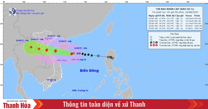
Storm forecast for the next 24-48 hours:
At 4:00 a.m. on August 25, the storm moved in a West-Northwest direction at a speed of about 20 km/h, entering the South of Bac Bo Gulf. It is 240 km from Nghe An , 210 km from Ha Tinh, and 140 km from Quang Tri. Intensity: level 13-14, gusting to level 16.
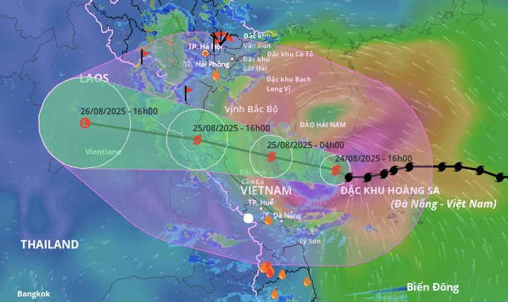
Level 3 risk warning in the North East Sea, Gulf of Tonkin, sea area of South Quang Tri - Hue (Hon Ngu, Con Co); level 4 risk in coastal areas of Thanh Hoa to Quang Tri.
At 4:00 p.m. on August 25, the storm was on land from Thanh Hoa to Quang Tri (18.5 degrees North latitude, 105.6 degrees East longitude). The intensity decreased to level 11-12, gusting to level 14.
Level 3 risk warning in the Gulf of Tonkin, sea area from South Quang Tri to Hue; level 4 risk in mainland Thanh Hoa to North Quang Tri and coastal area from Thanh Hoa to Quang Tri.
At 4:00 p.m. on August 26, the storm moved to Central Laos and weakened rapidly, with an intensity below level 6.
NM
Source: https://baothanhhoa.vn/du-bao-chieu-25-8-bao-so-5-vao-dat-lien-thanh-hoa-den-quang-tri-nbsp-259281.htm


Comment (0)