

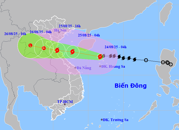
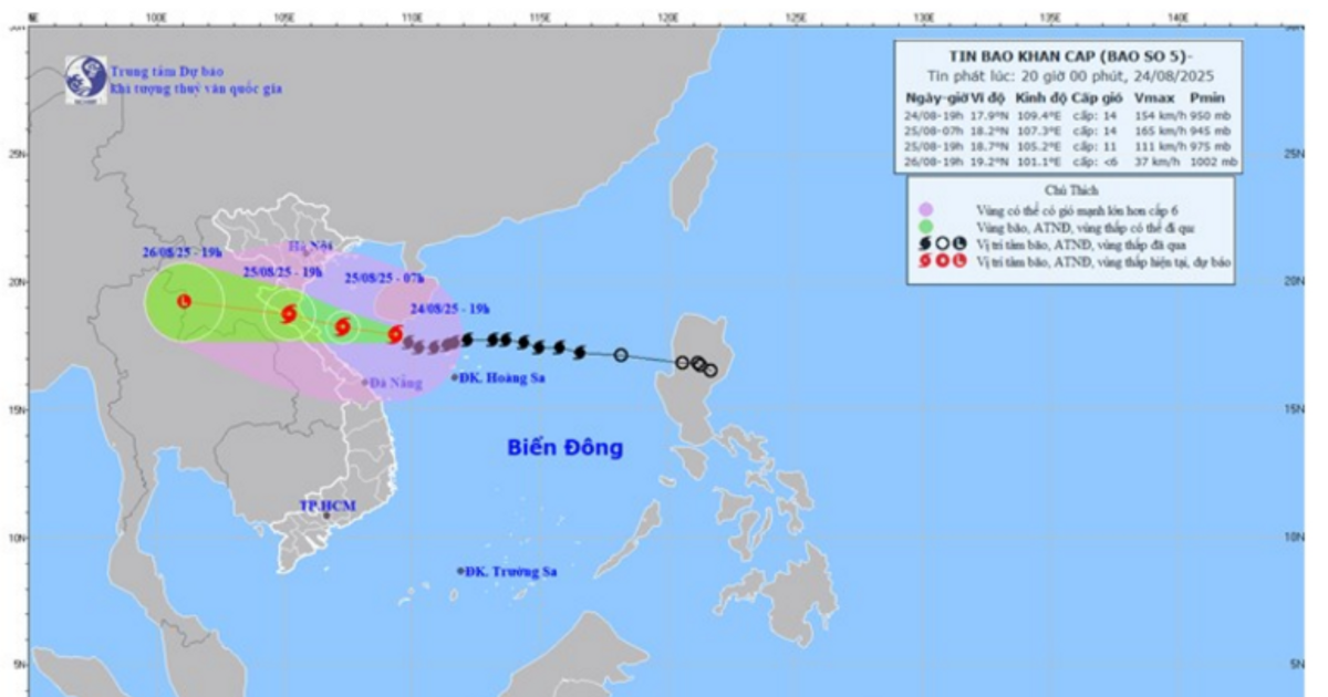
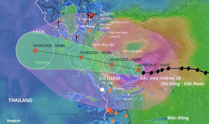
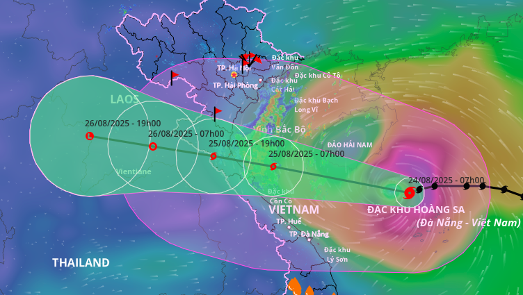
Forecast in the next 3 hours, the storm moves west at a speed of about 15-20km/hour. Then, change direction to west-northwest.
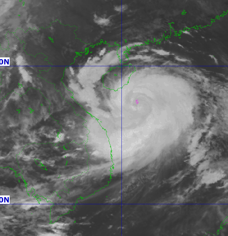
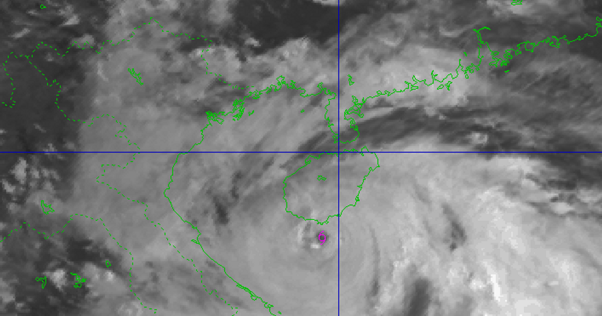
By early morning of August 25, the storm's eye was in the southern Gulf of Tonkin, about 200km east of Nghe An and Ha Tinh, with the strongest winds at level 12-13, gusting to 15, and possibly even stronger.
Storm No. 5 moves west-northwest at a speed of 20km/h towards the mainland and gradually weakens.
Level 4 disaster risk warning in coastal areas from Thanh Hoa to Quang Tri, mainland provinces from Thanh Hoa to northern Quang Tri; level 3 in the Gulf of Tonkin, sea areas from southern Quang Tri to Hue (including Hon Ngu island, Con Co special zone).
Due to the influence of the storm, the western area of the North East Sea (including Hoang Sa special zone) has strong winds of level 8-10, near the storm's eye level 11-13, gusting to level 15; waves 5-7m high, near the storm's eye 7-9m, rough seas.
From noon and afternoon of August 24, the sea area from Thanh Hoa to Hue (including Hon Ngu island, Con Co special zone) will gradually increase to level 6-8, then increase to level 9-10, near the storm center level 11-13, gusting to level 15; waves 4-6m high, near the storm center strong 7-9m, rough seas.
Coastal areas from Ninh Binh to northern Quang Tri have storm surges of 0.5-1.5m. There is a high risk of flooding in low-lying coastal areas, river mouths, and islands from Thanh Hoa to northern Quang Tri.
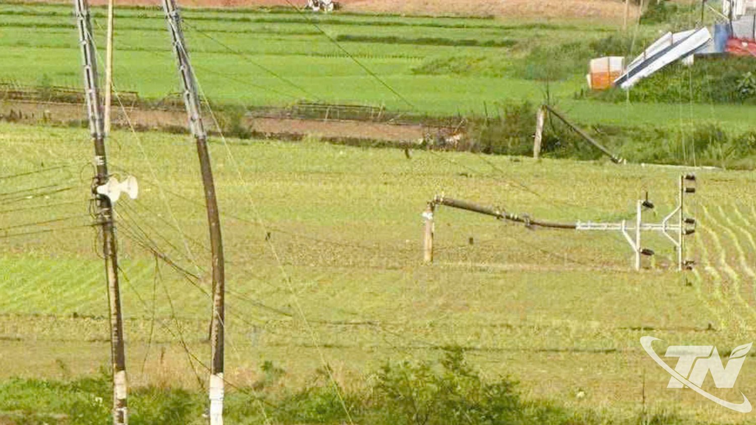
The hydrometeorological agency warns that the coastal mainland during the storm is extremely dangerous, unsafe for any means of transport or construction operating in the danger zone such as: cruise ships, passenger ships, transport ships, cages, rafts, aquaculture areas, dykes, embankments, coastal routes. Vehicles are highly likely to capsize, be destroyed; flooded due to strong winds, big waves and rising sea levels.
From the night of August 24, on land from Thanh Hoa to Quang Tri, winds will gradually increase to level 7-9, near the storm center, level 10-12, gusting to level 14-15; coastal areas from Quang Ninh to Ninh Binh, winds will gradually increase to level 6-7, gusting to level 8.
From the night of August 24 to the end of August 26, the Northern Delta, southern Phu Tho and from Thanh Hoa to Hue are likely to experience widespread heavy rain with rainfall ranging from 100 - 150mm, locally over 250mm; the area from Thanh Hoa to northern Quang Tri will experience heavy to very heavy rain with rainfall ranging from 200 - 400mm, locally over 700mm; warning of the risk of rain with an intensity greater than 200mm in 3 hours.
From August 25 to 26, Hanoi and Da Nang will have moderate to heavy rain and thunderstorms; Ho Chi Minh City will have rain, showers and thunderstorms in the late afternoon and evening. During thunderstorms, be on guard against the risk of tornadoes and strong gusts of wind.
Source: https://baodanang.vn/bao-so-5-co-kha-nang-manh-them-khi-di-chuyen-vao-ngoai-khoi-nghe-an-ha-tinh-3300180.html


Comment (0)